TopoQuest Logo
Do you find TopoQuest useful?
Help keep TopoQuest running and adding new maps/features by donating!
Bitcoin:  19c7KJd3qBynnjoSw5npx9KScwjBe4ifkT
Litecoin:  LXs6TkuXGGXo1vDsWCkWVdjQX94eUKd6ui
Home View Maps Find Maps Find Places Resources & Links


Morro Bay North, California Topographic Map

USGS Map Title: Morro Bay North, CA
USGS Map MRC: 35120D7
DRG (GeoTIFF) Download: o35120d7.tif


Neighboring USGS Topographic Map Quads:


  Cypress Mountain, CA  
35120E8
 

  York Mountain, CA  
35120E7
 

  Templeton, CA  
35120E6


  Morro Bay North, CA  
35120D7
 

  Atascadero, CA  
35120D6


  Morro Bay South, CA  
35120C7
 

  San Luis Obispo, CA  
35120C6


Map MRC Location:

N36°
W121°
N36°
W120°
H8 H7 H6 H5 H4 H3 H2 H1
G8 G7 G6 G5 G4 G3 G2 G1
F8 F7 F6 F5 F4 F3 F2 F1
E8 E7 E6 E5 E4 E3 E2 E1
D8 D7 D6 D5 D4 D3 D2 D1
C8 C7 C6 C5 C4 C3 C2 C1
B8 B7 B6 B5 B4 B3 B2 B1
A8 A7 A6 A5 A4 A3 A2 A1
N35°
W121°
N35°
W120°

Morro Bay North, CA USGS 1:24K Topographic Map Preview:
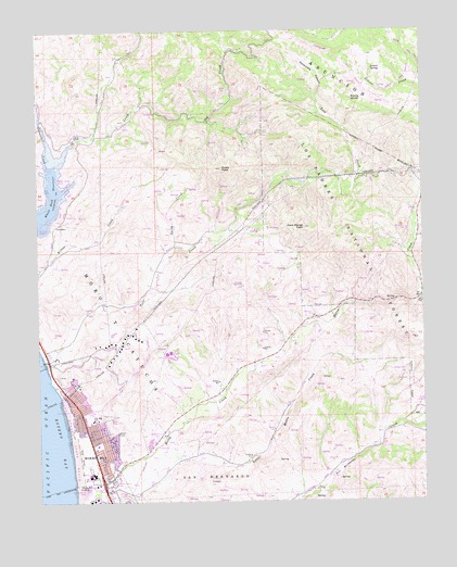
Morro Bay North, CA USGS Topographic Map
Click on map above to begin viewing in our Map Viewer.

This topographic map contains these locations and features:
Feature Name Type Latitude Longitude GNIS ID View Map
Alva Paul CreekStreamN35.3975°W120.8671°274685View Map
Atascadero State BeachParkN35.3930°W120.8655°269610View Map
Beauty SpringSpringN35.4816°W120.7710°269769View Map
California Department of Forestry and Fire Protection Station 14 Morro TorroBuildingN35.4512°W120.7527°2664823View Map
Central School (historical)SchoolN35.4719°W120.8638°1670555View Map
Cottontail CreekStreamN35.4644°W120.8724°270617View Map
Dark Range PeakSummitN35.4478°W120.7899°241265View Map
Del Mar Elementary SchoolSchoolN35.3964°W120.8578°270822View Map
Del Mar ParkParkN35.3986°W120.8585°1872270View Map
East Fork Morro CreekStreamN35.4283°W120.7524°270998View Map
Estero Bay United Methodist ChurchChurchN35.3969°W120.8571°1872272View Map
Fairview SchoolSchoolN35.4433°W120.8318°271092View Map
First Baptist ChurchChurchN35.4019°W120.8643°1872274View Map
First Christian ChurchChurchN35.3850°W120.8516°1872275View Map
Laurel SpringSpringN35.4897°W120.7670°271997View Map
LIla Keiser ParkParkN35.3783°W120.8568°1872311View Map
Little Morro CreekStreamN35.3791°W120.8521°272105View Map
Moro Y CayucosCivilN35.4225°W120.8532°272559View Map
Morro Bay Christian CenterChurchN35.4016°W120.8641°1872280View Map
Morro Bay Fire Department Station 2BuildingN35.3865°W120.8558°2664847View Map
Morro Bay Foursquare ChurchChurchN35.3853°W120.8516°1872281View Map
Morro Bay High SchoolSchoolN35.3825°W120.8576°1872313View Map
Morro Bay Wastewater Treatment PlantLocaleN35.3794°W120.8606°2356872View Map
Morro CreekStreamN35.3764°W120.8643°272562View Map
Mountain View School (historical)SchoolN35.3875°W120.7727°1670566View Map
Rusty PeakSummitN35.4636°W120.8171°273386View Map
San BernardoCivilN35.3783°W120.8199°273445View Map
Seventh Day Adventist ChurchChurchN35.3855°W120.8516°1872289View Map
Smith CreekStreamN35.4419°W120.8318°273762View Map
South Fork Santa Rita CreekStreamN35.5000°W120.7893°273841View Map
Sycamore CanyonValleyN35.4825°W120.7860°273997View Map
Sycamore SpringSpringN35.4875°W120.7785°274014View Map
The Church of Jesus Christ of Latter Day SaintsChurchN35.3978°W120.8563°1872268View Map
Toro CreekStreamN35.4128°W120.8741°274166View Map

Note: Coordinates in the location and feature list above are referenced to NAD83 datum.


Copyright (C) 2008-2024 Ryan Niemi / Sunset Dynamics ... All Rights Reserved