TopoQuest Logo
Do you find TopoQuest useful?
Help keep TopoQuest running and adding new maps/features by donating!
Bitcoin:  19c7KJd3qBynnjoSw5npx9KScwjBe4ifkT
Litecoin:  LXs6TkuXGGXo1vDsWCkWVdjQX94eUKd6ui
Home View Maps Find Maps Find Places Resources & Links


Morton, Texas Topographic Map

USGS Map Title: Morton, TX
USGS Map MRC: 33102F7
DRG (GeoTIFF) Download: o33102f7.tif


Neighboring USGS Topographic Map Quads:


  Maple, TX  
33102G8
 

  Enochs, TX  
33102G7
 

  County Line, TX  
33102G6
 

  Morton NW, TX  
33102F8
 

  Morton, TX  
33102F7
 

  Whiteface NW, TX  
33102F6
 

  Morton SW, TX  
33102E8
 

  Lehman, TX  
33102E7
 

  Whiteface SW, TX  
33102E6


Map MRC Location:

N34°
W103°
N34°
W102°
H8 H7 H6 H5 H4 H3 H2 H1
G8 G7 G6 G5 G4 G3 G2 G1
F8 F7 F6 F5 F4 F3 F2 F1
E8 E7 E6 E5 E4 E3 E2 E1
D8 D7 D6 D5 D4 D3 D2 D1
C8 C7 C6 C5 C4 C3 C2 C1
B8 B7 B6 B5 B4 B3 B2 B1
A8 A7 A6 A5 A4 A3 A2 A1
N33°
W103°
N33°
W102°

Morton, TX USGS 1:24K Topographic Map Preview:
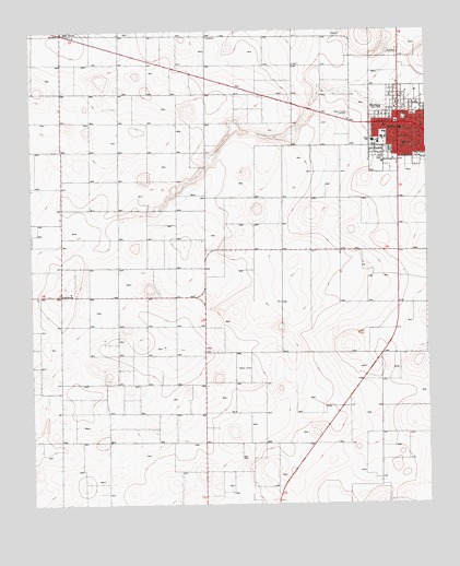
Morton, TX USGS Topographic Map
Click on map above to begin viewing in our Map Viewer.

This topographic map contains these locations and features:
Feature Name Type Latitude Longitude GNIS ID View Map
Church of Christ EastsideChurchN33.7240°W102.7522°2016624View Map
City of MortonCivilN33.7248°W102.7592°2411170View Map
Cochran County Constable's OfficeBuildingN33.7258°W102.7598°2750691View Map
Cochran County CourthouseBuildingN33.7254°W102.7597°2030613View Map
Cochran County Emergency Medical ServicesBuildingN33.7265°W102.7599°2655960View Map
Cochran County JailBuildingN33.7258°W102.7597°2738833View Map
Cochran County Sheriff's OfficeBuildingN33.7257°W102.7598°2750219View Map
Cochran Memorial HospitalHospitalN33.7197°W102.7575°2015648View Map
FamulinerPopulated PlaceN33.6804°W102.8660°1379752View Map
First Baptist ChurchChurchN33.7240°W102.7580°2016622View Map
First Missionary Baptist ChurchChurchN33.7243°W102.7591°2016623View Map
KRAN-AM (Morton)TowerN33.7293°W102.7749°1385642View Map
MortonPopulated PlaceN33.7251°W102.7594°1363181View Map
Morton City HallBuildingN33.7265°W102.7577°2753155View Map
Morton DivisionCivilN33.6400°W102.8734°1939011View Map
Morton Elementary SchoolSchoolN33.7217°W102.7642°2004659View Map
Morton High SchoolSchoolN33.7209°W102.7676°2004660View Map
Morton Junior High SchoolSchoolN33.7204°W102.7656°2004661View Map
Morton Memorial CemeteryCemeteryN33.7439°W102.7610°2773401View Map
Morton Post OfficePost OfficeN33.7239°W102.7602°2731712View Map
Morton Volunteer Fire DepartmentBuildingN33.7268°W102.7600°2551129View Map
Saint Ann ChurchChurchN33.7257°W102.7502°1367129View Map
Star RouteLocaleN33.7495°W102.8652°1369116View Map
Star Route (historical)Populated PlaceN33.7476°W102.8658°2034865View Map

Note: Coordinates in the location and feature list above are referenced to NAD83 datum.


Copyright (C) 2008-2025 Ryan Niemi / Sunset Dynamics ... All Rights Reserved