TopoQuest Logo
Do you find TopoQuest useful?
Help keep TopoQuest running and adding new maps/features by donating!
Bitcoin:  19c7KJd3qBynnjoSw5npx9KScwjBe4ifkT
Litecoin:  LXs6TkuXGGXo1vDsWCkWVdjQX94eUKd6ui
Home View Maps Find Maps Find Places Resources & Links


Beecher West, Illinois Topographic Map

USGS Map Title: Beecher West, IL
USGS Map MRC: 41087C6
DRG (GeoTIFF) Download: o41087c6.tif


Neighboring USGS Topographic Map Quads:


  Frankfort, IL  
41087D7
 

  Steger, IL  
41087D6
 

  Dyer, IN  
41087D5
 

  Peotone, IL  
41087C7
 

  Beecher West, IL  
41087C6
 

  Beecher East, IL  
41087C5
 

  Bradley, IL  
41087B7
 

  Momence, IL  
41087B6
 

  Illiana Heights, IL  
41087B5


Map MRC Location:

N42°
W88°
N42°
W87°
H8 H7 H6 H5 H4 H3 H2 H1
G8 G7 G6 G5 G4 G3 G2 G1
F8 F7 F6 F5 F4 F3 F2 F1
E8 E7 E6 E5 E4 E3 E2 E1
D8 D7 D6 D5 D4 D3 D2 D1
C8 C7 C6 C5 C4 C3 C2 C1
B8 B7 B6 B5 B4 B3 B2 B1
A8 A7 A6 A5 A4 A3 A2 A1
N41°
W88°
N41°
W87°

Beecher West, IL USGS 1:24K Topographic Map Preview:
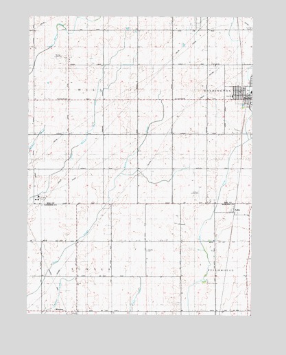
Beecher West, IL USGS Topographic Map
Click on map above to begin viewing in our Map Viewer.

This topographic map contains these locations and features:
Feature Name Type Latitude Longitude GNIS ID View Map
Beecher Community ChurchChurchN41.3422°W87.6333°2130249View Map
Beecher Elementary SchoolSchoolN41.3436°W87.6259°1822275View Map
Beecher Fire Protection DistrictBuildingN41.3430°W87.6280°2681913View Map
Beecher Police DepartmentBuildingN41.3423°W87.6287°2756965View Map
Beecher Post OfficePost OfficeN41.3424°W87.6280°1822274View Map
Beecher SchoolSchoolN41.3575°W87.7331°423584View Map
Depot ParkParkN41.3436°W87.6306°2355555View Map
Disselkoen FarmsLocaleN41.2983°W87.6319°2566246View Map
Heusing CemeteryCemeteryN41.2772°W87.6834°410127View Map
Judson (historical)Populated PlaceN41.2523°W87.6423°1810652View Map
Lions ParkParkN41.3467°W87.6322°2355553View Map
Meyer School (historical)SchoolN41.3561°W87.6509°1719170View Map
Norman Airport (historical)AirportN41.3584°W87.7250°427674View Map
Norman Landing Strip (historical)AirportN41.3434°W87.6259°423582View Map
Saint Luke United Church of ChristChurchN41.3428°W87.6286°2130250View Map
Saint Paul Lutheran CemeteryCemeteryN41.2884°W87.6660°1810691View Map
Saint Paul's Lutheran ChurchChurchN41.3548°W87.6456°426985View Map
Salzman School (historical)SchoolN41.3186°W87.6509°417910View Map
Sippel Memorial FieldParkN41.3444°W87.6261°2355556View Map
SollittPopulated PlaceN41.2934°W87.6348°418698View Map
Township of SumnerCivilN41.2520°W87.7225°429815View Map
Township of WillCivilN41.3400°W87.7276°429936View Map
Von Alvens Airview AirportAirportN41.2995°W87.6549°423583View Map
Von Alvens Airview Airport (historical)AirportN41.3000°W87.6500°427049View Map
Water Tower ParkParkN41.3436°W87.6319°2355552View Map
WhitakerPopulated PlaceN41.2514°W87.7278°421013View Map
Will Unit School (historical)SchoolN41.3395°W87.7273°421181View Map
Womens Welfare ParkParkN41.3450°W87.6306°2355554View Map
Zion ChurchChurchN41.2884°W87.6653°421660View Map
Zion Lutheran ChurchChurchN41.3414°W87.6359°423580View Map
Zion Lutheran SchoolSchoolN41.3420°W87.6359°423581View Map

Note: Coordinates in the location and feature list above are referenced to NAD83 datum.


Copyright (C) 2008-2025 Ryan Niemi / Sunset Dynamics ... All Rights Reserved