TopoQuest Logo
Do you find TopoQuest useful?
Help keep TopoQuest running and adding new maps/features by donating!
Bitcoin:  19c7KJd3qBynnjoSw5npx9KScwjBe4ifkT
Litecoin:  LXs6TkuXGGXo1vDsWCkWVdjQX94eUKd6ui
Home View Maps Find Maps Find Places Resources & Links


Mount Big Chief, Colorado Topographic Map

USGS Map Title: Mount Big Chief, CO
USGS Map MRC: 38104F8
DRG (GeoTIFF) Download: o38104f8.tif


Neighboring USGS Topographic Map Quads:


  Pikes Peak, CO  
38105G1
 

  Manitou Springs, CO  
38104G8
 

  Colorado Springs, CO  
38104G7
 

  Big Bull Mountain, CO  
38105F1
 

  Mount Big Chief, CO  
38104F8
 

  Cheyenne Mountain, CO  
38104F7
 

  Phantom Canyon, CO  
38105E1
 

  Mount Pittsburg, CO  
38104E8
 

  Timber Mountain, CO  
38104E7


Map MRC Location:

N39°
W105°
N39°
W104°
H8 H7 H6 H5 H4 H3 H2 H1
G8 G7 G6 G5 G4 G3 G2 G1
F8 F7 F6 F5 F4 F3 F2 F1
E8 E7 E6 E5 E4 E3 E2 E1
D8 D7 D6 D5 D4 D3 D2 D1
C8 C7 C6 C5 C4 C3 C2 C1
B8 B7 B6 B5 B4 B3 B2 B1
A8 A7 A6 A5 A4 A3 A2 A1
N38°
W105°
N38°
W104°

Mount Big Chief, CO USGS 1:24K Topographic Map Preview:
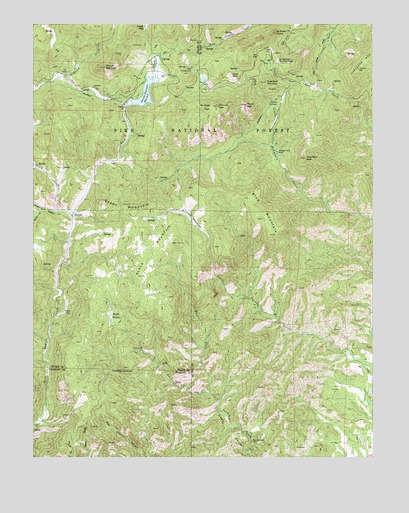
Mount Big Chief, CO USGS Topographic Map
Click on map above to begin viewing in our Map Viewer.

This topographic map contains these locations and features:
Feature Name Type Latitude Longitude GNIS ID View Map
Black MountainSummitN38.6894°W104.9586°193582View Map
Blue MountainSummitN38.6936°W104.9158°193586View Map
Broadmoor LodgeLocaleN38.7328°W104.9603°193588View Map
Cather SpringsSpringN38.7272°W104.9105°193599View Map
Cheyenne MountainSummitN38.7372°W104.8808°203681View Map
Cheyenne Mountain DivisionCivilN38.7037°W104.8905°1935424View Map
Comanche Group MineMineN38.7439°W104.9605°1734083View Map
Devils SlideCliffN38.7350°W104.9269°193595View Map
DuffieldPopulated PlaceN38.7422°W104.9125°193597View Map
Duffield MeadowsFlatN38.6939°W104.9422°193585View Map
East Fork Turkey CreekStreamN38.6411°W104.9325°193578View Map
Emerald Valley Boys CampLocaleN38.7133°W104.9283°193593View Map
Emerald Valley RanchLocaleN38.7133°W104.9111°193600View Map
Glen Cairn DamDamN38.6433°W104.8789°199828View Map
Glen Cairn ReservoirReservoirN38.6433°W104.8789°199829View Map
Gould CreekStreamN38.6947°W104.9861°191311View Map
Gray Back PeakSummitN38.7114°W104.9000°193601View Map
Green MountainSummitN38.6965°W104.9630°193583View Map
Heavy Stone LodeMineN38.7455°W104.9544°1734067View Map
Hopkins GulchValleyN38.6962°W104.9910°191312View Map
Knights PeakSummitN38.7253°W104.9458°1989390View Map
McKinley PeakSummitN38.7261°W104.9366°193591View Map
Moffet MeadowSwampN38.6654°W104.9720°193581View Map
Mount Big ChiefSummitN38.7375°W104.9741°193587View Map
Mount VigilSummitN38.7269°W104.9222°193594View Map
Pecks CampLocaleN38.6672°W104.9889°193580View Map
Penrose-Rosemont DamDamN38.7333°W104.9589°199032View Map
Penrose-Rosemont ReservoirReservoirN38.7272°W104.9641°193589View Map
Penrose-Rosemont ReservoirReservoirN38.7302°W104.9589°199033View Map
RosemontPopulated PlaceN38.7422°W104.9569°193590View Map
Saint Peters DomeSummitN38.7472°W104.9116°193596View Map
Saint Peters Dome MineMineN38.7294°W104.9100°1735595View Map
San Luis PeakSummitN38.7267°W104.9325°193592View Map
Stage Road Picnic GroundLocaleN38.7478°W104.8894°197671View Map
Sugarloaf MountainSummitN38.7333°W104.9150°193598View Map
Timberline MineMineN38.7244°W104.9316°1735605View Map
Turkey Canyon RanchLocaleN38.6294°W104.9200°193576View Map
West Fork Turkey CreekStreamN38.6411°W104.9325°193577View Map
Willow GulchValleyN38.6972°W104.9976°191313View Map
Winfield Scott Stratton MineMineN38.7336°W104.9175°1735606View Map
Wye CampgroundLocaleN38.7372°W104.9425°197670View Map

Note: Coordinates in the location and feature list above are referenced to NAD83 datum.


Copyright (C) 2008-2024 Ryan Niemi / Sunset Dynamics ... All Rights Reserved