TopoQuest Logo
Do you find TopoQuest useful?
Help keep TopoQuest running and adding new maps/features by donating!
Bitcoin:  19c7KJd3qBynnjoSw5npx9KScwjBe4ifkT
Litecoin:  LXs6TkuXGGXo1vDsWCkWVdjQX94eUKd6ui
Home View Maps Find Maps Find Places Resources & Links


Mount Blaine, Colorado Topographic Map

USGS Map Title: Mount Blaine, CO
USGS Map MRC: 39108E3
DRG (GeoTIFF) Download: o39108e3.tif


Neighboring USGS Topographic Map Quads:


  Figure Four Spring, CO  
39108F4
 

  Bull Fork, CO  
39108F3
 

  Cutoff Gulch, CO  
39108F2
 

  Desert Gulch, CO  
39108E4
 

  Mount Blaine, CO  
39108E3
 

  Circle Dot Gulch, CO  
39108E2
 

  The Saddle, CO  
39108D4
 

  Long Point, CO  
39108D3
 

  Red Pinnacle, CO  
39108D2


Map MRC Location:

N40°
W109°
N40°
W108°
H8 H7 H6 H5 H4 H3 H2 H1
G8 G7 G6 G5 G4 G3 G2 G1
F8 F7 F6 F5 F4 F3 F2 F1
E8 E7 E6 E5 E4 E3 E2 E1
D8 D7 D6 D5 D4 D3 D2 D1
C8 C7 C6 C5 C4 C3 C2 C1
B8 B7 B6 B5 B4 B3 B2 B1
A8 A7 A6 A5 A4 A3 A2 A1
N39°
W109°
N39°
W108°

Mount Blaine, CO USGS 1:24K Topographic Map Preview:
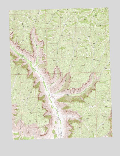
Mount Blaine, CO USGS Topographic Map
Click on map above to begin viewing in our Map Viewer.

This topographic map contains these locations and features:
Feature Name Type Latitude Longitude GNIS ID View Map
Buck GulchValleyN39.5496°W108.3301°172195View Map
Camp GulchValleyN39.6080°W108.3455°172056View Map
Crystal CreekStreamN39.5550°W108.2726°172194View Map
Deer Park GulchValleyN39.5375°W108.3234°172197View Map
Doe CreekStreamN39.5666°W108.2706°172203View Map
Doe GulchValleyN39.5424°W108.3247°172196View Map
Mount BlaineSummitN39.5116°W108.3398°172205View Map
Pearl CreekStreamN39.5666°W108.2706°172204View Map
Pine Trail ReservoirReservoirN39.5128°W108.3662°185628View Map
Potts CreekStreamN39.5878°W108.3420°172057View Map
Scott GulchValleyN39.5166°W108.3150°172193View Map
Scott SpringSpringN39.5455°W108.3520°172192View Map
Short GulchValleyN39.5636°W108.3018°172198View Map
Sleepy RidgeStreamN39.6114°W108.3140°172201View Map
Square S RanchLocaleN39.5133°W108.2651°171818View Map
Tom CreekStreamN39.5683°W108.3465°172200View Map
Trail RidgeRidgeN39.6044°W108.2990°172202View Map
Wiesse CreekStreamN39.5483°W108.3320°172199View Map

Note: Coordinates in the location and feature list above are referenced to NAD83 datum.


Copyright (C) 2008-2024 Ryan Niemi / Sunset Dynamics ... All Rights Reserved