TopoQuest Logo
Do you find TopoQuest useful?
Help keep TopoQuest running and adding new maps/features by donating!
Bitcoin:  19c7KJd3qBynnjoSw5npx9KScwjBe4ifkT
Litecoin:  LXs6TkuXGGXo1vDsWCkWVdjQX94eUKd6ui
Home View Maps Find Maps Find Places Resources & Links


Mount Blue, Maine Topographic Map

USGS Map Title: Mount Blue, ME
USGS Map MRC: 44070F3
DRG (GeoTIFF) Download: o44070f3.tif


Neighboring USGS Topographic Map Quads:


  Madrid, ME  
44070G4
 

  Phillips, ME  
44070G3
 

  Strong, ME  
44070G2
 

  Weld, ME  
44070F4
 

  Mount Blue, ME  
44070F3
 

  Farmington, ME  
44070F2
 

  Dixfield, ME  
44070E4
 

  East Dixfield, ME  
44070E3
 

  Wilton, ME  
44070E2


Map MRC Location:

N45°
W71°
N45°
W70°
H8 H7 H6 H5 H4 H3 H2 H1
G8 G7 G6 G5 G4 G3 G2 G1
F8 F7 F6 F5 F4 F3 F2 F1
E8 E7 E6 E5 E4 E3 E2 E1
D8 D7 D6 D5 D4 D3 D2 D1
C8 C7 C6 C5 C4 C3 C2 C1
B8 B7 B6 B5 B4 B3 B2 B1
A8 A7 A6 A5 A4 A3 A2 A1
N44°
W71°
N44°
W70°

Mount Blue, ME USGS 1:24K Topographic Map Preview:
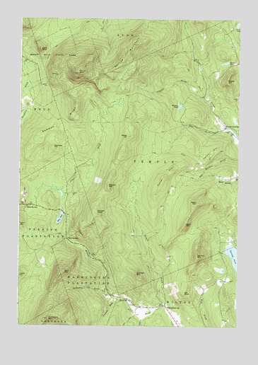
Mount Blue, ME USGS Topographic Map
Click on map above to begin viewing in our Map Viewer.

This topographic map contains these locations and features:
Feature Name Type Latitude Longitude GNIS ID View Map
Adams Richardson CemeteryCemeteryN44.6298°W70.3072°2724976View Map
Alder BrookStreamN44.6728°W70.3737°561124View Map
Anderson BrookStreamN44.6376°W70.3228°561245View Map
Bald MountainSummitN44.6470°W70.3502°561516View Map
Caldin HillSummitN44.6941°W70.2680°563347View Map
Center HillSummitN44.6858°W70.2918°563750View Map
Chandler HillSummitN44.6978°W70.3559°563824View Map
Conant BrookStreamN44.7187°W70.2695°564271View Map
Crockett MountainSummitN44.6463°W70.3073°564537View Map
Dakin BrookStreamN44.6314°W70.2965°564745View Map
Dean MountainSummitN44.6667°W70.2795°564919View Map
Deane CemeteryCemeteryN44.6653°W70.2620°2736283View Map
Derby MountainSummitN44.6756°W70.2731°565060View Map
Edes BrookStreamN44.7059°W70.2559°565782View Map
Gammon RidgeRidgeN44.7059°W70.3542°566674View Map
Gleason MountainSummitN44.6820°W70.3242°566836View Map
Grants PondLakeN44.7324°W70.2573°567063View Map
Hildreths MillPopulated PlaceN44.6739°W70.3690°579409View Map
Hills PondLakeN44.6687°W70.3513°568065View Map
Holman PondLakeN44.7147°W70.2836°568200View Map
Intervale CemeteryCemeteryN44.7044°W70.2546°568662View Map
Jessie PondLakeN44.7482°W70.2505°568816View Map
Kinneys HeadSummitN44.6706°W70.3298°569222View Map
Little BlueSummitN44.7376°W70.3635°569695View Map
Mount BlueSummitN44.7281°W70.3420°562606View Map
Old BluffSummitN44.6389°W70.2798°572684View Map
Perkins TownshipCivilN44.6643°W70.3649°2748518View Map
Potato HillSummitN44.7253°W70.2562°573710View Map
Saddleback MountainSummitN44.6277°W70.3577°574666View Map
Spruce MountainSummitN44.7351°W70.3137°576147View Map
Temple BrookStreamN44.6328°W70.2912°576712View Map
Temple IntervalePopulated PlaceN44.7070°W70.2576°579760View Map
Town of TempleCivilN44.6965°W70.2805°582761View Map
Townsend BrookStreamN44.6362°W70.3198°577244View Map
Twin BridgesLocaleN44.6603°W70.3473°577472View Map
Unorganized Territory of South FranklinCivilN44.6559°W70.3552°582735View Map
Varnum MountainSummitN44.6536°W70.2729°577699View Map
Washington TownshipCivilN44.6416°W70.3336°2748536View Map
Wilder HillSummitN44.7023°W70.3132°578476View Map
Wilton IntervalePopulated PlaceN44.6337°W70.2923°578560View Map

Note: Coordinates in the location and feature list above are referenced to NAD83 datum.


Copyright (C) 2008-2025 Ryan Niemi / Sunset Dynamics ... All Rights Reserved