TopoQuest Logo
Do you find TopoQuest useful?
Help keep TopoQuest running and adding new maps/features by donating!
Bitcoin:  19c7KJd3qBynnjoSw5npx9KScwjBe4ifkT
Litecoin:  LXs6TkuXGGXo1vDsWCkWVdjQX94eUKd6ui
Home View Maps Find Maps Find Places Resources & Links


Aimwell, Louisiana Topographic Map

USGS Map Title: Aimwell, LA
USGS Map MRC: 31091G8
DRG (GeoTIFF) Download: o31091g8.tif


Neighboring USGS Topographic Map Quads:


  Holum, LA  
31092H1
 

  Enterprise, LA  
31091H8
 

  Extension, LA  
31091H7
 

  Nickel, LA  
31092G1
 

  Aimwell, LA  
31091G8
 

  Harrisonburg, LA  
31091G7
 

  Jena East, LA  
31092F1
 

  Manifest, LA  
31091F8
 

  Jonesville North, LA  
31091F7


Map MRC Location:

N32°
W92°
N32°
W91°
H8 H7 H6 H5 H4 H3 H2 H1
G8 G7 G6 G5 G4 G3 G2 G1
F8 F7 F6 F5 F4 F3 F2 F1
E8 E7 E6 E5 E4 E3 E2 E1
D8 D7 D6 D5 D4 D3 D2 D1
C8 C7 C6 C5 C4 C3 C2 C1
B8 B7 B6 B5 B4 B3 B2 B1
A8 A7 A6 A5 A4 A3 A2 A1
N31°
W92°
N31°
W91°

Aimwell, LA USGS 1:24K Topographic Map Preview:
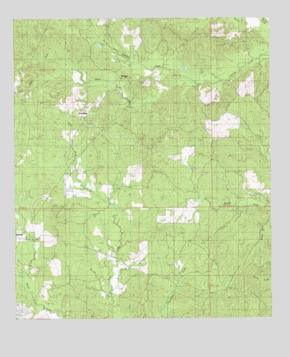
Aimwell, LA USGS Topographic Map
Click on map above to begin viewing in our Map Viewer.

This topographic map contains these locations and features:
Feature Name Type Latitude Longitude GNIS ID View Map
AimwellPopulated PlaceN31.7835°W91.9935°553268View Map
Aimwell Baptist ChurchChurchN31.7852°W91.9999°553269View Map
Aimwell CemeteryCemeteryN31.7838°W91.9923°545995View Map
Aimwell Lookout TowerTowerN31.7966°W91.9796°545996View Map
Aimwell Pentecostal ChurchChurchN31.7843°W91.9776°545997View Map
Aimwell Post OfficePost OfficeN31.7849°W91.9996°1630398View Map
Cassels HillSummitN31.8432°W91.9657°546005View Map
Chalk HillsSummitN31.8532°W91.9932°543070View Map
Ford CemeteryCemeteryN31.7621°W91.9479°535028View Map
Haggerty CreekStreamN31.8513°W91.9021°554641View Map
McClendon CemeteryCemeteryN31.8029°W91.9140°536971View Map
Old Spring Ridge CemeteryCemeteryN31.8163°W91.9737°537861View Map
Parish Governing Authority District 3CivilN31.8120°W91.9255°1929944View Map
PrichardPopulated PlaceN31.7996°W91.8776°546047View Map
Pritchard CemeteryCemeteryN31.7938°W91.8904°538408View Map
Rocky CreekStreamN31.7627°W91.9521°555821View Map
SherwoodPopulated PlaceN31.8504°W91.9479°541190View Map
Siloam CemeteryCemeteryN31.8107°W91.9304°539370View Map
Spring RidgePopulated PlaceN31.8341°W91.9654°541612View Map
Spring Ridge CemeteryCemeteryN31.8340°W91.9660°546063View Map
Spring Ridge ChurchChurchN31.8338°W91.9660°539601View Map
Sugar CreekStreamN31.8491°W91.8985°556157View Map
Ward ThreeCivilN31.8202°W91.9337°544974View Map

Note: Coordinates in the location and feature list above are referenced to NAD83 datum.


Copyright (C) 2008-2024 Ryan Niemi / Sunset Dynamics ... All Rights Reserved