TopoQuest Logo
Do you find TopoQuest useful?
Help keep TopoQuest running and adding new maps/features by donating!
Bitcoin:  19c7KJd3qBynnjoSw5npx9KScwjBe4ifkT
Litecoin:  LXs6TkuXGGXo1vDsWCkWVdjQX94eUKd6ui
Home View Maps Find Maps Find Places Resources & Links


Mount Carrie, Washington Topographic Map

USGS Map Title: Mount Carrie, WA
USGS Map MRC: 47123H6
DRG (GeoTIFF) Download: o47123h6.tif


Neighboring USGS Topographic Map Quads:


  Lake Crescent, WA  
48123A7
 

  Lake Sutherland, WA  
48123A6
 

  Elwha, WA  
48123A5
 

  Bogachiel Peak, WA  
47123H7
 

  Mount Carrie, WA  
47123H6
 

  Hurricane Hill, WA  
47123H5
 

  Mount Tom, WA  
47123G7
 

  Mount Olympus, WA  
47123G6
 

  Mount Queets, WA  
47123G5


Map MRC Location:

N48°
W124°
N48°
W123°
H8 H7 H6 H5 H4 H3 H2 H1
G8 G7 G6 G5 G4 G3 G2 G1
F8 F7 F6 F5 F4 F3 F2 F1
E8 E7 E6 E5 E4 E3 E2 E1
D8 D7 D6 D5 D4 D3 D2 D1
C8 C7 C6 C5 C4 C3 C2 C1
B8 B7 B6 B5 B4 B3 B2 B1
A8 A7 A6 A5 A4 A3 A2 A1
N47°
W124°
N47°
W123°

Mount Carrie, WA USGS 1:24K Topographic Map Preview:
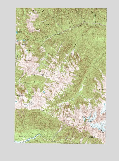
Mount Carrie, WA USGS Topographic Map
Click on map above to begin viewing in our Map Viewer.

This topographic map contains these locations and features:
Feature Name Type Latitude Longitude GNIS ID View Map
Appleton PassGapN47.9384°W123.7227°1515933View Map
Blue LakeLakeN47.9602°W123.7363°1516693View Map
Boulder Creek CampgroundLocaleN47.9781°W123.6930°1529621View Map
Boulder LakeLakeN47.9766°W123.7496°1516846View Map
Boulder Lake TrailTrailN47.9729°W123.7263°1516849View Map
Bridge CreekStreamN47.9298°W123.7341°1516949View Map
Carrie GlacierGlacierN47.8915°W123.6346°1531450View Map
Cat PeakSummitN47.9001°W123.6801°1517488View Map
Cougar CreekStreamN47.9845°W123.6560°1518166View Map
Crystal CreekStreamN47.9776°W123.6830°1518371View Map
Crystal RidgeRidgeN47.9788°W123.7228°1518383View Map
Deadmans GulchValleyN47.9833°W123.6411°1518551View Map
Deep CreekStreamN47.9837°W123.6438°1518586View Map
Deer CreekStreamN47.9845°W123.6519°1518603View Map
Everett PeakSummitN47.9649°W123.7377°1519407View Map
Fairchild GlacierGlacierN47.9066°W123.6290°1529151View Map
Falls CreekStreamN47.8793°W123.7263°1515699View Map
Glacier CreekStreamN47.8765°W123.6946°1519976View Map
Haigs LakeLakeN47.9223°W123.7113°1520448View Map
Heart LakeLakeN47.9098°W123.7344°1520651View Map
Heart Lake ShelterLocaleN47.9129°W123.7299°1520652View Map
Hell CreekStreamN47.9795°W123.6727°1520688View Map
Hoh River TrailTrailN47.8843°W123.7199°1520847View Map
Lake Number 8LakeN47.9132°W123.7497°1533152View Map
Mount AppletonSummitN47.9504°W123.7332°1515934View Map
Mount CarrieSummitN47.8942°W123.6491°1517421View Map
Mount FairchildSummitN47.9001°W123.6334°1519428View Map
Mount FitzhenrySummitN47.9227°W123.6303°1519621View Map
Mud LakeLakeN47.9581°W123.7269°1530183View Map
North Fork Boulder CreekStreamN47.9690°W123.7108°1529448View Map
Olympic Hot SpringsPopulated PlaceN47.9762°W123.6882°1524043View Map
Oyster LakeLakeN47.9378°W123.7154°1524126View Map
Rocky CreekStreamN47.9309°W123.7499°1525161View Map
Schoeffel CreekStreamN47.9831°W123.6463°1525504View Map
Sevenmile ShelterLocaleN47.9306°W123.7421°1525590View Map
Slide CreekStreamN47.8762°W123.7444°1525932View Map
Sol Duc ParkFlatN47.9109°W123.7277°1526100View Map
South Fork Boulder CreekStreamN47.9690°W123.7108°1529447View Map
Three Horse LakeLakeN47.9697°W123.7397°1527153View Map

Note: Coordinates in the location and feature list above are referenced to NAD83 datum.


Copyright (C) 2008-2024 Ryan Niemi / Sunset Dynamics ... All Rights Reserved