TopoQuest Logo
Do you find TopoQuest useful?
Help keep TopoQuest running and adding new maps/features by donating!
Bitcoin:  19c7KJd3qBynnjoSw5npx9KScwjBe4ifkT
Litecoin:  LXs6TkuXGGXo1vDsWCkWVdjQX94eUKd6ui
Home View Maps Find Maps Find Places Resources & Links


Mount Champion, Colorado Topographic Map

USGS Map Title: Mount Champion, CO
USGS Map MRC: 39106B5
DRG (GeoTIFF) Download: o39106b5.tif


Neighboring USGS Topographic Map Quads:


  Meredith, CO  
39106C6
 

  Nast, CO  
39106C5
 

  Homestake Reservoir, CO  
39106C4
 

  Thimble Rock, CO  
39106B6
 

  Mount Champion, CO  
39106B5
 

  Mount Massive, CO  
39106B4
 

  New York Peak, CO  
39106A6
 

  Independence Pass, CO  
39106A5
 

  Mount Elbert, CO  
39106A4


Map MRC Location:

N40°
W107°
N40°
W106°
H8 H7 H6 H5 H4 H3 H2 H1
G8 G7 G6 G5 G4 G3 G2 G1
F8 F7 F6 F5 F4 F3 F2 F1
E8 E7 E6 E5 E4 E3 E2 E1
D8 D7 D6 D5 D4 D3 D2 D1
C8 C7 C6 C5 C4 C3 C2 C1
B8 B7 B6 B5 B4 B3 B2 B1
A8 A7 A6 A5 A4 A3 A2 A1
N39°
W107°
N39°
W106°

Mount Champion, CO USGS 1:24K Topographic Map Preview:
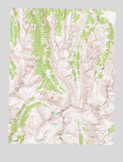
Mount Champion, CO USGS Topographic Map
Click on map above to begin viewing in our Map Viewer.

This topographic map contains these locations and features:
Feature Name Type Latitude Longitude GNIS ID View Map
Blue LakeLakeN39.1355°W106.5552°180104View Map
Champion MillLocaleN39.1375°W106.5045°180108View Map
Champion MineMineN39.1258°W106.5195°180110View Map
Deadman GulchValleyN39.1856°W106.5784°180096View Map
Deadman LakeLakeN39.1893°W106.5814°180095View Map
Deer MountainSummitN39.1569°W106.5214°180107View Map
Eureka MineMineN39.1292°W106.5278°1684525View Map
Fryingpan LakesLakeN39.1953°W106.5184°180094View Map
Geissler MountainSummitN39.1450°W106.5831°180100View Map
Granite LakesLakeN39.2361°W106.5714°180092View Map
Independence LakeLakeN39.1437°W106.5678°180103View Map
Jack CreekStreamN39.1453°W106.6139°180034View Map
Linkins LakeLakeN39.1285°W106.5887°180101View Map
Lost Man LakeLakeN39.1533°W106.5688°180102View Map
Lost Man ReservoirReservoirN39.1271°W106.6193°180099View Map
Marten CreekStreamN39.2453°W106.5314°180093View Map
Mount ChampionSummitN39.1322°W106.5217°180109View Map
Mount OklahomaSummitN39.1789°W106.5061°196668View Map
Scott LakeLakeN39.1573°W106.6177°180098View Map
Sioux LakeLakeN39.1760°W106.6029°196669View Map
South Fork PassGapN39.1711°W106.5884°180097View Map
South Fork TunnelTunnelN39.2401°W106.5616°196860View Map
Twining PeakSummitN39.1344°W106.5634°196503View Map
Williams MountainsRangeN39.1805°W106.6103°202690View Map

Note: Coordinates in the location and feature list above are referenced to NAD83 datum.


Copyright (C) 2008-2024 Ryan Niemi / Sunset Dynamics ... All Rights Reserved