TopoQuest Logo
Do you find TopoQuest useful?
Help keep TopoQuest running and adding new maps/features by donating!
Bitcoin:  19c7KJd3qBynnjoSw5npx9KScwjBe4ifkT
Litecoin:  LXs6TkuXGGXo1vDsWCkWVdjQX94eUKd6ui
Home View Maps Find Maps Find Places Resources & Links


Ainsworth, Nebraska Topographic Map

USGS Map Title: Ainsworth, NE
USGS Map MRC: 42099E7
DRG (GeoTIFF) Download: o42099e7.tif


Neighboring USGS Topographic Map Quads:


  Ainsworth NW, NE  
42099F8
 

  Dutch Creek, NE  
42099F7
 

  Bassett NW, NE  
42099F6
 

  Ainsworth SW, NE  
42099E8
 

  Ainsworth, NE  
42099E7
 

  Long Pine, NE  
42099E6
 

  Lost Lake Ranch, NE  
42099D8
 

  Hofeld Lake, NE  
42099D7
 

  Hagan Lake NW, NE  
42099D6


Map MRC Location:

N43°
W100°
N43°
W99°
H8 H7 H6 H5 H4 H3 H2 H1
G8 G7 G6 G5 G4 G3 G2 G1
F8 F7 F6 F5 F4 F3 F2 F1
E8 E7 E6 E5 E4 E3 E2 E1
D8 D7 D6 D5 D4 D3 D2 D1
C8 C7 C6 C5 C4 C3 C2 C1
B8 B7 B6 B5 B4 B3 B2 B1
A8 A7 A6 A5 A4 A3 A2 A1
N42°
W100°
N42°
W99°

Ainsworth, NE USGS 1:24K Topographic Map Preview:
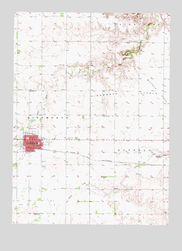
Ainsworth, NE USGS Topographic Map
Click on map above to begin viewing in our Map Viewer.

This topographic map contains these locations and features:
Feature Name Type Latitude Longitude GNIS ID View Map
AinsworthLocaleN42.5450°W99.8615°1844929View Map
AinsworthPopulated PlaceN42.5500°W99.8626°826919View Map
Ainsworth CemeteryCemeteryN42.5342°W99.8507°826920View Map
Ainsworth Community SchoolsSchoolN42.5478°W99.8560°1844971View Map
Ainsworth Family ClinicHospitalN42.5450°W99.8476°1844957View Map
Ainsworth Feed YardsLocaleN42.5689°W99.8675°2581821View Map
Ainsworth Police DepartmentBuildingN42.5504°W99.8639°1844961View Map
Ainsworth Post OfficePost OfficeN42.5493°W99.8628°1844982View Map
Ainsworth Public LibraryBuildingN42.5514°W99.8621°1844958View Map
Ainsworth TableSummitN42.5772°W99.7798°826921View Map
Ainsworth Volunteer Fire DepartmentBuildingN42.5484°W99.8622°1844962View Map
Assembly of God ChurchChurchN42.5469°W99.8521°1844942View Map
Berean Fundamental ChurchChurchN42.5478°W99.8462°1844943View Map
Brown County Ambulance AssociationBuildingN42.5484°W99.8629°2553757View Map
Brown County ClinicHospitalN42.5450°W99.8479°1844955View Map
Brown County CourthouseBuildingN42.5506°W99.8640°1844960View Map
Brown County HospitalHospitalN42.5445°W99.8497°1844956View Map
Brown County Sheriff's OfficeBuildingN42.5505°W99.8638°1844959View Map
Buffalo FlatsFlatN42.5789°W99.7587°827754View Map
Church of the NazareneChurchN42.5478°W99.8565°1844944View Map
City of AinsworthCivilN42.5484°W99.8576°2393893View Map
Coleman HouseBuildingN42.5500°W99.8626°1844931View Map
Community Care of AinsworthHospitalN42.5500°W99.8626°1844930View Map
Congregational United Church of ChristChurchN42.5483°W99.8648°1844945View Map
East City ParkParkN42.5486°W99.8448°1844964View Map
East City Park CampgroundLocaleN42.5486°W99.8448°1844954View Map
Eddys SchoolSchoolN42.5061°W99.8529°836987View Map
Evangelical Free ChurchChurchN42.5503°W99.8485°1844953View Map
Faith Baptist ChurchChurchN42.5439°W99.8640°1844946View Map
Jehovahs Witnesses Kingdom HallChurchN42.5489°W99.8648°1844947View Map
KBRB-AM (Ainsworth)TowerN42.5544°W99.8315°837315View Map
KBRB-FM (Ainsworth)TowerN42.5544°W99.8315°837378View Map
Lazy A Motel and CampgroundLocaleN42.5506°W99.8421°1844927View Map
Moody Group DamDamN42.5790°W99.8011°1769700View Map
Moody Group ReservoirReservoirN42.5800°W99.8004°1769701View Map
New Apostolic ChurchChurchN42.5464°W99.8476°1844948View Map
Park CemeteryCemeteryN42.5511°W99.8248°831974View Map
Parkside Berean ChurchChurchN42.5478°W99.8462°1844949View Map
Saint Pius X Catholic ChurchChurchN42.5481°W99.8490°1844952View Map
School Number 20SchoolN42.5644°W99.8043°836381View Map
School Number 27SchoolN42.5408°W99.7554°836500View Map
School Number 55SchoolN42.5786°W99.8632°836872View Map
Sellors-Barton MuseumBuildingN42.5503°W99.8629°1844932View Map
Skinners Motor CourtLocaleN42.5444°W99.8637°1844928View Map
United Methodist ChurchChurchN42.5483°W99.8635°1844950View Map
Zion Lutheran ChurchChurchN42.5500°W99.8593°1844951View Map

Note: Coordinates in the location and feature list above are referenced to NAD83 datum.


Copyright (C) 2008-2024 Ryan Niemi / Sunset Dynamics ... All Rights Reserved