TopoQuest Logo
Do you find TopoQuest useful?
Help keep TopoQuest running and adding new maps/features by donating!
Bitcoin:  19c7KJd3qBynnjoSw5npx9KScwjBe4ifkT
Litecoin:  LXs6TkuXGGXo1vDsWCkWVdjQX94eUKd6ui
Home View Maps Find Maps Find Places Resources & Links


Beechwood, Michigan Topographic Map

USGS Map Title: Beechwood, MI
USGS Map MRC: 46088B7
DRG (GeoTIFF) Download: o46088b7.tif


Neighboring USGS Topographic Map Quads:


  Perch Lake, MI  
46088C6
 

  Golden Lake, MI  
46088B8
 

  Beechwood, MI  
46088B7
 

  Gibbs City, MI  
46088B6
 

  Smoky Lake, MI  
46088A8
 

  Hagerman Lake, MI  
46088A7
 

  Iron River, MI  
46088A6


Map MRC Location:

N47°
W89°
N47°
W88°
H8 H7 H6 H5 H4 H3 H2 H1
G8 G7 G6 G5 G4 G3 G2 G1
F8 F7 F6 F5 F4 F3 F2 F1
E8 E7 E6 E5 E4 E3 E2 E1
D8 D7 D6 D5 D4 D3 D2 D1
C8 C7 C6 C5 C4 C3 C2 C1
B8 B7 B6 B5 B4 B3 B2 B1
A8 A7 A6 A5 A4 A3 A2 A1
N46°
W89°
N46°
W88°

Beechwood, MI USGS 1:24K Topographic Map Preview:
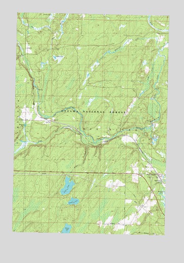
Beechwood, MI USGS Topographic Map
Click on map above to begin viewing in our Map Viewer.

This topographic map contains these locations and features:
Feature Name Type Latitude Longitude GNIS ID View Map
BasswoodPopulated PlaceN46.1886°W88.8451°1619105View Map
Basswood PondLakeN46.1859°W88.8664°620726View Map
Basswood Station (historical)LocaleN46.1886°W88.8450°2129425View Map
BeechwoodPopulated PlaceN46.1597°W88.7735°1619153View Map
Beechwood ChurchChurchN46.1313°W88.7821°621009View Map
Beechwood Post Office (historical)Post OfficeN46.1597°W88.7733°2129459View Map
Beechwood Station (historical)LocaleN46.1561°W88.7556°2129460View Map
Bethany ChurchChurchN46.1591°W88.7618°1622301View Map
Branch Line LakeLakeN46.1488°W88.7554°1619306View Map
Cooks RunStreamN46.1813°W88.8182°1619568View Map
Crowfoot LakeLakeN46.2249°W88.8435°624146View Map
Ermine LakeLakeN46.2491°W88.8470°1619864View Map
Fur Farm PondLakeN46.1795°W88.7601°626573View Map
Lode CreekStreamN46.2277°W88.7585°630868View Map
McAllister CreekStreamN46.2305°W88.7574°1620745View Map
McRae CreekStreamN46.1777°W88.8112°629973View Map
Post CreekStreamN46.2400°W88.8390°1621302View Map
Rosehill CemeteryCemeteryN46.1569°W88.7618°1622298View Map
Silver LakeLakeN46.1515°W88.8306°626122View Map
Timber LakeLakeN46.1432°W88.8252°1614868View Map
Township of Iron RiverCivilN46.2470°W88.7822°1626527View Map

Note: Coordinates in the location and feature list above are referenced to NAD83 datum.


Copyright (C) 2008-2024 Ryan Niemi / Sunset Dynamics ... All Rights Reserved