TopoQuest Logo
Do you find TopoQuest useful?
Help keep TopoQuest running and adding new maps/features by donating!
Bitcoin:  19c7KJd3qBynnjoSw5npx9KScwjBe4ifkT
Litecoin:  LXs6TkuXGGXo1vDsWCkWVdjQX94eUKd6ui
Home View Maps Find Maps Find Places Resources & Links


Mount Ichabod, Nevada Topographic Map

USGS Map Title: Mount Ichabod, NV
USGS Map MRC: 41115E5
DRG (GeoTIFF) Download: o41115e5.tif


Neighboring USGS Topographic Map Quads:


  Cornwall Mountain, NV  
41115F6
 

  Annie Creek, NV  
41115F5
 

  Marys River Basin NW, NV  
41115F4
 

  Wagon Springs, NV  
41115E6
 

  Mount Ichabod, NV  
41115E5
 

  Charleston Reservoir, NV  
41115E4
 

  Double Mountain, NV  
41115D6
 

  Devils Armchair, NV  
41115D5
 

  Stag Mountain, NV  
41115D4


Map MRC Location:

N42°
W116°
N42°
W115°
H8 H7 H6 H5 H4 H3 H2 H1
G8 G7 G6 G5 G4 G3 G2 G1
F8 F7 F6 F5 F4 F3 F2 F1
E8 E7 E6 E5 E4 E3 E2 E1
D8 D7 D6 D5 D4 D3 D2 D1
C8 C7 C6 C5 C4 C3 C2 C1
B8 B7 B6 B5 B4 B3 B2 B1
A8 A7 A6 A5 A4 A3 A2 A1
N41°
W116°
N41°
W115°

Mount Ichabod, NV USGS 1:24K Topographic Map Preview:
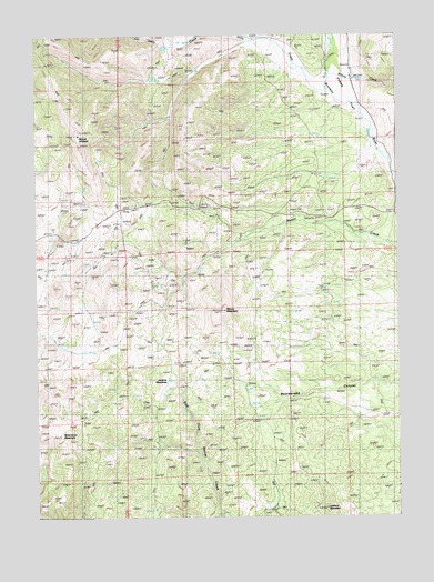
Mount Ichabod, NV USGS Topographic Map
Click on map above to begin viewing in our Map Viewer.

This topographic map contains these locations and features:
Feature Name Type Latitude Longitude GNIS ID View Map
A Torreuil RanchLocaleN41.5719°W115.5548°845103View Map
Dam Gulch CreekStreamN41.6002°W115.5109°849155View Map
Dolly CreekStreamN41.6107°W115.5245°859539View Map
Dry Lake ReservoirReservoirN41.5582°W115.5534°849156View Map
Evans FlatFlatN41.6096°W115.5178°856442View Map
F Shively RanchLocaleN41.6219°W115.5756°840397View Map
J M Prunty RanchLocaleN41.6135°W115.5159°841322View Map
Jenkins MeadowsFlatN41.5377°W115.5745°841367View Map
Lookout MountainSummitN41.5019°W115.5259°841821View Map
Mason MountainSummitN41.5535°W115.5606°845207View Map
Mount IchabodSummitN41.5991°W115.6104°856322View Map
Mud Spring GulchValleyN41.6235°W115.5776°860685View Map
P R Prunty RanchLocaleN41.6213°W115.5367°842673View Map
Stage CreekStreamN41.5760°W115.5384°850827View Map
Wild Horse MountainSummitN41.5194°W115.6179°856426View Map
Willow CreekStreamN41.6194°W115.5228°862043View Map

Note: Coordinates in the location and feature list above are referenced to NAD83 datum.


Copyright (C) 2008-2024 Ryan Niemi / Sunset Dynamics ... All Rights Reserved