TopoQuest Logo
Do you find TopoQuest useful?
Help keep TopoQuest running and adding new maps/features by donating!
Bitcoin:  19c7KJd3qBynnjoSw5npx9KScwjBe4ifkT
Litecoin:  LXs6TkuXGGXo1vDsWCkWVdjQX94eUKd6ui
Home View Maps Find Maps Find Places Resources & Links


Mount Lewis, Nevada Topographic Map

USGS Map Title: Mount Lewis, NV
USGS Map MRC: 40116D7
DRG (GeoTIFF) Download: o40116d7.tif


Neighboring USGS Topographic Map Quads:


  Blossom Spring, NV  
40116E8
 

  Bateman Spring, NV  
40116E7
 

  Mule Canyon, NV  
40116E6
 

  Crippen Canyon, NV  
40116D8
 

  Mount Lewis, NV  
40116D7
 

  Mud Spring Gulch, NV  
40116D6
 

  Goat Peak, NV  
40116C8
 

  Ferris Creek, NV  
40116C7
 

  Tenabo, NV  
40116C6


Map MRC Location:

N41°
W117°
N41°
W116°
H8 H7 H6 H5 H4 H3 H2 H1
G8 G7 G6 G5 G4 G3 G2 G1
F8 F7 F6 F5 F4 F3 F2 F1
E8 E7 E6 E5 E4 E3 E2 E1
D8 D7 D6 D5 D4 D3 D2 D1
C8 C7 C6 C5 C4 C3 C2 C1
B8 B7 B6 B5 B4 B3 B2 B1
A8 A7 A6 A5 A4 A3 A2 A1
N40°
W117°
N40°
W116°

Mount Lewis, NV USGS 1:24K Topographic Map Preview:
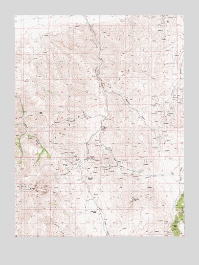
Mount Lewis, NV USGS Topographic Map
Click on map above to begin viewing in our Map Viewer.

This topographic map contains these locations and features:
Feature Name Type Latitude Longitude GNIS ID View Map
Aztec Group MineMineN40.4132°W116.8231°853566View Map
Barse MineMineN40.4977°W116.7654°854482View Map
Bateman CanyonValleyN40.4560°W116.8079°838644View Map
Bateman Canyon MineMineN40.4313°W116.7712°853556View Map
Battle Mountain MineMineN40.4444°W116.8698°853838View Map
Bens PeakSummitN40.4449°W116.8565°847238View Map
Bens SpringSpringN40.4454°W116.8695°846626View Map
Blue Dick MineMineN40.4141°W116.8390°854373View Map
Buck SpringSpringN40.4135°W116.8456°846627View Map
Celestine O'Neal MineMineN40.4444°W116.8698°853839View Map
Cherry SpringSpringN40.4626°W116.8660°846625View Map
Crum CanyonValleyN40.4941°W116.8215°839885View Map
Dean (historical)Populated PlaceN40.4252°W116.8562°863152View Map
Dean CanyonValleyN40.4338°W116.8690°839954View Map
Dean MineMineN40.4294°W116.8468°854424View Map
Dean Post OfficePost OfficeN40.4252°W116.8562°864433View Map
Defiance MineMineN40.4444°W116.8698°853837View Map
Dixie PassGapN40.3841°W116.7540°856631View Map
Dusang and Logan MineMineN40.4310°W116.8723°853840View Map
Eagle MinesMineN40.3838°W116.7545°853563View Map
Eagle Monitor MineMineN40.4444°W116.8698°853836View Map
East Fork Rock CreekStreamN40.4357°W116.8134°840267View Map
First Riffles MineMineN40.4444°W116.8073°853559View Map
Gold Dyke MineMineN40.4105°W116.7906°853560View Map
Gold Rod MineMineN40.4241°W116.7881°853591View Map
Granite MountainSummitN40.3841°W116.7501°845485View Map
Gray Eagle MineMineN40.3794°W116.7520°854473View Map
Havingdon PeakSummitN40.3960°W116.7898°858012View Map
Highland Chief MineMineN40.4219°W116.8401°856669View Map
HilltopPopulated PlaceN40.4146°W116.8004°856043View Map
Hilltop CanyonValleyN40.4363°W116.8131°841010View Map
Hilltop MineMineN40.4157°W116.8062°853561View Map
Hilltop Mining DistrictCivilN40.4241°W116.7881°853590View Map
Hilltop Post Office (historical)Post OfficeN40.4146°W116.8004°864638View Map
Indian Box SpringSpringN40.3892°W116.8157°841238View Map
Jenkins MineMineN40.4241°W116.7881°853856View Map
Kattenhorn MineMineN40.4169°W116.8318°841459View Map
Kimberly Consolidated MineMineN40.4138°W116.8056°853562View Map
Maysville (historical)Populated PlaceN40.4066°W116.8270°853832View Map
Maysville CanyonValleyN40.4357°W116.8131°841978View Map
Maysville SummitSummitN40.4080°W116.8231°845555View Map
Middletown (historical)Populated PlaceN40.4399°W116.8698°846761View Map
Miners Dream MineMineN40.4280°W116.8220°853564View Map
Miners Dream Placer MineMineN40.4291°W116.8212°858466View Map
Morning Glory MineMineN40.4241°W116.7881°853857View Map
Mount LewisSummitN40.4038°W116.8626°854511View Map
Neff MineMineN40.4241°W116.7881°853858View Map
Nelson MineMineN40.4360°W116.8126°842404View Map
O K MineMineN40.4241°W116.7881°853859View Map
O'Haras PeakSummitN40.3816°W116.7543°854553View Map
O'Neal MineMineN40.4444°W116.8698°858470View Map
Paymaster and Christopher MineMineN40.4146°W116.8081°853557View Map
Pittsburg MineMineN40.4221°W116.8387°854575View Map
Pittsburg Post OfficePost OfficeN40.4285°W116.8223°864655View Map
Pittsburgh (historical)Populated PlaceN40.4285°W116.8223°858354View Map
Red Top MineMineN40.4169°W116.8204°854589View Map
Riffles Placer MineMineN40.4427°W116.8079°853558View Map
Southern Pacific Lease MineMineN40.4413°W116.8234°853565View Map
Starr (historical)Populated PlaceN40.4407°W116.8698°863901View Map
Starr Grove MineMineN40.4407°W116.8698°853841View Map
Starr Post Office (historical)Post OfficeN40.4407°W116.8698°865025View Map
The ParkFlatN40.4127°W116.7576°844270View Map
Tunnel SpringSpringN40.4118°W116.7836°849509View Map
West Fork Rock CreekStreamN40.4363°W116.8131°844720View Map

Note: Coordinates in the location and feature list above are referenced to NAD83 datum.


Copyright (C) 2008-2025 Ryan Niemi / Sunset Dynamics ... All Rights Reserved