TopoQuest Logo
Do you find TopoQuest useful?
Help keep TopoQuest running and adding new maps/features by donating!
Bitcoin:  19c7KJd3qBynnjoSw5npx9KScwjBe4ifkT
Litecoin:  LXs6TkuXGGXo1vDsWCkWVdjQX94eUKd6ui
Home View Maps Find Maps Find Places Resources & Links


Mount Montgomery, Nevada Topographic Map

USGS Map Title: Mount Montgomery, NV
USGS Map MRC: 37118H3
DRG (GeoTIFF) Download: o37118h3.tif


Neighboring USGS Topographic Map Quads:


  Jacks Spring, NV  
38118A4
 

  Basalt, NV  
38118A3
 

  Miller Mountain, NV  
38118A2
 

  Truman Meadows, NV  
37118H4
 

  Mount Montgomery, NV  
37118H3
 

  Volcanic Hills West, NV  
37118H2
 

  Benton, CA  
37118G4
 

  Boundary Peak, NV  
37118G3
 

  Davis Mountain, NV  
37118G2


Map MRC Location:

N38°
W119°
N38°
W118°
H8 H7 H6 H5 H4 H3 H2 H1
G8 G7 G6 G5 G4 G3 G2 G1
F8 F7 F6 F5 F4 F3 F2 F1
E8 E7 E6 E5 E4 E3 E2 E1
D8 D7 D6 D5 D4 D3 D2 D1
C8 C7 C6 C5 C4 C3 C2 C1
B8 B7 B6 B5 B4 B3 B2 B1
A8 A7 A6 A5 A4 A3 A2 A1
N37°
W119°
N37°
W118°

Mount Montgomery, NV USGS 1:24K Topographic Map Preview:
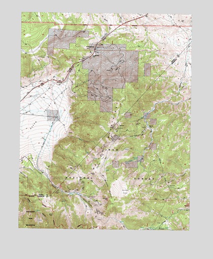
Mount Montgomery, NV USGS Topographic Map
Click on map above to begin viewing in our Map Viewer.

This topographic map contains these locations and features:
Feature Name Type Latitude Longitude GNIS ID View Map
Albert MineMineN37.8974°W118.3348°858677View Map
B and B MineMineN37.8877°W118.2521°858774View Map
Bley (historical)Populated PlaceN37.9888°W118.3110°857562View Map
Bley Post Office (historical)Post OfficeN37.9888°W118.3110°864556View Map
Brownie CreekStreamN37.9288°W118.3490°859029View Map
Buckskin MineMineN37.9363°W118.2898°859055View Map
Buena Vista Mining DistrictCivilN37.8847°W118.3210°856590View Map
Buffalo PointSummitN37.8827°W118.3501°859063View Map
Candelaria PipelineLocaleN37.9494°W118.2707°859142View Map
Foreys Toll House (historical)LocaleN37.9666°W118.3382°847886View Map
Garner RidgeRidgeN37.8910°W118.3237°859802View Map
Gold HitPopulated PlaceN37.9335°W118.2801°859841View Map
Hereford Valley RanchLocaleN37.9402°W118.3490°859975View Map
Hereford Valley RanchLocaleN37.9388°W118.3493°847937View Map
Horseshoe RockPillarN37.8924°W118.3101°860047View Map
Indian Queen MineMineN37.8847°W118.3210°855729View Map
Indian Queen Quartz Mill (historical)LocaleN37.9069°W118.3554°847885View Map
Kennedy FlatsFlatN37.8952°W118.2979°860249View Map
Kennedy PointSummitN37.8847°W118.3123°863830View Map
Lucky MineMineN37.8797°W118.2709°853382View Map
Montgomery PassGapN37.9735°W118.3268°860631View Map
Montgomery Summit MineMineN37.9741°W118.3623°853414View Map
Morgan MineMineN37.8933°W118.3232°860643View Map
Mount MontgomeryPopulated PlaceN37.9797°W118.3215°860659View Map
Mount Montgomery Post Office (historical)Post OfficeN37.9797°W118.3215°864603View Map
Mustang MountainRidgeN37.9010°W118.3090°860709View Map
Mustang PointSummitN37.9060°W118.3193°860710View Map
Nichols (historical)LocaleN37.9566°W118.3748°847923View Map
Oneota (historical)Populated PlaceN37.9377°W118.2898°847968View Map
Oneota Post Office (historical)Post OfficeN37.9377°W118.2898°864555View Map
Pinchot SpringsSpringN37.9153°W118.2921°860948View Map
Queen CanyonValleyN37.9169°W118.3615°861038View Map
Queen Canyon MineMineN37.8935°W118.3454°861039View Map
Queen MineMineN37.8894°W118.3176°861040View Map
Red Rose Mercury MineMineN37.8847°W118.3210°855730View Map
Red Rose MineMineN37.9008°W118.2662°853383View Map
Sagehen FlatFlatN37.9144°W118.3132°861232View Map
Silex (historical)LocaleN37.9591°W118.3676°847929View Map
Spor MineMineN37.9013°W118.3307°861533View Map
SugarloafSummitN37.9344°W118.3057°861617View Map
Sugarloaf CanyonValleyN37.9341°W118.2835°861622View Map
Tiptop MineMineN37.9299°W118.3060°861741View Map
Wild Rose MineMineN37.9324°W118.3068°862004View Map

Note: Coordinates in the location and feature list above are referenced to NAD83 datum.


Copyright (C) 2008-2024 Ryan Niemi / Sunset Dynamics ... All Rights Reserved