TopoQuest Logo
Do you find TopoQuest useful?
Help keep TopoQuest running and adding new maps/features by donating!
Bitcoin:  19c7KJd3qBynnjoSw5npx9KScwjBe4ifkT
Litecoin:  LXs6TkuXGGXo1vDsWCkWVdjQX94eUKd6ui
Home View Maps Find Maps Find Places Resources & Links


Mount Wallace, Montana Topographic Map

USGS Map Title: Mount Wallace, MT
USGS Map MRC: 45110B4
DRG (GeoTIFF) Download: o45110b4.tif


Neighboring USGS Topographic Map Quads:


  Knowles Peak, MT  
45110C5
 

  The Pyramid, MT  
45110C4
 

  The Needles, MT  
45110C3
 

  Mineral Mountain, MT  
45110B5
 

  Mount Wallace, MT  
45110B4
 

  Iron Mountain, MT  
45110B3
 

  Ash Mountain, MT  
45110A5
 

  Specimen Creek, MT  
45110A4
 

  Hummingbird Peak, MT  
45110A3


Map MRC Location:

N46°
W111°
N46°
W110°
H8 H7 H6 H5 H4 H3 H2 H1
G8 G7 G6 G5 G4 G3 G2 G1
F8 F7 F6 F5 F4 F3 F2 F1
E8 E7 E6 E5 E4 E3 E2 E1
D8 D7 D6 D5 D4 D3 D2 D1
C8 C7 C6 C5 C4 C3 C2 C1
B8 B7 B6 B5 B4 B3 B2 B1
A8 A7 A6 A5 A4 A3 A2 A1
N45°
W111°
N45°
W110°

Mount Wallace, MT USGS 1:24K Topographic Map Preview:
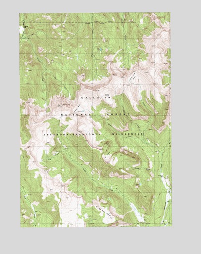
Mount Wallace, MT USGS Topographic Map
Click on map above to begin viewing in our Map Viewer.

This topographic map contains these locations and features:
Feature Name Type Latitude Longitude GNIS ID View Map
Bull Moose CabinLocaleN45.1544°W110.3830°780572View Map
Clover BasinBasinN45.1947°W110.4446°781412View Map
Clover CreekStreamN45.1674°W110.3841°781414View Map
Colley LakeLakeN45.2285°W110.4336°781510View Map
East Fork Hellroaring CreekStreamN45.1266°W110.3844°782856View Map
East Fork Wallace CreekStreamN45.2180°W110.4802°782921View Map
Gardiner-Cooke City DivisionCivilN45.1283°W110.4674°1940625View Map
Hyman CreekStreamN45.1560°W110.3849°785201View Map
Knife CreekStreamN45.1691°W110.4635°785802View Map
Middle Fork Hellroaring CreekStreamN45.1388°W110.3802°787276View Map
Mount WallaceSummitN45.1960°W110.4655°792782View Map
North Fork BasinBasinN45.2105°W110.4027°788090View Map
North Fork Clover CreekStreamN45.1733°W110.3966°788117View Map
North Fork Hellroaring CreekStreamN45.1674°W110.3841°767990View Map
Passage FallsFallsN45.2422°W110.4971°806997View Map
Red Rock PlateauPlainN45.1319°W110.4293°806996View Map
Silver BasinBasinN45.2013°W110.4283°790492View Map
Silver CreekStreamN45.1738°W110.3988°790508View Map
The HoleBasinN45.1663°W110.4269°792037View Map
Wallace CreekStreamN45.2380°W110.4971°792775View Map

Note: Coordinates in the location and feature list above are referenced to NAD83 datum.


Copyright (C) 2008-2024 Ryan Niemi / Sunset Dynamics ... All Rights Reserved