TopoQuest Logo
Do you find TopoQuest useful?
Help keep TopoQuest running and adding new maps/features by donating!
Bitcoin:  19c7KJd3qBynnjoSw5npx9KScwjBe4ifkT
Litecoin:  LXs6TkuXGGXo1vDsWCkWVdjQX94eUKd6ui
Home View Maps Find Maps Find Places Resources & Links


Mount Wow, Washington Topographic Map

USGS Map Title: Mount Wow, WA
USGS Map MRC: 46121G8
DRG (GeoTIFF) Download: o46121g8.tif


Neighboring USGS Topographic Map Quads:


  Le Dout Creek, WA  
46122H1
 

  Golden Lakes, WA  
46121H8
 

  Mowich Lake, WA  
46121H7
 

  Ashford, WA  
46122G1
 

  Mount Wow, WA  
46121G8
 

  Mount Rainier West, WA  
46121G7
 

  Anderson Lake, WA  
46122F1
 

  Sawtooth Ridge, WA  
46121F8
 

  Wahpenayo Peak, WA  
46121F7


Map MRC Location:

N47°
W122°
N47°
W121°
H8 H7 H6 H5 H4 H3 H2 H1
G8 G7 G6 G5 G4 G3 G2 G1
F8 F7 F6 F5 F4 F3 F2 F1
E8 E7 E6 E5 E4 E3 E2 E1
D8 D7 D6 D5 D4 D3 D2 D1
C8 C7 C6 C5 C4 C3 C2 C1
B8 B7 B6 B5 B4 B3 B2 B1
A8 A7 A6 A5 A4 A3 A2 A1
N46°
W122°
N46°
W121°

Mount Wow, WA USGS 1:24K Topographic Map Preview:
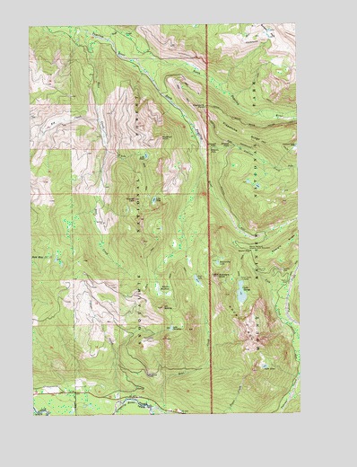
Mount Wow, WA USGS Topographic Map
Click on map above to begin viewing in our Map Viewer.

This topographic map contains these locations and features:
Feature Name Type Latitude Longitude GNIS ID View Map
Aurora LakeLakeN46.8356°W121.8767°1515980View Map
Beljica MeadowsFlatN46.7887°W121.9401°1516386View Map
Beljica Meadows LakeLakeN46.7905°W121.9423°1530475View Map
Big CreekStreamN46.8448°W121.9693°1516488View Map
Copper CreekStreamN46.7543°W121.9615°1518069View Map
Deer CreekStreamN46.8734°W121.9740°1518602View Map
Denman FallsFallsN46.8357°W121.9079°1518673View Map
Ethania FallsFallsN46.8351°W121.9168°1519384View Map
Glacier ViewSummitN46.8190°W121.9525°1519992View Map
Glacier View WildernessReserveN46.7965°W121.9323°1529170View Map
Goat CreekStreamN46.7509°W121.9412°1520016View Map
Goat LakeLakeN46.7930°W121.9240°1520033View Map
Gobblers KnobSummitN46.7942°W121.9143°1520066View Map
Kenworthy LakeLakeN46.7983°W121.9143°1521625View Map
Klapatche PointCliffN46.8482°W121.9190°1521711View Map
Klapatche RidgeRidgeN46.8347°W121.8800°1521712View Map
Lake AllenLakeN46.7650°W121.8927°1515817View Map
Lake ChristineLakeN46.7776°W121.9363°1517756View Map
Lake GeorgeLakeN46.7886°W121.9034°1519925View Map
Lake HelenLakeN46.8329°W121.9469°1520681View Map
Lake WestLakeN46.8188°W121.9434°1528009View Map
Larrupin FallsFallsN46.8354°W121.9148°1521910View Map
Marine Memorial Airplane Crash MonumentParkN46.8023°W121.8984°1522735View Map
Mount BeljicaSummitN46.7841°W121.9405°1516387View Map
Mount WowSummitN46.7783°W121.9017°1528316View Map
North Puyallup RiverStreamN46.8640°W121.9512°1523902View Map
Puyallup PointSummitN46.8381°W121.9430°1524710View Map
Round PassGapN46.8018°W121.8987°1525243View Map
Saddle LakeLakeN46.8201°W121.9462°1529171View Map
Saint Andrews CreekStreamN46.8373°W121.9215°1525348View Map
South Puyallup RiverStreamN46.8637°W121.9512°1526309View Map
Swift CreekStreamN46.8704°W121.9643°1526861View Map
Tahoma VistaLocaleN46.7957°W121.8840°1526900View Map

Note: Coordinates in the location and feature list above are referenced to NAD83 datum.


Copyright (C) 2008-2024 Ryan Niemi / Sunset Dynamics ... All Rights Reserved