TopoQuest Logo
Do you find TopoQuest useful?
Help keep TopoQuest running and adding new maps/features by donating!
Bitcoin:  19c7KJd3qBynnjoSw5npx9KScwjBe4ifkT
Litecoin:  LXs6TkuXGGXo1vDsWCkWVdjQX94eUKd6ui
Home View Maps Find Maps Find Places Resources & Links


Mountain View, Washington Topographic Map

USGS Map Title: Mountain View, WA
USGS Map MRC: 46117A3
DRG (GeoTIFF) Download: o46117a3.tif


Neighboring USGS Topographic Map Quads:


  Pinkham Butte, WA  
46117B4
 

  Harlow Ridge, WA  
46117B3
 

  Anatone, WA  
46117B2
 

  Saddle Butte, WA  
46117A4
 

  Mountain View, WA  
46117A3
 

  Fields Spring, WA  
46117A2
 

  Troy, OR  
45117H4
 

  Flora, OR  
45117H3
 

  Paradise, OR  
45117H2


Map MRC Location:

N47°
W118°
N47°
W117°
H8 H7 H6 H5 H4 H3 H2 H1
G8 G7 G6 G5 G4 G3 G2 G1
F8 F7 F6 F5 F4 F3 F2 F1
E8 E7 E6 E5 E4 E3 E2 E1
D8 D7 D6 D5 D4 D3 D2 D1
C8 C7 C6 C5 C4 C3 C2 C1
B8 B7 B6 B5 B4 B3 B2 B1
A8 A7 A6 A5 A4 A3 A2 A1
N46°
W118°
N46°
W117°

Mountain View, WA USGS 1:24K Topographic Map Preview:
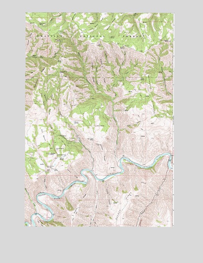
Mountain View, WA USGS Topographic Map
Click on map above to begin viewing in our Map Viewer.

This topographic map contains these locations and features:
Feature Name Type Latitude Longitude GNIS ID View Map
Allen GulchValleyN46.0854°W117.2954°1503000View Map
Anatone ButteSummitN46.1085°W117.2543°1511965View Map
Autrey CemeteryCemeteryN46.0515°W117.3378°1503086View Map
Bear CreekStreamN46.0271°W117.3143°1503223View Map
Buford CreekStreamN46.0344°W117.2532°1138883View Map
Buford RidgeRidgeN46.0007°W117.2946°1503632View Map
Burnt RidgeRidgeN46.1171°W117.3021°1503666View Map
Cape HornCapeN46.0329°W117.3538°1503796View Map
Chimney RidgeRidgeN46.0899°W117.3193°1503963View Map
Chitim GulchValleyN46.0196°W117.3588°1508313View Map
Corral RidgeRidgeN46.0307°W117.3354°1504153View Map
Cottonwood CreekStreamN46.0388°W117.2949°1531426View Map
Cougar CreekStreamN46.0326°W117.3188°1504185View Map
Coyote CanyonValleyN46.0268°W117.3074°1504235View Map
Crite SpringSpringN46.1061°W117.3115°1511501View Map
Devils CanyonValleyN46.0746°W117.3018°1504449View Map
Devils SlideSpringN46.1168°W117.3354°1514025View Map
East Bear CreekStreamN46.0054°W117.3181°1141503View Map
East Fork Cottonwood CreekStreamN46.0729°W117.3016°1504635View Map
Hanson FerryPopulated PlaceN46.0271°W117.3357°1514673View Map
Hanson RidgeRidgeN46.0418°W117.3085°1505379View Map
Herndon SpringSpringN46.0451°W117.3485°1505476View Map
Hostetler SpringSpringN46.1108°W117.3043°1505634View Map
Indian Tom SpringSpringN46.1088°W117.3446°1505734View Map
Indian Tom TrailTrailN46.0993°W117.3688°1510362View Map
Lost Cabin RidgeRidgeN46.1157°W117.2785°1506318View Map
Mallory RidgeRidgeN46.0807°W117.2704°1506439View Map
McLoughlin SpringSpringN46.0510°W117.3166°1506582View Map
McMillan SpringSpringN46.1036°W117.2678°1534058View Map
McNeil SpringSpringN46.0402°W117.3453°1506588View Map
McNeill IslandIslandN46.0174°W117.3507°1506589View Map
Medicine CreekStreamN46.0485°W117.3274°1506611View Map
Menatchee CreekStreamN46.0079°W117.3652°1506623View Map
Middle RidgeRidgeN46.0740°W117.3521°1506669View Map
Middle RidgeRidgeN46.0935°W117.3107°1506670View Map
Mine RidgeRidgeN46.0760°W117.3624°1506723View Map
Morrow RidgeRidgeN46.1102°W117.3716°1506801View Map
Mount View SchoolSchoolN46.0513°W117.3479°1534056View Map
Mountain ViewPopulated PlaceN46.0418°W117.3396°1511170View Map
Mountain View CemeteryCemeteryN46.0343°W117.3561°1506841View Map
Mullin SpringSpringN46.1054°W117.2928°1506888View Map
Mullin Spring GulchValleyN46.0854°W117.2954°1506889View Map
Plato SpringSpringN46.0331°W117.3508°1507480View Map
Powe GulchValleyN46.0563°W117.2954°1507609View Map
R Barber RanchLocaleN46.0599°W117.3335°1534057View Map
Rattlesnake CreekStreamN46.0415°W117.2521°1507728View Map
Robinson SpringSpringN46.0588°W117.3159°1507836View Map
Saddle RidgeRidgeN46.0110°W117.3302°1507986View Map
Sawtooth RidgeRidgeN46.0846°W117.3627°1508137View Map
Seven Sisters SpringSpringN46.1183°W117.3639°1508231View Map
Short RidgeRidgeN46.0965°W117.2927°1513663View Map
Smooth GulchValleyN46.0785°W117.3093°1508449View Map
Swank SpringsSpringN46.0607°W117.3332°1508861View Map
The BenchRidgeN46.0626°W117.3629°1508962View Map
Virgin SpringSpringN46.0860°W117.2747°1509236View Map
West Bear CreekStreamN46.0054°W117.3179°1152023View Map
Whitetail ButteSummitN46.0426°W117.3538°1512804View Map
Willow SpringSpringN46.0966°W117.3444°1509558View Map
Willow Spring SaddleGapN46.0902°W117.3463°1509562View Map
Yellow Pine GulchValleyN46.0785°W117.3096°1509659View Map

Note: Coordinates in the location and feature list above are referenced to NAD83 datum.


Copyright (C) 2008-2024 Ryan Niemi / Sunset Dynamics ... All Rights Reserved