TopoQuest Logo
Do you find TopoQuest useful?
Help keep TopoQuest running and adding new maps/features by donating!
Bitcoin:  19c7KJd3qBynnjoSw5npx9KScwjBe4ifkT
Litecoin:  LXs6TkuXGGXo1vDsWCkWVdjQX94eUKd6ui
Home View Maps Find Maps Find Places Resources & Links


Muldoon, Idaho Topographic Map

USGS Map Title: Muldoon, ID
USGS Map MRC: 43113E8
DRG (GeoTIFF) Download: o43113e8.tif


Neighboring USGS Topographic Map Quads:


  Grays Peak, ID  
43114F1
 

  Star Hope Mine, ID  
43113F8
 

  Smiley Mountain, ID  
43113F7
 

  Baugh Creek, ID  
43114E1
 

  Muldoon, ID  
43113E8
 

  Trail Creek, ID  
43113E7
 

  Little Wood River Reservoir, ID  
43114D1
 

  Lake Hills, ID  
43113D8
 

  Fish Creek Reservoir, ID  
43113D7


Map MRC Location:

N44°
W114°
N44°
W113°
H8 H7 H6 H5 H4 H3 H2 H1
G8 G7 G6 G5 G4 G3 G2 G1
F8 F7 F6 F5 F4 F3 F2 F1
E8 E7 E6 E5 E4 E3 E2 E1
D8 D7 D6 D5 D4 D3 D2 D1
C8 C7 C6 C5 C4 C3 C2 C1
B8 B7 B6 B5 B4 B3 B2 B1
A8 A7 A6 A5 A4 A3 A2 A1
N43°
W114°
N43°
W113°

Muldoon, ID USGS 1:24K Topographic Map Preview:
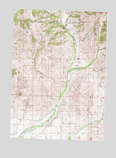
Muldoon, ID USGS Topographic Map
Click on map above to begin viewing in our Map Viewer.

This topographic map contains these locations and features:
Feature Name Type Latitude Longitude GNIS ID View Map
Argosy CreekStreamN43.5874°W113.8864°376705View Map
Bell RockPillarN43.6027°W113.9834°377329View Map
Boundary GulchValleyN43.5993°W113.9220°378123View Map
Buck CanyonValleyN43.5705°W113.9059°378350View Map
Chicken CreekStreamN43.5577°W113.9261°371990View Map
Copper CreekStreamN43.5660°W113.9259°379706View Map
Copper Creek CampLocaleN43.6074°W113.9311°379711View Map
Deep GulchValleyN43.5916°W113.9184°380400View Map
Elk MountainSummitN43.5538°W113.9934°381386View Map
Garfield CanyonValleyN43.6088°W113.9325°382197View Map
Garfield Forest Service StationLocaleN43.6105°W113.9317°394854View Map
Garfield MountainSummitN43.6063°W113.9798°396531View Map
Idaho Muldoon MineMineN43.6077°W113.8845°383608View Map
Kerf CreekStreamN43.6116°W113.9359°384182View Map
Little Thompson CreekStreamN43.5577°W113.9453°384974View Map
Logan TunnelTunnelN43.6141°W113.8806°385974View Map
Morman GulchValleyN43.6168°W113.9375°387221View Map
MuldoonLocaleN43.5724°W113.9120°387371View Map
Muldoon MineMineN43.6038°W113.8920°387373View Map
Muldoon RidgeRidgeN43.5916°W113.8953°387374View Map
Mutual GulchValleyN43.6085°W113.9242°387431View Map
Mutual MineMineN43.6149°W113.9100°387432View Map
Payne CreekStreamN43.6057°W113.9298°388287View Map
Rocky BarBarN43.5166°W113.9439°389536View Map
Smelter ButteSummitN43.5791°W113.9109°397170View Map
Thompson CreekStreamN43.5435°W113.9328°392029View Map
Timber GulchValleyN43.5141°W113.8967°392151View Map
Trail CreekStreamN43.5213°W113.8786°392297View Map

Note: Coordinates in the location and feature list above are referenced to NAD83 datum.


Copyright (C) 2008-2024 Ryan Niemi / Sunset Dynamics ... All Rights Reserved