TopoQuest Logo
Do you find TopoQuest useful?
Help keep TopoQuest running and adding new maps/features by donating!
Bitcoin:  19c7KJd3qBynnjoSw5npx9KScwjBe4ifkT
Litecoin:  LXs6TkuXGGXo1vDsWCkWVdjQX94eUKd6ui
Home View Maps Find Maps Find Places Resources & Links


Muleshoe, Texas Topographic Map

USGS Map Title: Muleshoe, TX
USGS Map MRC: 34102B6
DRG (GeoTIFF) Download: o34102b6.tif


Neighboring USGS Topographic Map Quads:


  Progress, TX  
34102C7
 

  Lazbuddie SW, TX  
34102C6
 

  Lazbuddie SE, TX  
34102C5
 

  Baileyboro NE, TX  
34102B7
 

  Muleshoe, TX  
34102B6
 

  Muleshoe NE, TX  
34102B5
 

  Baileyboro, TX  
34102A7
 

  Needmore, TX  
34102A6
 

  Sudan, TX  
34102A5


Map MRC Location:

N35°
W103°
N35°
W102°
H8 H7 H6 H5 H4 H3 H2 H1
G8 G7 G6 G5 G4 G3 G2 G1
F8 F7 F6 F5 F4 F3 F2 F1
E8 E7 E6 E5 E4 E3 E2 E1
D8 D7 D6 D5 D4 D3 D2 D1
C8 C7 C6 C5 C4 C3 C2 C1
B8 B7 B6 B5 B4 B3 B2 B1
A8 A7 A6 A5 A4 A3 A2 A1
N34°
W103°
N34°
W102°

Muleshoe, TX USGS 1:24K Topographic Map Preview:
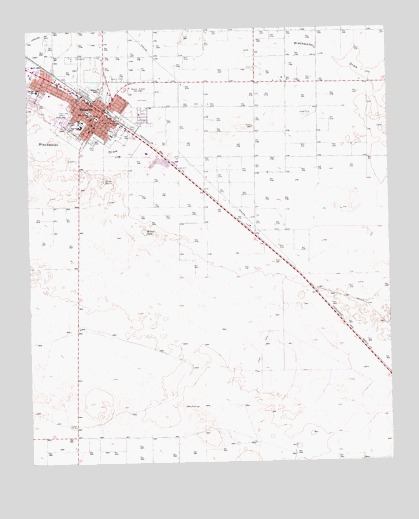
Muleshoe, TX USGS Topographic Map
Click on map above to begin viewing in our Map Viewer.

This topographic map contains these locations and features:
Feature Name Type Latitude Longitude GNIS ID View Map
Babe Ruth ParkParkN34.2156°W102.7291°2028803View Map
Bailey County Emergency Medical ServicesBuildingN34.2214°W102.7295°2656041View Map
Bailey County Law Enforcement CenterBuildingN34.2237°W102.7272°2738834View Map
Bailey County Sheriff's OfficeBuildingN34.2239°W102.7271°2750259View Map
Church of ChristChurchN34.2312°W102.7394°2016472View Map
City of MuleshoeCivilN34.2292°W102.7284°2411193View Map
City ParkParkN34.2192°W102.7210°2028607View Map
Dillman Elementary SchoolSchoolN34.2236°W102.7319°2002927View Map
First Baptist ChurchChurchN34.2245°W102.7288°2016523View Map
Hilltop SchoolSchoolN34.2326°W102.7258°1359289View Map
KMUL-AM (Muleshoe)TowerN34.2276°W102.7366°1385644View Map
KMUL-FM (Muleshoe)TowerN34.2276°W102.7366°1385947View Map
KMUL-FM (Muleshoe)TowerN34.2162°W102.7288°1385948View Map
Mary DeShazo Elementary SchoolSchoolN34.2262°W102.7286°1362244View Map
Mary Deshazo Elementary SchoolSchoolN34.2237°W102.7324°2002928View Map
Millen LakeReservoirN34.2451°W102.6622°1857634View Map
Millen Lake DamDamN34.2451°W102.6622°1857633View Map
MuleshoePopulated PlaceN34.2265°W102.7238°1375067View Map
Muleshoe Area Medical CenterHospitalN34.2213°W102.7286°2015611View Map
Muleshoe City HallBuildingN34.2246°W102.7250°2753575View Map
Muleshoe City ParkParkN34.2192°W102.7205°2029745View Map
Muleshoe High SchoolSchoolN34.2225°W102.7319°2002929View Map
Muleshoe Municipal AirportAirportN34.1839°W102.6411°1387229View Map
Muleshoe Police DepartmentBuildingN34.2234°W102.7237°2750361View Map
Muleshoe Post OfficePost OfficeN34.2234°W102.7229°2732284View Map
Muleshoe Volunteer Fire DepartmentBuildingN34.2236°W102.7203°2551036View Map
Primera Iglesia Bautista Hispana ChurchChurchN34.2223°W102.7252°2016524View Map
Richland Hills Baptist ChurchChurchN34.2312°W102.7397°2016470View Map
Richland Hills SchoolSchoolN34.2322°W102.7464°1366432View Map
The Church of God of the First BornChurchN34.2331°W102.7297°2016473View Map
Trinity Baptist ChurchChurchN34.2234°W102.7210°2016471View Map
Watson Junior High SchoolSchoolN34.2236°W102.7313°2002930View Map
Willow LakeLakeN34.1917°W102.7102°1371659View Map

Note: Coordinates in the location and feature list above are referenced to NAD83 datum.


Copyright (C) 2008-2025 Ryan Niemi / Sunset Dynamics ... All Rights Reserved