TopoQuest Logo
Do you find TopoQuest useful?
Help keep TopoQuest running and adding new maps/features by donating!
Bitcoin:  19c7KJd3qBynnjoSw5npx9KScwjBe4ifkT
Litecoin:  LXs6TkuXGGXo1vDsWCkWVdjQX94eUKd6ui
Home View Maps Find Maps Find Places Resources & Links


Murdo SW, South Dakota Topographic Map

USGS Map Title: Murdo SW, SD
USGS Map MRC: 43100G6
DRG (GeoTIFF) Download: o43100g6.tif


Neighboring USGS Topographic Map Quads:


  Okaton NE, SD  
43100H7
 

  Murdo, SD  
43100H6
 

  Draper, SD  
43100H5
 

  Okaton SE, SD  
43100G7
 

  Murdo SW, SD  
43100G6
 

  Murdo SE, SD  
43100G5
 

  West of Westover, SD  
43100F7
 

  Westover, SD  
43100F6
 

  White River NE, SD  
43100F5


Map MRC Location:

N44°
W101°
N44°
W100°
H8 H7 H6 H5 H4 H3 H2 H1
G8 G7 G6 G5 G4 G3 G2 G1
F8 F7 F6 F5 F4 F3 F2 F1
E8 E7 E6 E5 E4 E3 E2 E1
D8 D7 D6 D5 D4 D3 D2 D1
C8 C7 C6 C5 C4 C3 C2 C1
B8 B7 B6 B5 B4 B3 B2 B1
A8 A7 A6 A5 A4 A3 A2 A1
N43°
W101°
N43°
W100°

Murdo SW, SD USGS 1:24K Topographic Map Preview:
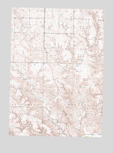
Murdo SW, SD USGS Topographic Map
Click on map above to begin viewing in our Map Viewer.

This topographic map contains these locations and features:
Feature Name Type Latitude Longitude GNIS ID View Map
Baker Number 1 DamDamN43.8383°W100.6504°1260373View Map
Baker Number 2 DamDamN43.8033°W100.6304°1260368View Map
Baker Number 2 DamDamN43.8450°W100.6504°1260372View Map
Baker Number 3 DamDamN43.8450°W100.6487°1260367View Map
Baker Number 3 DamDamN43.8450°W100.6304°1260371View Map
Baker Number 4 DamDamN43.8300°W100.6387°1260370View Map
Dugan Number 1 DamDamN43.8600°W100.7471°1260358View Map
Dykstra Number 13 DamDamN43.8083°W100.7487°1260382View Map
Dykstra Number 15 DamDamN43.8583°W100.6371°1260380View Map
Dykstra Number 16 DamDamN43.8550°W100.6554°1260379View Map
Dykstra Number 17 DamDamN43.8667°W100.6954°1260378View Map
East Buffalo SchoolSchoolN43.8642°W100.6268°1254824View Map
East Fork Hay CreekStreamN43.8178°W100.6712°1254838View Map
Hay CreekStreamN43.7519°W100.6360°1255472View Map
Hight Number 1 DamDamN43.7983°W100.6571°1260365View Map
Hight Number 2 DamDamN43.8150°W100.6771°1260364View Map
Hight Number 4 DamDamN43.7983°W100.6787°1260363View Map
Hight Number 5 DamDamN43.7900°W100.7004°1260362View Map
Hix Number 3 DamDamN43.7533°W100.7037°1260812View Map
Iversen Number 1 DamDamN43.8083°W100.6604°1260366View Map
Murdo Municipal AirportAirportN43.8536°W100.7128°1259796View Map
Nix Number 1 DamDamN43.8367°W100.6721°1260377View Map
Nix Number 2 DamDamN43.8550°W100.6804°1260376View Map
Nix Number 3 DamDamN43.8467°W100.6704°1260375View Map
Nix Number 4 DamDamN43.8200°W100.6654°1260374View Map
Rahn Number 1 DamDamN43.8133°W100.7104°1260361View Map
Rahn Number 2 DamDamN43.8333°W100.7187°1260360View Map
Rahn Number 3 DamDamN43.8433°W100.7221°1260359View Map
Thomas Number 1 DamDamN43.7550°W100.6771°1259599View Map
Township of BuffaloCivilN43.8647°W100.6460°1268703View Map
Township of WestoverCivilN43.7708°W100.6349°1268702View Map
Unorganized Territory of WestoverCivilN43.7786°W100.6529°2393828View Map
West Fork Hay CreekStreamN43.8178°W100.6712°1258897View Map

Note: Coordinates in the location and feature list above are referenced to NAD83 datum.


Copyright (C) 2008-2025 Ryan Niemi / Sunset Dynamics ... All Rights Reserved