TopoQuest Logo
Do you find TopoQuest useful?
Help keep TopoQuest running and adding new maps/features by donating!
Bitcoin:  19c7KJd3qBynnjoSw5npx9KScwjBe4ifkT
Litecoin:  LXs6TkuXGGXo1vDsWCkWVdjQX94eUKd6ui
Home View Maps Find Maps Find Places Resources & Links


Murphy, Oregon Topographic Map

USGS Map Title: Murphy, OR
USGS Map MRC: 42123C3
DRG (GeoTIFF) Download: o42123c3.tif


Neighboring USGS Topographic Map Quads:


  Wilderville, OR  
42123D4
 

  Grants Pass, OR  
42123D3
 

  Rogue River, OR  
42123D2
 

  Murphy Mountain, OR  
42123C4
 

  Murphy, OR  
42123C3
 

  Applegate, OR  
42123C2
 

  Kerby Peak, OR  
42123B4
 

  Williams, OR  
42123B3
 

  Tallowbox Mountain, OR  
42123B2


Map MRC Location:

N43°
W124°
N43°
W123°
H8 H7 H6 H5 H4 H3 H2 H1
G8 G7 G6 G5 G4 G3 G2 G1
F8 F7 F6 F5 F4 F3 F2 F1
E8 E7 E6 E5 E4 E3 E2 E1
D8 D7 D6 D5 D4 D3 D2 D1
C8 C7 C6 C5 C4 C3 C2 C1
B8 B7 B6 B5 B4 B3 B2 B1
A8 A7 A6 A5 A4 A3 A2 A1
N42°
W124°
N42°
W123°

Murphy, OR USGS 1:24K Topographic Map Preview:
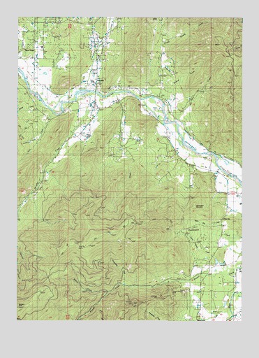
Murphy, OR USGS Topographic Map
Click on map above to begin viewing in our Map Viewer.

This topographic map contains these locations and features:
Feature Name Type Latitude Longitude GNIS ID View Map
Applegate County ParkParkN42.3435°W123.3134°1638163View Map
Applegate Valley Rural Fire Protection District 9 Station 4BuildingN42.3030°W123.2596°2576525View Map
Black Canyon CreekStreamN42.3198°W123.2789°1155191View Map
Blodgett CreekStreamN42.2665°W123.2873°1155195View Map
Blodgett DitchCanalN42.2568°W123.2845°1155194View Map
Board Shanty CreekStreamN42.3421°W123.3076°1138355View Map
Bricker CreekStreamN42.2804°W123.2553°1155197View Map
Camp Meeting CreekStreamN42.2765°W123.2564°1139255View Map
Caris CreekStreamN42.3060°W123.2503°1118608View Map
Cherry FlatFlatN42.3035°W123.3626°1139596View Map
Dales Bluff CreekStreamN42.3179°W123.2739°1155192View Map
Dry CreekStreamN42.3110°W123.3623°1155198View Map
Fifer ReservoirReservoirN42.3310°W123.3177°1157292View Map
Grays CreekStreamN42.3437°W123.3223°1143015View Map
Hidden Valley High SchoolSchoolN42.3257°W123.3367°1162500View Map
Honeysuckle CreekStreamN42.2643°W123.3153°1143700View Map
House ReservoirReservoirN42.3516°W123.3609°1638162View Map
Humdinger MineMineN42.2571°W123.2992°1143909View Map
Iron CreekStreamN42.3348°W123.3573°1144113View Map
Johnston CreekStreamN42.3207°W123.2845°1155190View Map
Josephine County School District / Hidden Valley High School Sewage Treatment PlantLocaleN42.3281°W123.3363°2660651View Map
Lincoln Savage Middle SchoolSchoolN42.3484°W123.3348°1162498View Map
Lincoln Savage ReservoirReservoirN42.3507°W123.3338°1157288View Map
Lippert Dam Number TwoDamN42.2738°W123.2606°1155597View Map
Lippert Reservoir Number TwoReservoirN42.2733°W123.2620°1155598View Map
Madrona Elementary SchoolSchoolN42.3627°W123.3628°2440341View Map
Madronna CreekStreamN42.3326°W123.3406°1157286View Map
Maple GulchValleyN42.3026°W123.2651°1155193View Map
Meehan SloughStreamN42.3418°W123.3006°1157289View Map
Michigan MineMineN42.3496°W123.3078°1146126View Map
Miller CreekStreamN42.3107°W123.2578°1146266View Map
Miller SpringSpringN42.3135°W123.3012°1157293View Map
MurphyPopulated PlaceN42.3476°W123.3334°1146674View Map
Murphy BridgeBridgeN42.3440°W123.3328°1638164View Map
Murphy CreekStreamN42.3437°W123.3364°1146676View Map
Murphy DitchCanalN42.3457°W123.3587°1157284View Map
Murphy Elementary School (historical)SchoolN42.3472°W123.3339°1162497View Map
Murphy Post OfficePost OfficeN42.3378°W123.3330°1165681View Map
New HopePopulated PlaceN42.3623°W123.3678°1146811View Map
New Hope Census Designated PlaceCensusN42.3693°W123.3590°2611771View Map
New Hope Christian SchoolsSchoolN42.3593°W123.3661°1162499View Map
Onion CreekStreamN42.3437°W123.3698°1147232View Map
Oregon Bonanza MineMineN42.2801°W123.2876°1147258View Map
Oscar CreekStreamN42.3326°W123.2895°1147280View Map
Packers GulchValleyN42.3254°W123.3656°1147334View Map
Panther CreekStreamN42.3390°W123.3656°1147394View Map
Pennington ButteSummitN42.2832°W123.3123°1155200View Map
Pennington MountainSummitN42.2971°W123.2775°1147585View Map
Reinhardt ReservoirReservoirN42.3363°W123.3694°1157287View Map
Rural / Metro Fire Department Station 7BuildingN42.3375°W123.3385°2577119View Map
Schoolhouse GulchValleyN42.3304°W123.3342°1157285View Map
Skunk CreekStreamN42.3526°W123.3637°1155189View Map
Small ReservoirReservoirN42.3249°W123.3082°1157290View Map
Snow Bird MineMineN42.2568°W123.3120°1135003View Map
Spalding ReservoirReservoirN42.3332°W123.3406°1157383View Map
Tobiason ReservoirReservoirN42.3245°W123.3173°1157382View Map
Wallow CreekStreamN42.2615°W123.3259°1151856View Map
Water GapGapN42.2918°W123.2623°1151934View Map
Water Gap CreekStreamN42.2960°W123.2562°1151935View Map
Webb ReservoirReservoirN42.2571°W123.2603°1155196View Map
Wildcat GulchValleyN42.3415°W123.2959°1152348View Map
Willson ReservoirReservoirN42.3319°W123.3338°1157291View Map
Wood ReservoirReservoirN42.3031°W123.2630°1155199View Map

Note: Coordinates in the location and feature list above are referenced to NAD83 datum.


Copyright (C) 2008-2024 Ryan Niemi / Sunset Dynamics ... All Rights Reserved