TopoQuest Logo
Do you find TopoQuest useful?
Help keep TopoQuest running and adding new maps/features by donating!
Bitcoin:  19c7KJd3qBynnjoSw5npx9KScwjBe4ifkT
Litecoin:  LXs6TkuXGGXo1vDsWCkWVdjQX94eUKd6ui
Home View Maps Find Maps Find Places Resources & Links


Murray, Idaho Topographic Map

USGS Map Title: Murray, ID
USGS Map MRC: 47115F7
DRG (GeoTIFF) Download: o47115f7.tif


Neighboring USGS Topographic Map Quads:


  Taylor Peak, ID  
47115G8
 

  Bloom Peak, MT  
47115G7
 

  Larchwood, MT  
47115G6
 

  Prichard, ID  
47115F8
 

  Murray, ID  
47115F7
 

  Black Peak, MT  
47115F6
 

  Osburn, ID  
47115E8
 

  Burke, ID  
47115E7
 

  Thompson Pass, MT  
47115E6


Map MRC Location:

N48°
W116°
N48°
W115°
H8 H7 H6 H5 H4 H3 H2 H1
G8 G7 G6 G5 G4 G3 G2 G1
F8 F7 F6 F5 F4 F3 F2 F1
E8 E7 E6 E5 E4 E3 E2 E1
D8 D7 D6 D5 D4 D3 D2 D1
C8 C7 C6 C5 C4 C3 C2 C1
B8 B7 B6 B5 B4 B3 B2 B1
A8 A7 A6 A5 A4 A3 A2 A1
N47°
W116°
N47°
W115°

Murray, ID USGS 1:24K Topographic Map Preview:
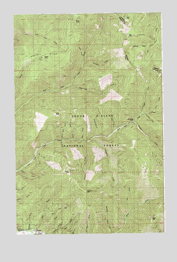
Murray, ID USGS Topographic Map
Click on map above to begin viewing in our Map Viewer.

This topographic map contains these locations and features:
Feature Name Type Latitude Longitude GNIS ID View Map
34 CreekStreamN47.7213°W115.8168°393792View Map
Alder GulchValleyN47.6285°W115.8579°376522View Map
Axe GulchValleyN47.6383°W115.7777°376787View Map
Berry LakeLakeN47.7473°W115.7803°779729View Map
Bloom SpringSpringN47.7454°W115.8194°395219View Map
Bobtail CreekStreamN47.6938°W115.8749°377982View Map
Bobtail RidgeRidgeN47.7271°W115.8491°395125View Map
Bonanza GulchValleyN47.6252°W115.7957°378013View Map
Buckskin GulchValleyN47.6285°W115.8641°378433View Map
Cabin CreekStreamN47.6777°W115.8193°378639View Map
Casper CreekStreamN47.6922°W115.7688°378994View Map
Columbus CreekStreamN47.6927°W115.7663°395248View Map
Cottonwood CreekStreamN47.7094°W115.8285°379837View Map
Dons MountainSummitN47.6577°W115.7568°400531View Map
Dream GulchValleyN47.6277°W115.8732°380751View Map
East Fork Alder GulchValleyN47.6333°W115.8516°381042View Map
East LakeLakeN47.7376°W115.7789°771094View Map
Falls CreekStreamN47.6788°W115.8257°381574View Map
Goat GulchValleyN47.6835°W115.7907°382325View Map
Horseshoe PeakSummitN47.6488°W115.8160°383424View Map
Jack Waite ForksLocaleN47.6883°W115.7760°383813View Map
Johns MountainSummitN47.6591°W115.7679°400530View Map
Little BaldySummitN47.6933°W115.8407°384712View Map
Log GulchValleyN47.6777°W115.8363°385967View Map
Maple PeakSummitN47.6327°W115.7602°386446View Map
MurrayPopulated PlaceN47.6271°W115.8585°396938View Map
Murray PeakSummitN47.6605°W115.8299°387417View Map
Murray Post OfficePost OfficeN47.6265°W115.8563°2781811View Map
Niagara CreekStreamN47.6774°W115.8168°387552View Map
Oregon GulchValleyN47.6613°W115.8702°387993View Map
Pennsylvania GulchValleyN47.6808°W115.8068°394901View Map
Prichard / Murray Volunteer Fire DepartmentBuildingN47.6270°W115.8564°2619295View Map
Saw GulchValleyN47.6671°W115.8593°389938View Map
Silent CreekStreamN47.6938°W115.7585°390409View Map
Silver CreekStreamN47.7249°W115.8160°390424View Map
Snowshoe CreekStreamN47.6935°W115.7516°390763View Map
Toboggan CreekStreamN47.6780°W115.8113°392199View Map
Tributary CreekStreamN47.6883°W115.7760°392388View Map
White Rock GulchValleyN47.6794°W115.8352°398351View Map

Note: Coordinates in the location and feature list above are referenced to NAD83 datum.


Copyright (C) 2008-2024 Ryan Niemi / Sunset Dynamics ... All Rights Reserved