TopoQuest Logo
Do you find TopoQuest useful?
Help keep TopoQuest running and adding new maps/features by donating!
Bitcoin:  19c7KJd3qBynnjoSw5npx9KScwjBe4ifkT
Litecoin:  LXs6TkuXGGXo1vDsWCkWVdjQX94eUKd6ui
Home View Maps Find Maps Find Places Resources & Links


Belgrade NW, Nebraska Topographic Map

USGS Map Title: Belgrade NW, NE
USGS Map MRC: 41098D2
DRG (GeoTIFF) Download: o41098d2.tif


Neighboring USGS Topographic Map Quads:


  Spalding SE, NE  
41098E3
 

  Cedar Rapids, NE  
41098E2
 

  Cedar Rapids SE, NE  
41098E1
 

  Wolbach NE, NE  
41098D3
 

  Belgrade NW, NE  
41098D2
 

  Belgrade, NE  
41098D1
 

  Cushing, NE  
41098C3
 

  Belgrade SW, NE  
41098C2
 

  Belgrade SE, NE  
41098C1


Map MRC Location:

N42°
W99°
N42°
W98°
H8 H7 H6 H5 H4 H3 H2 H1
G8 G7 G6 G5 G4 G3 G2 G1
F8 F7 F6 F5 F4 F3 F2 F1
E8 E7 E6 E5 E4 E3 E2 E1
D8 D7 D6 D5 D4 D3 D2 D1
C8 C7 C6 C5 C4 C3 C2 C1
B8 B7 B6 B5 B4 B3 B2 B1
A8 A7 A6 A5 A4 A3 A2 A1
N41°
W99°
N41°
W98°

Belgrade NW, NE USGS 1:24K Topographic Map Preview:
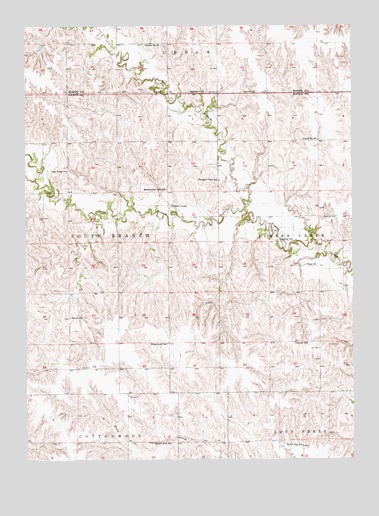
Belgrade NW, NE USGS Topographic Map
Click on map above to begin viewing in our Map Viewer.

This topographic map contains these locations and features:
Feature Name Type Latitude Longitude GNIS ID View Map
Banner School (historical)SchoolN41.4083°W98.1476°827178View Map
Bruna SchoolSchoolN41.4158°W98.2337°827704View Map
Clay Ridge School (historical)SchoolN41.4575°W98.2351°828176View Map
Meadowlark Hill School (historical)SchoolN41.4528°W98.1965°831179View Map
Mount Zion School (historical)SchoolN41.3797°W98.2017°831497View Map
North Branch Timber CreekStreamN41.4470°W98.1667°831669View Map
North Star School (historical)SchoolN41.3786°W98.1448°831736View Map
Peace Lutheran ChurchChurchN41.4308°W98.1437°832016View Map
Pleasant View SchoolSchoolN41.4556°W98.1762°832261View Map
Redwing CemeteryCemeteryN41.4447°W98.1373°832507View Map
Redwing School (historical)SchoolN41.4375°W98.1484°832508View Map
Ridgewood School (historical)SchoolN41.4086°W98.1962°832557View Map
Robinson DamDamN41.4947°W98.2439°1767053View Map
Robinson ReservoirReservoirN41.4937°W98.2441°1767054View Map
School Number 29 (historical)SchoolN41.4947°W98.2045°836520View Map
School Number 46 (historical)SchoolN41.4672°W98.1381°836755View Map
Scott DamDamN41.4449°W98.1454°1770104View Map
Scott ReservoirReservoirN41.4462°W98.1469°1770105View Map
South Branch Timber CreekStreamN41.4470°W98.1667°833559View Map
Timber CreekPopulated PlaceN41.4481°W98.1959°834112View Map
Township of CedarCivilN41.4995°W98.2003°1880701View Map
Township of South BranchCivilN41.4374°W98.2340°838258View Map

Note: Coordinates in the location and feature list above are referenced to NAD83 datum.


Copyright (C) 2008-2024 Ryan Niemi / Sunset Dynamics ... All Rights Reserved