TopoQuest Logo
Do you find TopoQuest useful?
Help keep TopoQuest running and adding new maps/features by donating!
Bitcoin:  19c7KJd3qBynnjoSw5npx9KScwjBe4ifkT
Litecoin:  LXs6TkuXGGXo1vDsWCkWVdjQX94eUKd6ui
Home View Maps Find Maps Find Places Resources & Links


Nashua, Montana Topographic Map

USGS Map Title: Nashua, MT
USGS Map MRC: 48106B3
DRG (GeoTIFF) Download: o48106b3.tif


Neighboring USGS Topographic Map Quads:


  Uhlan Coulee, MT  
48106C4
 

  Sargent Creek, MT  
48106C3
 

  Spring Creek SW, MT  
48106C2
 

  Lindeke Coulee, MT  
48106B4
 

  Nashua, MT  
48106B3
 

  Milk River Coulee, MT  
48106B2
 

  Fort Peck, MT  
48106A4
 

  Milk River Hills, MT  
48106A3
 

  Kintyre, MT  
48106A2


Map MRC Location:

N49°
W107°
N49°
W106°
H8 H7 H6 H5 H4 H3 H2 H1
G8 G7 G6 G5 G4 G3 G2 G1
F8 F7 F6 F5 F4 F3 F2 F1
E8 E7 E6 E5 E4 E3 E2 E1
D8 D7 D6 D5 D4 D3 D2 D1
C8 C7 C6 C5 C4 C3 C2 C1
B8 B7 B6 B5 B4 B3 B2 B1
A8 A7 A6 A5 A4 A3 A2 A1
N48°
W107°
N48°
W106°

Nashua, MT USGS 1:24K Topographic Map Preview:
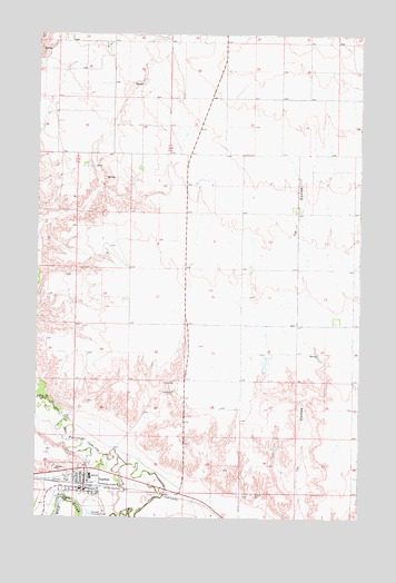
Nashua, MT USGS Topographic Map
Click on map above to begin viewing in our Map Viewer.

This topographic map contains these locations and features:
Feature Name Type Latitude Longitude GNIS ID View Map
27N42E04ABBA01 WellWellN48.1306°W106.3053°826525View Map
27N42E04ABCC01 WellWellN48.1284°W106.3059°826506View Map
28N42E04CBAA01 WellWellN48.2106°W106.3128°1634145View Map
28N42E05BBDC01 WellWellN48.2156°W106.3361°1634184View Map
28N42E06BACD01 WellWellN48.2159°W106.3534°1634186View Map
28N42E20AA__01 WellWellN48.1722°W106.3203°1633817View Map
28N42E29AACB01 WellWellN48.1581°W106.3220°826828View Map
28N42E29AD__01 WellWellN48.1542°W106.3203°826799View Map
28N42E31BD__01 WellWellN48.1397°W106.3525°826618View Map
28N42E31DD__01 WellWellN48.1325°W106.3417°826555View Map
28N42E32DD__01 WellWellN48.1325°W106.3203°826554View Map
28N42E33CDDD01 WellWellN48.1322°W106.3075°826550View Map
Big Four School (historical)SchoolN48.2195°W106.3456°1819527View Map
Church of Nazarene of Nashua (historical)ChurchN48.1322°W106.3564°1677300View Map
Farmers Produce Company Elevator (historical)LocaleN48.1336°W106.3573°1688585View Map
Fort Peck Reservation Number 6 DamDamN48.1634°W106.2872°798098View Map
Harvest States Cooperatives ElevatorLocaleN48.1336°W106.3573°1688583View Map
Imperial Elevator (historical)LocaleN48.1336°W106.3573°1688586View Map
Lions ParkParkN48.1331°W106.3570°1819484View Map
NashuaPopulated PlaceN48.1322°W106.3564°774553View Map
NashuaLocaleN48.1336°W106.3581°1819628View Map
Nashua CemeteryCemeteryN48.1425°W106.3706°1677344View Map
Nashua Post OfficePost OfficeN48.1324°W106.3611°1819627View Map
Nashua Volunteer Fire DepartmentBuildingN48.1326°W106.3559°1688576View Map
Occident Elevator (historical)LocaleN48.1336°W106.3573°1688587View Map
Our Redeemers Lutheran ChurchChurchN48.1345°W106.3550°1677305View Map
Peavey Company ElevatorLocaleN48.1336°W106.3573°1688584View Map
Porcupine Creek OverflowStreamN48.1256°W106.3425°775374View Map
Queen of Angels Catholic ChurchChurchN48.1361°W106.3586°1677299View Map
Town of NashuaCivilN48.1336°W106.3571°2413034View Map
Vale School (historical)SchoolN48.1897°W106.2931°1819517View Map
Warren Memorial ParkParkN48.1370°W106.3564°1688602View Map
Winter Truesdell Elevator (historical)LocaleN48.1336°W106.3573°1688588View Map

Note: Coordinates in the location and feature list above are referenced to NAD83 datum.


Copyright (C) 2008-2025 Ryan Niemi / Sunset Dynamics ... All Rights Reserved