TopoQuest Logo
Do you find TopoQuest useful?
Help keep TopoQuest running and adding new maps/features by donating!
Bitcoin:  19c7KJd3qBynnjoSw5npx9KScwjBe4ifkT
Litecoin:  LXs6TkuXGGXo1vDsWCkWVdjQX94eUKd6ui
Home View Maps Find Maps Find Places Resources & Links


Needle Butte, Montana Topographic Map

USGS Map Title: Needle Butte, MT
USGS Map MRC: 46106G5
DRG (GeoTIFF) Download: o46106g5.tif


Neighboring USGS Topographic Map Quads:


  Black Hills, MT  
46106H6
 

  Christenson Reservoir, MT  
46106H5
 

  Hillside, MT  
46106H4
 

  Needle Butte Reservoir, MT  
46106G6
 

  Needle Butte, MT  
46106G5
 

  Clear Water Reservoir, MT  
46106G4
 

  Rudie Coulee, MT  
46106F6
 

  Rough Creek NE, MT  
46106F5
 

  Van Burton Creek, MT  
46106F4


Map MRC Location:

N47°
W107°
N47°
W106°
H8 H7 H6 H5 H4 H3 H2 H1
G8 G7 G6 G5 G4 G3 G2 G1
F8 F7 F6 F5 F4 F3 F2 F1
E8 E7 E6 E5 E4 E3 E2 E1
D8 D7 D6 D5 D4 D3 D2 D1
C8 C7 C6 C5 C4 C3 C2 C1
B8 B7 B6 B5 B4 B3 B2 B1
A8 A7 A6 A5 A4 A3 A2 A1
N46°
W107°
N46°
W106°

Needle Butte, MT USGS 1:24K Topographic Map Preview:
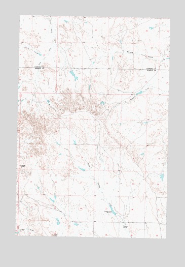
Needle Butte, MT USGS Topographic Map
Click on map above to begin viewing in our Map Viewer.

This topographic map contains these locations and features:
Feature Name Type Latitude Longitude GNIS ID View Map
Caladine CouleeValleyN46.8519°W106.6050°769496View Map
G Newman Number 1 DamDamN46.8433°W106.5823°797051View Map
G Newman Number 6 DamDamN46.8333°W106.5223°797052View Map
Killen Number 7 DamDamN46.7700°W106.5956°796336View Map
Killen Number 8 DamDamN46.7583°W106.5889°796840View Map
Killen Number 9 DamDamN46.7567°W106.5823°796841View Map
Lee Number 11 DamDamN46.7883°W106.5689°796839View Map
Lee Number 12 DamDamN46.8267°W106.5556°796844View Map
Lee Number 13 DamDamN46.7867°W106.5056°796845View Map
Maudlin Post Office (historical)Post OfficeN46.7864°W106.5389°1716776View Map
Maudlin School (historical)SchoolN46.7936°W106.5289°1716625View Map
Needle ButtePillarN46.7897°W106.6223°774560View Map
Nordang CouleeValleyN46.8522°W106.5014°774666View Map
Sunday ButteSummitN46.7511°W106.5945°777319View Map
Sunday Creek ReservoirReservoirN46.7651°W106.5451°777322View Map
Sunday Creek Reservoir DamDamN46.7633°W106.5439°796846View Map
Sweetser SpringSpringN46.7570°W106.5362°777369View Map
Westcott School (historical)SchoolN46.7736°W106.5825°1716627View Map

Note: Coordinates in the location and feature list above are referenced to NAD83 datum.


Copyright (C) 2008-2024 Ryan Niemi / Sunset Dynamics ... All Rights Reserved