TopoQuest Logo
Do you find TopoQuest useful?
Help keep TopoQuest running and adding new maps/features by donating!
Bitcoin:  19c7KJd3qBynnjoSw5npx9KScwjBe4ifkT
Litecoin:  LXs6TkuXGGXo1vDsWCkWVdjQX94eUKd6ui
Home View Maps Find Maps Find Places Resources & Links


Belle Creek North, Montana Topographic Map

USGS Map Title: Belle Creek North, MT
USGS Map MRC: 45105B1
DRG (GeoTIFF) Download: o45105b1.tif


Neighboring USGS Topographic Map Quads:


  Dry Creek Butte, MT  
45105C2
 

  Boyes, MT  
45105C1
 

  Knudson Draw, MT  
45104C8
 

  Sanburn Reservoir, MT  
45105B2
 

  Belle Creek North, MT  
45105B1
 

  Hammond, MT  
45104B8
 

  Belle Creek SW, MT  
45105A2
 

  Belle Creek South, MT  
45105A1
 

  Stack Rocks, MT  
45104A8


Map MRC Location:

N46°
W106°
N46°
W105°
H8 H7 H6 H5 H4 H3 H2 H1
G8 G7 G6 G5 G4 G3 G2 G1
F8 F7 F6 F5 F4 F3 F2 F1
E8 E7 E6 E5 E4 E3 E2 E1
D8 D7 D6 D5 D4 D3 D2 D1
C8 C7 C6 C5 C4 C3 C2 C1
B8 B7 B6 B5 B4 B3 B2 B1
A8 A7 A6 A5 A4 A3 A2 A1
N45°
W106°
N45°
W105°

Belle Creek North, MT USGS 1:24K Topographic Map Preview:
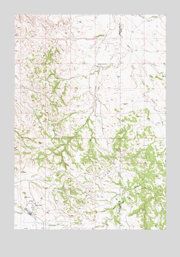
Belle Creek North, MT USGS Topographic Map
Click on map above to begin viewing in our Map Viewer.

This topographic map contains these locations and features:
Feature Name Type Latitude Longitude GNIS ID View Map
07S54E13BBCA01 WellWellN45.2333°W105.0575°808519View Map
07S54E13DDDA01 WellWellN45.2228°W105.0383°808491View Map
07S54E17ADCD01 WellWellN45.2297°W105.1230°808507View Map
07S54E23DBAA01 WellWellN45.2136°W105.0653°808448View Map
07S54E24AB__01 WellWellN45.2175°W105.0450°808468View Map
07S54E25BCCB01 WellWellN45.2014°W105.0586°808403View Map
07S54E26CCCA01 WellWellN45.1939°W105.0772°808381View Map
07S55E07DDAA01 WellWellN45.2392°W105.0191°808542View Map
07S55E08AB__01 WellWellN45.2461°W105.0044°808568View Map
07S55E30ABBA01 WellWellN45.2067°W105.0264°808423View Map
07S55E32BDDD01 WellWellN45.1861°W105.0089°808352View Map
08S54E02AABD01 WellWellN45.1769°W105.0603°808315View Map
08S54E11DACC01 WellWellN45.1367°W105.0630°808119View Map
08S54E21ADA_01 WellWellN45.1278°W105.0997°808062View Map
08S54E21ADAA01 WellWellN45.1305°W105.1003°808077View Map
08S54E21ADAD01 WellWellN45.1292°W105.0991°808069View Map
08S54E21DB__01 WellWellN45.1255°W105.1072°808051View Map
Ash DrawValleyN45.1928°W105.0030°768375View Map
Belle CreekPopulated PlaceN45.1392°W105.1108°802022View Map
Belle Creek ChurchChurchN45.1389°W105.1155°1690034View Map
Belle Creek Rural Fire DistrictBuildingN45.1357°W105.1123°2546708View Map
Duncan CreekStreamN45.2294°W105.0322°770898View Map
Duncan Creek School (historical)SchoolN45.2203°W105.0591°770900View Map

Note: Coordinates in the location and feature list above are referenced to NAD83 datum.


Copyright (C) 2008-2025 Ryan Niemi / Sunset Dynamics ... All Rights Reserved