TopoQuest Logo
Do you find TopoQuest useful?
Help keep TopoQuest running and adding new maps/features by donating!
Bitcoin:  19c7KJd3qBynnjoSw5npx9KScwjBe4ifkT
Litecoin:  LXs6TkuXGGXo1vDsWCkWVdjQX94eUKd6ui
Home View Maps Find Maps Find Places Resources & Links


New Columbus, Kentucky Topographic Map

USGS Map Title: New Columbus, KY
USGS Map MRC: 38084D6
DRG (GeoTIFF) Download: o38084d6.tif


Neighboring USGS Topographic Map Quads:


  Owenton, KY  
38084E7
 

  Lawrenceville, KY  
38084E6
 

  Mason, KY  
38084E5
 

  Monterey, KY  
38084D7
 

  New Columbus, KY  
38084D6
 

  Sadieville, KY  
38084D5
 

  Switzer, KY  
38084C7
 

  Stamping Ground, KY  
38084C6
 

  Delaplain, KY  
38084C5


Map MRC Location:

N39°
W85°
N39°
W84°
H8 H7 H6 H5 H4 H3 H2 H1
G8 G7 G6 G5 G4 G3 G2 G1
F8 F7 F6 F5 F4 F3 F2 F1
E8 E7 E6 E5 E4 E3 E2 E1
D8 D7 D6 D5 D4 D3 D2 D1
C8 C7 C6 C5 C4 C3 C2 C1
B8 B7 B6 B5 B4 B3 B2 B1
A8 A7 A6 A5 A4 A3 A2 A1
N38°
W85°
N38°
W84°

New Columbus, KY USGS 1:24K Topographic Map Preview:
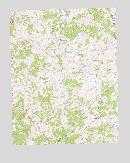
New Columbus, KY USGS Topographic Map
Click on map above to begin viewing in our Map Viewer.

This topographic map contains these locations and features:
Feature Name Type Latitude Longitude GNIS ID View Map
Barnett CemeteryCemeteryN38.3920°W84.6311°486402View Map
BeechwoodPopulated PlaceN38.4123°W84.7461°507481View Map
Beechwood Post Office (historical)Post OfficeN38.4080°W84.7378°2567475View Map
Bethany (historical)Populated PlaceN38.4077°W84.7375°2742113View Map
Bethany Christian ChurchChurchN38.4076°W84.7377°486939View Map
Bethany Christian Church CemeteryCemeteryN38.4073°W84.7377°1900845View Map
Bethany Post Office (historical)Post OfficeN38.4068°W84.7382°2567476View Map
BreckPopulated PlaceN38.4959°W84.7355°507577View Map
Breck Post Office (historical)Post OfficeN38.4949°W84.7358°2567479View Map
Caney CreekStreamN38.4717°W84.6930°488843View Map
Caney Fork Baptist ChurchChurchN38.4123°W84.6880°488849View Map
Caney Fork Baptist Church CemeteryCemeteryN38.4131°W84.6872°1900856View Map
Clark HollowValleyN38.4446°W84.7062°489542View Map
Davis Chapel CemeteryCemeteryN38.4498°W84.6344°490659View Map
Davis Chapel Methodist Episcopal Church South (historical)ChurchN38.4494°W84.6347°2567488View Map
Deep CreekStreamN38.4898°W84.6852°490753View Map
Dickey ForkStreamN38.4634°W84.7066°490880View Map
FairbanksPopulated PlaceN38.4334°W84.7324°507967View Map
Fairbanks Post Office (historical)Post OfficeN38.4332°W84.7324°2567367View Map
Fairview CemeteryCemeteryN38.4615°W84.6374°491906View Map
Frame School (historical)SchoolN38.4355°W84.7283°2567369View Map
Gwills BranchStreamN38.4412°W84.6366°493509View Map
Hammond School (historical)SchoolN38.4912°W84.7116°2567376View Map
Hawkins School (historical)SchoolN38.4157°W84.7498°2567379View Map
Henderson School (historical)SchoolN38.4590°W84.7470°2567382View Map
Hensley CemeteryCemeteryN38.3909°W84.6261°494071View Map
Holiness Church (historical)ChurchN38.4096°W84.6997°2567384View Map
Hudson-Abbot CemeteryCemeteryN38.4515°W84.6511°494728View Map
Hughes CemeteryCemeteryN38.4656°W84.6480°494746View Map
Jones School (historical)SchoolN38.4426°W84.6916°2567391View Map
JosephinePopulated PlaceN38.3987°W84.6499°508359View Map
Lees Mill Covered BridgeBridgeN38.4463°W84.6634°2567394View Map
Lees Mill Post Office (historical)Post OfficeN38.4464°W84.6621°2567395View Map
Little Indian BranchStreamN38.3945°W84.6391°496765View Map
Locust Grove ChurchChurchN38.4915°W84.7116°496960View Map
Lytles ForkStreamN38.4401°W84.6308°497398View Map
Morrison CemeteryCemeteryN38.4534°W84.7497°498629View Map
Mountain IslandIslandN38.4701°W84.6866°498960View Map
Mountain Island Baptist Church (historical)ChurchN38.4715°W84.6866°2567410View Map
Mountain Island Post Office (historical)Post OfficeN38.4719°W84.6863°2567411View Map
Naill CemeteryCemeteryN38.4662°W84.7402°499156View Map
NatleePopulated PlaceN38.4470°W84.6619°508674View Map
Natlee Post Office (historical)Post OfficeN38.4463°W84.6624°2567415View Map
New ColumbusPopulated PlaceN38.4576°W84.6452°499304View Map
New Columbus Post Office (historical)Post OfficeN38.4566°W84.6447°2567416View Map
New Columbus School (historical)SchoolN38.4598°W84.6437°2567417View Map
Old Beechwood Road CemeteryCemeteryN38.3884°W84.7183°1900842View Map
Opossum BranchStreamN38.3976°W84.6494°499958View Map
Paynes RunStreamN38.4526°W84.6686°500298View Map
Pleasant Grove Baptist Church (historical)ChurchN38.4807°W84.6390°2567423View Map
Pleasant View CemeteryCemeteryN38.4406°W84.6649°500941View Map
Red Oak CreekStreamN38.4348°W84.7055°501671View Map
RockdalePopulated PlaceN38.4092°W84.6847°508959View Map
Rockdale Post Office (historical)Post OfficeN38.4093°W84.6846°2567431View Map
Rush RunStreamN38.4795°W84.6963°502493View Map
School Number Twenty-Four (historical)SchoolN38.4416°W84.6815°2567442View Map
Shellbark BranchStreamN38.4362°W84.7063°503327View Map
Slayton Post Office (historical)Post OfficeN38.4721°W84.6915°2567449View Map
Souder CemeteryCemeteryN38.4995°W84.6677°503886View Map
South Owen Volunteer Fire DepartmentBuildingN38.3788°W84.7090°2636863View Map
Southard BranchStreamN38.4231°W84.7291°503990View Map
True CemeteryCemeteryN38.4867°W84.6530°505524View Map

Note: Coordinates in the location and feature list above are referenced to NAD83 datum.


Copyright (C) 2008-2024 Ryan Niemi / Sunset Dynamics ... All Rights Reserved