TopoQuest Logo
Do you find TopoQuest useful?
Help keep TopoQuest running and adding new maps/features by donating!
Bitcoin:  19c7KJd3qBynnjoSw5npx9KScwjBe4ifkT
Litecoin:  LXs6TkuXGGXo1vDsWCkWVdjQX94eUKd6ui
Home View Maps Find Maps Find Places Resources & Links


New Effington, South Dakota Topographic Map

USGS Map Title: New Effington, SD
USGS Map MRC: 45096G8
DRG (GeoTIFF) Download: o45096g8.tif


Neighboring USGS Topographic Map Quads:


  Claire City NE, ND  
45097H1
 

  New Effington NW, ND  
45096H8
 

  New Effington NE, ND  
45096H7
 

  Claire City, SD  
45097G1
 

  New Effington, SD  
45096G8
 

  Victor, SD  
45096G7
 

  Sisseton, SD  
45097F1
 

  Peever NW, SD  
45096F8
 

  Peever NE, SD  
45096F7


Map MRC Location:

N46°
W97°
N46°
W96°
H8 H7 H6 H5 H4 H3 H2 H1
G8 G7 G6 G5 G4 G3 G2 G1
F8 F7 F6 F5 F4 F3 F2 F1
E8 E7 E6 E5 E4 E3 E2 E1
D8 D7 D6 D5 D4 D3 D2 D1
C8 C7 C6 C5 C4 C3 C2 C1
B8 B7 B6 B5 B4 B3 B2 B1
A8 A7 A6 A5 A4 A3 A2 A1
N45°
W97°
N45°
W96°

New Effington, SD USGS 1:24K Topographic Map Preview:
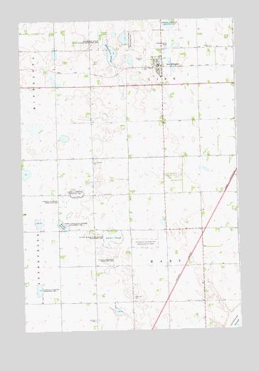
New Effington, SD USGS Topographic Map
Click on map above to begin viewing in our Map Viewer.

This topographic map contains these locations and features:
Feature Name Type Latitude Longitude GNIS ID View Map
Bethania CemeteryCemeteryN45.7636°W96.9370°1253874View Map
Dobberstien SloughLakeN45.8617°W96.9471°1254710View Map
Dobberstien Slough State Wildlife ManagementParkN45.8669°W96.9515°1254711View Map
Effington (historical)LocaleN45.8130°W96.9584°1263914View Map
Faith Garden of Rest CemeteryCemeteryN45.8709°W96.9180°1255005View Map
Interchange 242CrossingN45.7905°W96.8945°2725737View Map
Knebel SloughLakeN45.7925°W96.9767°1255958View Map
Knebel Slough State Wildlife Management AreaParkN45.7925°W96.9770°1255959View Map
New EffingtonPopulated PlaceN45.8563°W96.9204°1260945View Map
New Effington CemeteryCemeteryN45.8554°W96.9285°1256676View Map
New Effington City HallBuildingN45.8570°W96.9207°2725160View Map
New Effington Elementary SchoolSchoolN45.8501°W96.9188°2729634View Map
New Effington Fire DepartmentBuildingN45.8569°W96.9181°2580977View Map
New Effington Police DepartmentBuildingN45.8569°W96.9207°2755493View Map
New Effington Post OfficePost OfficeN45.8568°W96.9196°2710619View Map
Old Effington CemeteryCemeteryN45.8178°W96.9589°1256861View Map
Scandia CemeteryCemeteryN45.7543°W96.9592°1257825View Map
School Number 2 (historical)SchoolN45.7605°W96.9454°1263913View Map
School Number 3 (historical)SchoolN45.7533°W96.8967°1263941View Map
School Number 5 (historical)SchoolN45.8422°W96.8976°1263915View Map
School Number 6 (historical)SchoolN45.8491°W96.9509°1263916View Map
Slather SloughSwampN45.7872°W96.9476°1258109View Map
Slather Slough State Wildlife Management AreaParkN45.7888°W96.9509°1258110View Map
Town of New EffingtonCivilN45.8559°W96.9173°1267490View Map
Township of HartCivilN45.7760°W96.9168°1268556View Map
Walla ChurchChurchN45.8636°W96.8895°1258808View Map
Walla Church CemeteryCemeteryN45.8640°W96.8896°2779334View Map
Zions CemeteryCemeteryN45.8054°W96.9485°1259121View Map

Note: Coordinates in the location and feature list above are referenced to NAD83 datum.


Copyright (C) 2008-2025 Ryan Niemi / Sunset Dynamics ... All Rights Reserved