TopoQuest Logo
Do you find TopoQuest useful?
Help keep TopoQuest running and adding new maps/features by donating!
Bitcoin:  19c7KJd3qBynnjoSw5npx9KScwjBe4ifkT
Litecoin:  LXs6TkuXGGXo1vDsWCkWVdjQX94eUKd6ui
Home View Maps Find Maps Find Places Resources & Links


New Holland, North Carolina Topographic Map

USGS Map Title: New Holland, NC
USGS Map MRC: 35076D2
DRG (GeoTIFF) Download: o35076d2.tif


Neighboring USGS Topographic Map Quads:


  New Lake SE, NC  
35076E3
 

  Fairfield, NC  
35076E2
 

  Engelhard West, NC  
35076E1
 

  Swanquarter, NC  
35076D3
 

  New Holland, NC  
35076D2


  Great Island, NC  
35076C3
 

  Bluff Point, NC  
35076C2


Map MRC Location:

N36°
W77°
N36°
W76°
H8 H7 H6 H5 H4 H3 H2 H1
G8 G7 G6 G5 G4 G3 G2 G1
F8 F7 F6 F5 F4 F3 F2 F1
E8 E7 E6 E5 E4 E3 E2 E1
D8 D7 D6 D5 D4 D3 D2 D1
C8 C7 C6 C5 C4 C3 C2 C1
B8 B7 B6 B5 B4 B3 B2 B1
A8 A7 A6 A5 A4 A3 A2 A1
N35°
W77°
N35°
W76°

New Holland, NC USGS 1:24K Topographic Map Preview:
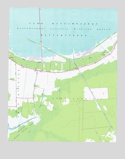
New Holland, NC USGS Topographic Map
Click on map above to begin viewing in our Map Viewer.

This topographic map contains these locations and features:
Feature Name Type Latitude Longitude GNIS ID View Map
AramuskeetAreaN35.4029°W76.1527°1018690View Map
Aromuskek MarshesAreaN35.4168°W76.1996°1952413View Map
Donald Farm CemeteryCemeteryN35.4441°W76.2313°984265View Map
Hyde CountyCivilN35.4081°W76.1450°1008564View Map
HydelandPopulated PlaceN35.4266°W76.2196°1020872View Map
Hydeland CanalCanalN35.4129°W76.2107°987311View Map
Judges QuarterLocaleN35.4077°W76.2405°1003085View Map
Juniper Bay CreekStreamN35.3868°W76.2452°987833View Map
Juniper CanalCanalN35.4216°W76.2202°987841View Map
Lake ComfortLocaleN35.4416°W76.2166°1003086View Map
Mattamuskeet High SchoolSchoolN35.4396°W76.2191°1003081View Map
Mattamuskeet National Wildlife Refuge HeadquartersBuildingN35.4518°W76.1744°1003082View Map
New HollandPopulated PlaceN35.4435°W76.1696°1021628View Map
New Holland SchoolSchoolN35.4566°W76.1357°990976View Map
Northwest CreekStreamN35.3871°W76.2488°991306View Map
Old Richmond ChurchChurchN35.4527°W76.2482°991595View Map
Outfall CanalCanalN35.4054°W76.1419°991730View Map
Quarter CanalCanalN35.4279°W76.2405°992938View Map
Saint Mary ChurchChurchN35.4241°W76.2399°994027View Map
Soule CemeteryCemeteryN35.4407°W76.2113°995117View Map
Soule ChurchChurchN35.4421°W76.2177°995118View Map
The BluffLocaleN35.4118°W76.2188°1018691View Map
WHYC-FM (Swan Quarter)TowerN35.4416°W76.2188°1018274View Map

Note: Coordinates in the location and feature list above are referenced to NAD83 datum.


Copyright (C) 2008-2025 Ryan Niemi / Sunset Dynamics ... All Rights Reserved