TopoQuest Logo
Do you find TopoQuest useful?
Help keep TopoQuest running and adding new maps/features by donating!
Bitcoin:  19c7KJd3qBynnjoSw5npx9KScwjBe4ifkT
Litecoin:  LXs6TkuXGGXo1vDsWCkWVdjQX94eUKd6ui
Home View Maps Find Maps Find Places Resources & Links


New Sweden, Maine Topographic Map

USGS Map Title: New Sweden, ME
USGS Map MRC: 46068H1
DRG (GeoTIFF) Download: o46068h1.tif


Neighboring USGS Topographic Map Quads:


  Stockholm, ME  
47068A2
 

  Picard Brook, ME  
47068A1
 

  Doyle Ridge, ME  
47067A8
 

  Mud Lake, ME  
46068H2
 

  New Sweden, ME  
46068H1
 

  Fort Fairfield NW, ME  
46067H8
 

  Washburn, ME  
46068G2
 

  Caribou, ME  
46068G1
 

  Goodwin, ME  
46067G8


Map MRC Location:

N47°
W69°
N47°
W68°
H8 H7 H6 H5 H4 H3 H2 H1
G8 G7 G6 G5 G4 G3 G2 G1
F8 F7 F6 F5 F4 F3 F2 F1
E8 E7 E6 E5 E4 E3 E2 E1
D8 D7 D6 D5 D4 D3 D2 D1
C8 C7 C6 C5 C4 C3 C2 C1
B8 B7 B6 B5 B4 B3 B2 B1
A8 A7 A6 A5 A4 A3 A2 A1
N46°
W69°
N46°
W68°

New Sweden, ME USGS 1:24K Topographic Map Preview:
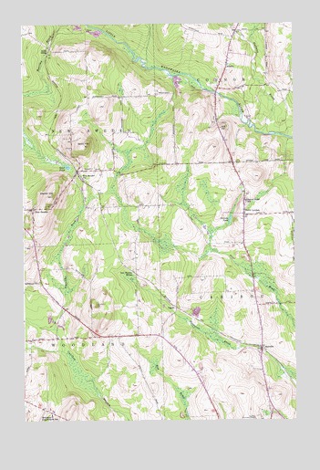
New Sweden, ME USGS Topographic Map
Click on map above to begin viewing in our Map Viewer.

This topographic map contains these locations and features:
Feature Name Type Latitude Longitude GNIS ID View Map
AcadiaPopulated PlaceN46.9862°W68.0317°561074View Map
Aroostook Band of Micmac Tribal Designated Statistical Area (historical)CensusN46.9501°W68.0934°2418778View Map
BarrettsPopulated PlaceN46.8975°W68.0156°561647View Map
Ben Thomas SidingLocaleN46.9220°W68.0750°562042View Map
Capitol HillSummitN46.9461°W68.1112°563496View Map
Capitol Hill CemeteryCemeteryN46.9427°W68.1191°2678405View Map
Cary Medical CenterHospitalN46.8796°W68.0083°1910285View Map
Cary Medical Center Community Health Resource LibraryBuildingN46.8797°W68.0077°1910286View Map
Connor Consolidated SchoolSchoolN46.9730°W68.0353°2738014View Map
Gelot HillSummitN46.9620°W68.0963°566730View Map
Gelot PondLakeN46.9551°W68.1044°566731View Map
Halfway BrookStreamN46.9656°W68.0145°567484View Map
Johnson CemeteryCemeteryN46.9228°W68.1175°2678694View Map
Little Black BrookStreamN46.9939°W68.0197°569688View Map
New Holy Rosary CemeteryCemeteryN46.8845°W68.0432°2678613View Map
New SwedenPopulated PlaceN46.9417°W68.1206°572126View Map
New Sweden Post OfficePost OfficeN46.9541°W68.0993°1910517View Map
New Sweden StationPopulated PlaceN46.9537°W68.1006°572127View Map
North LyndonPopulated PlaceN46.9395°W68.0236°572362View Map
OgrenPopulated PlaceN46.9109°W68.0559°579586View Map
Picard BrookStreamN46.9995°W68.0289°573276View Map
Rista SidingLocaleN46.9917°W68.1131°574237View Map
Sacred Heart CemeteryCemeteryN46.9434°W68.0223°2677994View Map
Sacred Heart SchoolSchoolN46.9445°W68.0222°574650View Map
Sealander BrookStreamN46.9042°W68.1111°575124View Map
Thomas ParkParkN46.9423°W68.1134°576989View Map
Town of New SwedenCivilN46.9759°W68.1211°582625View Map
Town of WoodlandCivilN46.8841°W68.1195°582826View Map
Violette PondLakeN46.9382°W68.0295°577738View Map
WFST-AM (Caribou)TowerN46.8867°W68.0450°582012View Map
Williams Family CemeteryCemeteryN46.9273°W68.1195°2678695View Map
Woodland CemeteryCemeteryN46.8779°W68.1111°2678693View Map
Woodland Consolidated SchoolSchoolN46.8768°W68.1126°578670View Map

Note: Coordinates in the location and feature list above are referenced to NAD83 datum.


Copyright (C) 2008-2025 Ryan Niemi / Sunset Dynamics ... All Rights Reserved