TopoQuest Logo
Do you find TopoQuest useful?
Help keep TopoQuest running and adding new maps/features by donating!
Bitcoin:  19c7KJd3qBynnjoSw5npx9KScwjBe4ifkT
Litecoin:  LXs6TkuXGGXo1vDsWCkWVdjQX94eUKd6ui
Home View Maps Find Maps Find Places Resources & Links


Newald, Wisconsin Topographic Map

USGS Map Title: Newald, WI
USGS Map MRC: 45088F6
DRG (GeoTIFF) Download: o45088f6.tif


Neighboring USGS Topographic Map Quads:


  Alvin SE, WI  
45088G7
 

  Long Lake, WI  
45088G6
 

  Long Lake SE, WI  
45088G5
 

  Crandon NE, WI  
45088F7
 

  Newald, WI  
45088F6
 

  Lake Gordon, WI  
45088F5
 

  Lake Lucerne, WI  
45088E7
 

  Laona, WI  
45088E6
 

  Blackwell, WI  
45088E5


Map MRC Location:

N46°
W89°
N46°
W88°
H8 H7 H6 H5 H4 H3 H2 H1
G8 G7 G6 G5 G4 G3 G2 G1
F8 F7 F6 F5 F4 F3 F2 F1
E8 E7 E6 E5 E4 E3 E2 E1
D8 D7 D6 D5 D4 D3 D2 D1
C8 C7 C6 C5 C4 C3 C2 C1
B8 B7 B6 B5 B4 B3 B2 B1
A8 A7 A6 A5 A4 A3 A2 A1
N45°
W89°
N45°
W88°

Newald, WI USGS 1:24K Topographic Map Preview:
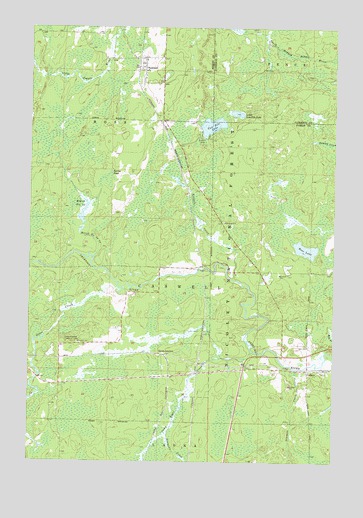
Newald, WI USGS Topographic Map
Click on map above to begin viewing in our Map Viewer.

This topographic map contains these locations and features:
Feature Name Type Latitude Longitude GNIS ID View Map
Big Joe CampgroundLocaleN45.6647°W88.6523°1580950View Map
Bills CreekStreamN45.6608°W88.6251°1578785View Map
Camp Eight CreekStreamN45.6569°W88.6582°1578917View Map
CavourPopulated PlaceN45.6522°W88.6296°1578963View Map
Consolidated Lookout TowerTowerN45.6594°W88.7348°1581197View Map
Gruman CreekStreamN45.6519°W88.6404°1579368View Map
Kersten CreekStreamN45.6775°W88.6665°1579581View Map
Laona JunctionPopulated PlaceN45.6561°W88.6940°1579630View Map
Little Van Zile LakeLakeN45.7253°W88.6656°1579720View Map
Marsh Number 10 CreekStreamN45.6841°W88.7234°1581272View Map
Marsh Number TenLakeN45.6961°W88.7283°1579818View Map
NewaldPopulated PlaceN45.7386°W88.7054°1580002View Map
Newald Census Designated PlaceCensusN45.7396°W88.7005°2586535View Map
Newald Volunteer Fire DepartmentBuildingN45.7402°W88.7031°2696959View Map
Otter CreekStreamN45.6747°W88.7134°1580067View Map
Ross LakeLakeN45.6862°W88.6368°1580291View Map
Sixtytwo CreekStreamN45.6330°W88.6934°1580427View Map
Spring PondLakeN45.7083°W88.7169°1580505View Map
Town of CaswellCivilN45.6711°W88.6733°1582930View Map
Town of RossCivilN45.7274°W88.7405°1584067View Map
Town Park Recreation SiteLocaleN45.7180°W88.6790°1580949View Map
Van Zile LakeLakeN45.7216°W88.6757°1580707View Map

Note: Coordinates in the location and feature list above are referenced to NAD83 datum.


Copyright (C) 2008-2024 Ryan Niemi / Sunset Dynamics ... All Rights Reserved