TopoQuest Logo
Do you find TopoQuest useful?
Help keep TopoQuest running and adding new maps/features by donating!
Bitcoin:  19c7KJd3qBynnjoSw5npx9KScwjBe4ifkT
Litecoin:  LXs6TkuXGGXo1vDsWCkWVdjQX94eUKd6ui
Home View Maps Find Maps Find Places Resources & Links


Nez Perce Peak, Idaho Topographic Map

USGS Map Title: Nez Perce Peak, ID
USGS Map MRC: 45114F5
DRG (GeoTIFF) Download: o45114f5.tif


Neighboring USGS Topographic Map Quads:


  Burnt Strip Mountain, ID  
45114G6
 

  Watchtower Peak, ID  
45114G5
 

  Mount Jerusalem, MT  
45114G4
 

  Beaver Jack Mountain, ID  
45114F6
 

  Nez Perce Peak, ID  
45114F5
 

  Bare Cone, MT  
45114F4
 

  Wood Hump, ID  
45114E6
 

  Blue Joint, ID  
45114E5
 

  Horse Creek Pass, MT  
45114E4


Map MRC Location:

N46°
W115°
N46°
W114°
H8 H7 H6 H5 H4 H3 H2 H1
G8 G7 G6 G5 G4 G3 G2 G1
F8 F7 F6 F5 F4 F3 F2 F1
E8 E7 E6 E5 E4 E3 E2 E1
D8 D7 D6 D5 D4 D3 D2 D1
C8 C7 C6 C5 C4 C3 C2 C1
B8 B7 B6 B5 B4 B3 B2 B1
A8 A7 A6 A5 A4 A3 A2 A1
N45°
W115°
N45°
W114°

Nez Perce Peak, ID USGS 1:24K Topographic Map Preview:
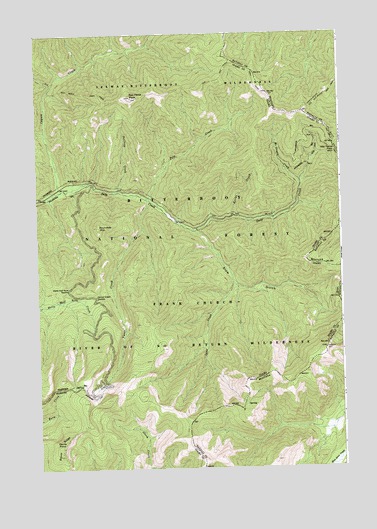
Nez Perce Peak, ID USGS Topographic Map
Click on map above to begin viewing in our Map Viewer.

This topographic map contains these locations and features:
Feature Name Type Latitude Longitude GNIS ID View Map
Blue Joint MeadowsFlatN45.6282°W114.5120°794487View Map
Cayuse CreekStreamN45.7055°W114.6151°379070View Map
Devils PointSummitN45.6327°W114.6151°372393View Map
Halfway CreekStreamN45.7052°W114.5912°372964View Map
Hells Half Acre SaddleGapN45.6766°W114.6123°373039View Map
Kerlee CreekStreamN45.6980°W114.5437°373399View Map
Lazy CreekStreamN45.6780°W114.5445°373533View Map
MacGregor CreekStreamN45.7071°W114.5162°373786View Map
Magruder CreekStreamN45.7446°W114.5112°386368View Map
Nez Perce PassGapN45.7163°W114.5020°787982View Map
Nez Perce PeakSummitN45.7316°W114.5857°374140View Map
Old Nez Perce TrailTrailN45.7399°W114.5379°788423View Map
Old Nez Perce TrailTrailN45.7341°W114.5598°374259View Map
Pete CreekStreamN45.7030°W114.5790°374372View Map
Roundtop MountainSummitN45.6944°W114.5998°374803View Map
Shumaker CreekStreamN45.7077°W114.6020°400354View Map
Slow GulchValleyN45.6935°W114.5601°375074View Map
South Route Old Nez Perce TrailTrailN45.7210°W114.5040°375174View Map
Steep HillSummitN45.6594°W114.5076°395030View Map
Vance CreekStreamN45.7027°W114.5795°375693View Map
Vance Creek SaddleGapN45.6746°W114.6009°375694View Map

Note: Coordinates in the location and feature list above are referenced to NAD83 datum.


Copyright (C) 2008-2025 Ryan Niemi / Sunset Dynamics ... All Rights Reserved