TopoQuest Logo
Do you find TopoQuest useful?
Help keep TopoQuest running and adding new maps/features by donating!
Bitcoin:  19c7KJd3qBynnjoSw5npx9KScwjBe4ifkT
Litecoin:  LXs6TkuXGGXo1vDsWCkWVdjQX94eUKd6ui
Home View Maps Find Maps Find Places Resources & Links


Nicksville, Arizona Topographic Map

USGS Map Title: Nicksville, AZ
USGS Map MRC: 31110D2
DRG (GeoTIFF) Download: o31110d2.tif


Neighboring USGS Topographic Map Quads:


  Fort Huachuca, AZ  
31110E3
 

  Lewis Springs, AZ  
31110E2
 

  Tombstone SE, AZ  
31110E1
 

  Miller Peak, AZ  
31110D3
 

  Nicksville, AZ  
31110D2
 

  Hereford, AZ  
31110D1
 

  Montezuma Pass, AZ  
31110C3
 

  Bob Thompson Peak, AZ  
31110C2
 

  Stark, AZ  
31110C1


Map MRC Location:

N32°
W111°
N32°
W110°
H8 H7 H6 H5 H4 H3 H2 H1
G8 G7 G6 G5 G4 G3 G2 G1
F8 F7 F6 F5 F4 F3 F2 F1
E8 E7 E6 E5 E4 E3 E2 E1
D8 D7 D6 D5 D4 D3 D2 D1
C8 C7 C6 C5 C4 C3 C2 C1
B8 B7 B6 B5 B4 B3 B2 B1
A8 A7 A6 A5 A4 A3 A2 A1
N31°
W111°
N31°
W110°

Nicksville, AZ USGS 1:24K Topographic Map Preview:
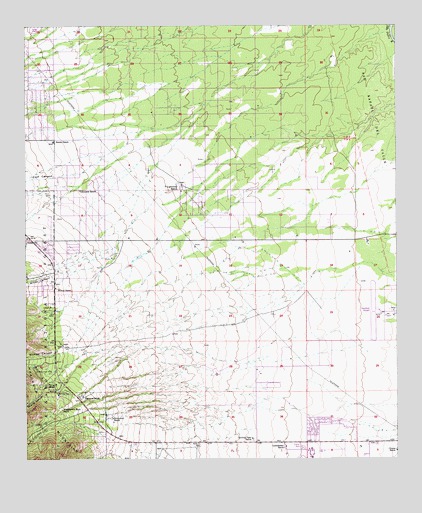
Nicksville, AZ USGS Topographic Map
Click on map above to begin viewing in our Map Viewer.

This topographic map contains these locations and features:
Feature Name Type Latitude Longitude GNIS ID View Map
Air Haven Mobile Home EstatesPopulated PlaceN31.4824°W110.2457°2622672View Map
Ash CanyonValleyN31.3820°W110.2251°25776View Map
Baumkirchner MineMineN31.4001°W110.2476°26048View Map
Carr CanyonValleyN31.4568°W110.2395°27296View Map
Carr Canyon Forest Service BarnLocaleN31.4493°W110.2495°45012View Map
Clinton RanchLocaleN31.3773°W110.1259°27723View Map
Coronado Elementary SchoolSchoolN31.4752°W110.1960°2543733View Map
Fairview RanchLocaleN31.3932°W110.2315°28955View Map
Flying H RanchLocaleN31.3962°W110.2434°29080View Map
Grace Presbyterian ChurchChurchN31.4740°W110.2456°2623135View Map
Hereford Airport (historical)AirportN31.4170°W110.1345°39205View Map
Hereford Army Air Field (historical)MilitaryN31.4175°W110.1328°2092044View Map
Hereford Post OfficePost OfficeN31.4372°W110.2480°2622637View Map
Hunter CanyonValleyN31.4070°W110.2376°30293View Map
Hunters CorralLocaleN31.4054°W110.2420°2680467View Map
Kennedy RanchLocaleN31.4526°W110.2320°30739View Map
Kinjockity RanchLocaleN31.3868°W110.2215°30780View Map
Leinedecker RanchLocaleN31.3784°W110.1631°30939View Map
Miller CanyonValleyN31.4295°W110.2367°31865View Map
Miracle ValleyPopulated PlaceN31.3793°W110.1534°39214View Map
Miracle Valley Bible College and SeminarySchoolN31.3768°W110.1550°2544821View Map
Miracle Valley Census Designated PlaceCensusN31.3829°W110.1485°2582827View Map
NicksvillePopulated PlaceN31.4384°W110.2490°32321View Map
Rambo RanchLocaleN31.4668°W110.2412°33348View Map
Sierra Springs ChurchChurchN31.4391°W110.1713°2623290View Map
Sierra Vista Southeast Census Designated PlaceCensusN31.4524°W110.2160°2408736View Map
Smiling Tiger RanchLocaleN31.3809°W110.1745°34545View Map
Stump CanyonValleyN31.4045°W110.2331°34908View Map
Thompsons CorralLocaleN31.3842°W110.2442°2680468View Map
Valley View Elementary SchoolSchoolN31.3812°W110.2060°2544948View Map
Wilcox RanchLocaleN31.4243°W110.2406°36151View Map
Wintergreen Mink RanchLocaleN31.3895°W110.2390°36337View Map
Y-Lightning RanchLocaleN31.4523°W110.1981°36421View Map

Note: Coordinates in the location and feature list above are referenced to NAD83 datum.


Copyright (C) 2008-2025 Ryan Niemi / Sunset Dynamics ... All Rights Reserved