TopoQuest Logo
Do you find TopoQuest useful?
Help keep TopoQuest running and adding new maps/features by donating!
Bitcoin:  19c7KJd3qBynnjoSw5npx9KScwjBe4ifkT
Litecoin:  LXs6TkuXGGXo1vDsWCkWVdjQX94eUKd6ui
Home View Maps Find Maps Find Places Resources & Links


Nine Meadow Ridge, Maine Topographic Map

USGS Map Title: Nine Meadow Ridge, ME
USGS Map MRC: 45068D5
DRG (GeoTIFF) Download: o45068d5.tif


Neighboring USGS Topographic Map Quads:


  Nollesemic Lake, ME  
45068E6
 

  Medunkeunk Lake, ME  
45068E5
 

  Mattaseunk Lake, ME  
45068E4
 

  Mattamiscontis Mountain, ME  
45068D6
 

  Nine Meadow Ridge, ME  
45068D5
 

  Lincoln Center, ME  
45068D4
 

  Seboeis, ME  
45068C6
 

  Lincoln West, ME  
45068C5
 

  Lincoln East, ME  
45068C4


Map MRC Location:

N46°
W69°
N46°
W68°
H8 H7 H6 H5 H4 H3 H2 H1
G8 G7 G6 G5 G4 G3 G2 G1
F8 F7 F6 F5 F4 F3 F2 F1
E8 E7 E6 E5 E4 E3 E2 E1
D8 D7 D6 D5 D4 D3 D2 D1
C8 C7 C6 C5 C4 C3 C2 C1
B8 B7 B6 B5 B4 B3 B2 B1
A8 A7 A6 A5 A4 A3 A2 A1
N45°
W69°
N45°
W68°

Nine Meadow Ridge, ME USGS 1:24K Topographic Map Preview:
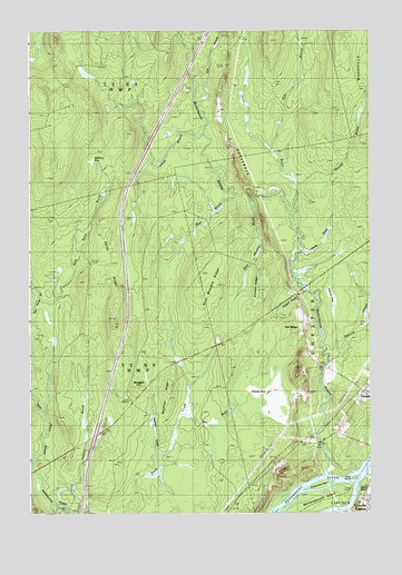
Nine Meadow Ridge, ME USGS Topographic Map
Click on map above to begin viewing in our Map Viewer.

This topographic map contains these locations and features:
Feature Name Type Latitude Longitude GNIS ID View Map
Adley RidgeRidgeN45.4376°W68.5956°561098View Map
Bear BrookStreamN45.4559°W68.5514°561808View Map
Blackman RidgeRidgeN45.4039°W68.5750°562524View Map
Bog BrookStreamN45.4001°W68.5695°562652View Map
Bowerbank (historical)Populated PlaceN45.3964°W68.5992°579149View Map
Chokecherry IslandIslandN45.3828°W68.5186°563967View Map
East Branch Medunkeunk StreamStreamN45.4803°W68.5625°565554View Map
East Branch Trout BrookStreamN45.4692°W68.5367°565580View Map
Ebhorse StreamStreamN45.4139°W68.5150°565765View Map
Eighteen BogSwampN45.4312°W68.5128°565819View Map
Eleven BrookStreamN45.4434°W68.5203°565834View Map
Fairfield SchoolSchoolN45.4067°W68.5034°565997View Map
Halfway BrookStreamN45.3770°W68.6164°567478View Map
HorsebackRidgeN45.4656°W68.5489°568293View Map
Interchange 55CrossingN45.3842°W68.6039°1913629View Map
Keene BogSwampN45.4059°W68.5400°569058View Map
Little IslandIslandN45.3842°W68.5061°569853View Map
Mattanawcook IslandIslandN45.3784°W68.5186°570908View Map
Medunkeunk StreamStreamN45.3853°W68.5147°571114View Map
Nelson IslandIslandN45.3814°W68.5053°572092View Map
Nine Meadow BrookStreamN45.4539°W68.5434°571064View Map
Nine Meadow RidgeRidgeN45.4359°W68.5625°572174View Map
Pea RidgePopulated PlaceN45.4228°W68.5247°579609View Map
Penobscot Island Indian ReservationCivilN45.3766°W68.5273°1987300View Map
Raketail BrookStreamN45.3898°W68.5772°573982View Map
Sally Ayers BrookStreamN45.4301°W68.6234°574758View Map
Sargent BrookStreamN45.4328°W68.5242°574918View Map
Savage BrookStreamN45.4601°W68.5275°574942View Map
Sixteen RidgeRidgeN45.4345°W68.5409°575510View Map
South Branch Medunkeunk StreamStreamN45.4731°W68.5614°575787View Map
Stinking BogSwampN45.4745°W68.6153°576355View Map
T2 R8 NWPCivilN45.4117°W68.6229°1987306View Map
Town of ChesterCivilN45.4306°W68.5179°582408View Map
Trout BrookStreamN45.4526°W68.5289°577333View Map
Woodard (historical)Populated PlaceN45.4070°W68.5842°579852View Map

Note: Coordinates in the location and feature list above are referenced to NAD83 datum.


Copyright (C) 2008-2024 Ryan Niemi / Sunset Dynamics ... All Rights Reserved