TopoQuest Logo
Do you find TopoQuest useful?
Help keep TopoQuest running and adding new maps/features by donating!
Bitcoin:  19c7KJd3qBynnjoSw5npx9KScwjBe4ifkT
Litecoin:  LXs6TkuXGGXo1vDsWCkWVdjQX94eUKd6ui
Home View Maps Find Maps Find Places Resources & Links


Ninemile Summit, Nevada Topographic Map

USGS Map Title: Ninemile Summit, NV
USGS Map MRC: 41118F3
DRG (GeoTIFF) Download: o41118f3.tif


Neighboring USGS Topographic Map Quads:


  Shyster Butte, NV  
41118G4
 

  Kings River Ranch, NV  
41118G3
 

  Calavera Canyon, NV  
41118G2
 

  Bilk Creek Reservoir, NV  
41118F4
 

  Ninemile Summit, NV  
41118F3
 

  Sheep Ranch Springs, NV  
41118F2
 

  Quinn River Crossing, NV  
41118E4
 

  Mustang Spring, NV  
41118E3
 

  Coyote Hills, NV  
41118E2


Map MRC Location:

N42°
W119°
N42°
W118°
H8 H7 H6 H5 H4 H3 H2 H1
G8 G7 G6 G5 G4 G3 G2 G1
F8 F7 F6 F5 F4 F3 F2 F1
E8 E7 E6 E5 E4 E3 E2 E1
D8 D7 D6 D5 D4 D3 D2 D1
C8 C7 C6 C5 C4 C3 C2 C1
B8 B7 B6 B5 B4 B3 B2 B1
A8 A7 A6 A5 A4 A3 A2 A1
N41°
W119°
N41°
W118°

Ninemile Summit, NV USGS 1:24K Topographic Map Preview:
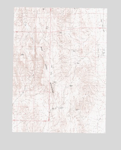
Ninemile Summit, NV USGS Topographic Map
Click on map above to begin viewing in our Map Viewer.

This topographic map contains these locations and features:
Feature Name Type Latitude Longitude GNIS ID View Map
Agate SpringSpringN41.6952°W118.2877°852271View Map
Basque BasinFlatN41.6902°W118.3224°852273View Map
Basque SpringSpringN41.6756°W118.3208°852270View Map
Bilk Creek MountainsRangeN41.6743°W118.3235°838779View Map
Cherry Hill SpringSpringN41.6485°W118.2914°839442View Map
Dacite SpringSpringN41.7257°W118.3143°852272View Map
East Road SpringSpringN41.6503°W118.3123°852269View Map
Lassens Meadows (historical)LocaleN41.6763°W118.2593°854831View Map
Mud SpringSpringN41.7299°W118.3335°842320View Map
Nine Mile RanchLocaleN41.7046°W118.2568°854550View Map
Ninemile SpringsSpringN41.7018°W118.2613°842480View Map
Ninemile SummitGapN41.6699°W118.2996°845587View Map
Ninemile Summit SpringSpringN41.7074°W118.2954°858626View Map
Road SpringSpringN41.6487°W118.3229°843243View Map
Table MountainSummitN41.7016°W118.3677°844160View Map

Note: Coordinates in the location and feature list above are referenced to NAD83 datum.


Copyright (C) 2008-2025 Ryan Niemi / Sunset Dynamics ... All Rights Reserved