TopoQuest Logo
Do you find TopoQuest useful?
Help keep TopoQuest running and adding new maps/features by donating!
Bitcoin:  19c7KJd3qBynnjoSw5npx9KScwjBe4ifkT
Litecoin:  LXs6TkuXGGXo1vDsWCkWVdjQX94eUKd6ui
Home View Maps Find Maps Find Places Resources & Links


Bellview, New Mexico Topographic Map

USGS Map Title: Bellview, NM
USGS Map MRC: 34103G1
DRG (GeoTIFF) Download: o34103g1.tif


Neighboring USGS Topographic Map Quads:


  Day Canyon, NM  
34103H2
 

  Endee Hill, NM  
34103H1
 

  Mustang Lake, TX  
34102H8
 

  Broadview, NM  
34103G2
 

  Bellview, NM  
34103G1
 

  Garcia Lake, TX  
34102G8
 

  Pleasant Hill NW, NM  
34103F2
 

  Pleasant Hill NE, NM  
34103F1
 

  Rhea, TX  
34102F8


Map MRC Location:

N35°
W104°
N35°
W103°
H8 H7 H6 H5 H4 H3 H2 H1
G8 G7 G6 G5 G4 G3 G2 G1
F8 F7 F6 F5 F4 F3 F2 F1
E8 E7 E6 E5 E4 E3 E2 E1
D8 D7 D6 D5 D4 D3 D2 D1
C8 C7 C6 C5 C4 C3 C2 C1
B8 B7 B6 B5 B4 B3 B2 B1
A8 A7 A6 A5 A4 A3 A2 A1
N34°
W104°
N34°
W103°

Bellview, NM USGS 1:24K Topographic Map Preview:
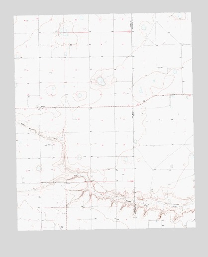
Bellview, NM USGS Topographic Map
Click on map above to begin viewing in our Map Viewer.

This topographic map contains these locations and features:
Feature Name Type Latitude Longitude GNIS ID View Map
10102 Water WellWellN34.8231°W103.1155°931135View Map
10103 Water WellWellN34.7831°W103.0544°931145View Map
10211 Water WellWellN34.8742°W103.1072°931126View Map
10228 Water WellWellN34.8517°W103.0727°931131View Map
10229 Water WellWellN34.8453°W103.0977°931176View Map
10231 Water WellWellN34.8165°W103.0711°931172View Map
10232 Water WellWellN34.8145°W103.0716°931170View Map
10233 Water WellWellN34.8145°W103.0413°931169View Map
10234 Water WellWellN34.7948°W103.0716°931148View Map
10252 Water WellWellN34.7515°W103.1083°931154View Map
10755 Water WellWellN34.7765°W103.0755°931159View Map
10912 Water WellWellN34.7628°W103.0477°931157View Map
10927 Water WellWellN34.8515°W103.0902°931130View Map
10929 Water WellWellN34.8234°W103.0888°931136View Map
10930 Water WellWellN34.8015°W103.0724°931140View Map
10932 Water WellWellN34.7767°W103.0824°931161View Map
10933 Water WellWellN34.8309°W103.0502°931138View Map
10934 Water WellWellN34.7798°W103.0549°931163View Map
10935 Water WellWellN34.8156°W103.1049°931171View Map
11450 Water WellWellN34.7767°W103.0738°931160View Map
11451 Water WellWellN34.7651°W103.0888°931158View Map
11452 Water WellWellN34.7703°W103.1088°931151View Map
11463 Water WellWellN34.7720°W103.0624°931152View Map
11464 Water WellWellN34.7565°W103.0736°931156View Map
11479 Water WellWellN34.7928°W103.0736°931146View Map
11489 Water WellWellN34.8684°W103.0880°931183View Map
11547 Water WellWellN34.7928°W103.1174°931147View Map
11548 Water WellWellN34.8003°W103.1005°931165View Map
BellviewPopulated PlaceN34.8212°W103.1077°915801View Map
Bellview Post OfficePost OfficeN34.8212°W103.1077°938105View Map
HollenePopulated PlaceN34.7776°W103.0908°898554View Map
Hollene Post Office (historical)Post OfficeN34.7776°W103.0908°937372View Map
Mitchell Farms Airport (historical)AirportN34.8717°W103.0721°936913View Map
Tierra Blanca CreekStreamN34.7631°W103.0005°897489View Map

Note: Coordinates in the location and feature list above are referenced to NAD83 datum.


Copyright (C) 2008-2025 Ryan Niemi / Sunset Dynamics ... All Rights Reserved