TopoQuest Logo
Do you find TopoQuest useful?
Help keep TopoQuest running and adding new maps/features by donating!
Bitcoin:  19c7KJd3qBynnjoSw5npx9KScwjBe4ifkT
Litecoin:  LXs6TkuXGGXo1vDsWCkWVdjQX94eUKd6ui
Home View Maps Find Maps Find Places Resources & Links


North Bay, North Carolina Topographic Map

USGS Map Title: North Bay, NC
USGS Map MRC: 35076A3
DRG (GeoTIFF) Download: o35076a3.tif


Neighboring USGS Topographic Map Quads:


  Little Fishing Point, NC  
35076B4


  Point of Marsh, NC  
35076A4
 

  North Bay, NC  
35076A3


  Long Bay, NC  
34076H4
 

  Atlantic, NC  
34076H3


Map MRC Location:

N36°
W77°
N36°
W76°
H8 H7 H6 H5 H4 H3 H2 H1
G8 G7 G6 G5 G4 G3 G2 G1
F8 F7 F6 F5 F4 F3 F2 F1
E8 E7 E6 E5 E4 E3 E2 E1
D8 D7 D6 D5 D4 D3 D2 D1
C8 C7 C6 C5 C4 C3 C2 C1
B8 B7 B6 B5 B4 B3 B2 B1
A8 A7 A6 A5 A4 A3 A2 A1
N35°
W77°
N35°
W76°

North Bay, NC USGS 1:24K Topographic Map Preview:
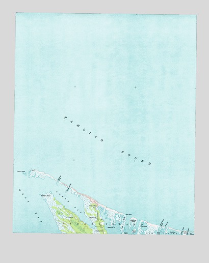
North Bay, NC USGS Topographic Map
Click on map above to begin viewing in our Map Viewer.

This topographic map contains these locations and features:
Feature Name Type Latitude Longitude GNIS ID View Map
Beach IslandIslandN35.0029°W76.2905°980675View Map
Beach MarshSwampN35.0066°W76.2985°980676View Map
Cedar IslandPopulated PlaceN35.0082°W76.3160°1002771View Map
Cedar Island Post OfficePost OfficeN35.0166°W76.3168°2773811View Map
Deep SloughGutN35.0018°W76.2541°984100View Map
End of Island SloughGutN35.0032°W76.2724°984782View Map
Ferry LandingLocaleN35.0177°W76.3160°1002769View Map
Fullers DitchGutN35.0013°W76.2577°985500View Map
Goodwin HillsPopulated PlaceN35.0024°W76.3119°1020473View Map
Great PondLakeN35.0043°W76.2841°986036View Map
Head of BayLocaleN35.0149°W76.3177°986563View Map
Hog IslandIslandN35.0021°W76.2799°986884View Map
Hunting IslandIslandN35.0007°W76.2563°987268View Map
Noras CoveBayN35.0007°W76.2755°991175View Map
North BayBayN35.0168°W76.3338°991192View Map
Point of GrassCapeN35.0346°W76.3666°992611View Map
Raymond SandGutN35.0299°W76.3438°993079View Map
Sandy LandingGutN35.0260°W76.3360°994286View Map
Ship PointCapeN35.0113°W76.2969°994737View Map
Ship Shoal IslandIslandN35.0066°W76.2916°994739View Map
Snake GutGutN35.0032°W76.2696°995040View Map
Township of Cedar IslandCivilN35.0610°W76.2609°1026500View Map
Waterbush PointCapeN35.0046°W76.3046°996846View Map
Western PointCapeN35.0221°W76.3555°997061View Map

Note: Coordinates in the location and feature list above are referenced to NAD83 datum.


Copyright (C) 2008-2024 Ryan Niemi / Sunset Dynamics ... All Rights Reserved