TopoQuest Logo
Do you find TopoQuest useful?
Help keep TopoQuest running and adding new maps/features by donating!
Bitcoin:  19c7KJd3qBynnjoSw5npx9KScwjBe4ifkT
Litecoin:  LXs6TkuXGGXo1vDsWCkWVdjQX94eUKd6ui
Home View Maps Find Maps Find Places Resources & Links


Northville, Ohio Topographic Map

USGS Map Title: Northville, OH
USGS Map MRC: 40083B7
DRG (GeoTIFF) Download: o40083b7.tif


Neighboring USGS Topographic Map Quads:


  De Graff, OH  
40083C8
 

  Bellefontaine, OH  
40083C7
 

  Zanesfield, OH  
40083C6
 

  Saint Paris, OH  
40083B8
 

  Northville, OH  
40083B7
 

  Kingscreek, OH  
40083B6
 

  Thackery, OH  
40083A8
 

  Urbana West, OH  
40083A7
 

  Urbana East, OH  
40083A6


Map MRC Location:

N41°
W84°
N41°
W83°
H8 H7 H6 H5 H4 H3 H2 H1
G8 G7 G6 G5 G4 G3 G2 G1
F8 F7 F6 F5 F4 F3 F2 F1
E8 E7 E6 E5 E4 E3 E2 E1
D8 D7 D6 D5 D4 D3 D2 D1
C8 C7 C6 C5 C4 C3 C2 C1
B8 B7 B6 B5 B4 B3 B2 B1
A8 A7 A6 A5 A4 A3 A2 A1
N40°
W84°
N40°
W83°

Northville, OH USGS 1:24K Topographic Map Preview:
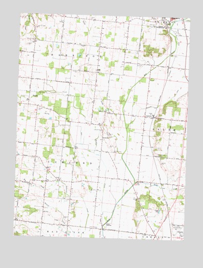
Northville, OH USGS Topographic Map
Click on map above to begin viewing in our Map Viewer.

This topographic map contains these locations and features:
Feature Name Type Latitude Longitude GNIS ID View Map
Calland CemeteryCemeteryN40.2331°W83.8691°1038624View Map
Camp ShawneeLocaleN40.1328°W83.8077°1060920View Map
Champaign CountyCivilN40.1377°W83.7695°1074023View Map
Concord CemeteryCemeteryN40.1576°W83.8416°1961143View Map
Concord SchoolSchoolN40.1639°W83.8522°1060993View Map
Concord United Methodist ChurchChurchN40.1573°W83.8430°1064500View Map
Couchman School (historical)SchoolN40.2289°W83.7527°1077592View Map
Craft School (historical)SchoolN40.2478°W83.8255°1077593View Map
Cranes PondLakeN40.1410°W83.7684°1039456View Map
ErisPopulated PlaceN40.1562°W83.8527°1056279View Map
Eris Post Office (historical)Post OfficeN40.1556°W83.8527°1965541View Map
Glady CreekStreamN40.1723°W83.7966°1083989View Map
Harban CreekStreamN40.1251°W83.8308°1041301View Map
Harbour CemeteryCemeteryN40.1356°W83.8385°1041304View Map
Hewling CemeteryCemeteryN40.2328°W83.8269°1961145View Map
Hog CreekStreamN40.1556°W83.8447°1041646View Map
Idle and Stevens CemeteryCemeteryN40.1737°W83.8038°1041912View Map
Johnson CemeteryCemeteryN40.1973°W83.8589°1042119View Map
Kenton Memorial CemeteryCemeteryN40.1303°W83.8130°1961147View Map
Kings CreekStreamN40.1564°W83.7874°1066060View Map
LippincottPopulated PlaceN40.1937°W83.7755°1065005View Map
Lippincott Post Office (historical)Post OfficeN40.1931°W83.7749°1965537View Map
Macochee CreekStreamN40.2495°W83.7538°1077343View Map
Macochee DitchCanalN40.2026°W83.7672°1042872View Map
Muddy CreekStreamN40.1320°W83.8097°1043712View Map
Muddy Run CemeteryCemeteryN40.2448°W83.7760°1043721View Map
NorthvillePopulated PlaceN40.1820°W83.8122°1056458View Map
Northville Post Office (historical)Post OfficeN40.1820°W83.8124°1965559View Map
Old Pimtown (historical)Populated PlaceN40.2401°W83.7585°1063634View Map
Sayres PondsLakeN40.1976°W83.8147°1079588View Map
School Number 5 (historical)SchoolN40.2339°W83.8499°1077608View Map
Scott and Pullins CemeteryCemeteryN40.1851°W83.8124°1046052View Map
Siegenthaler-Kaestner Esker State Nature PreserveParkN40.2317°W83.8569°1077514View Map
Snow Hill School (historical)SchoolN40.1423°W83.7816°1077610View Map
Snowhill CemeteryCemeteryN40.1473°W83.7852°1046408View Map
Spring RunStreamN40.1731°W83.8183°1046572View Map
Sullivans CemeteryCemeteryN40.2178°W83.8313°1046847View Map
Township of ConcordCivilN40.1688°W83.8509°1085839View Map
Township of HarrisonCivilN40.2341°W83.8439°1085841View Map
Wesley ChapelChurchN40.2195°W83.8183°1047695View Map
Wesley Chapel CemeteryCemeteryN40.2189°W83.8177°1961160View Map
Wesley Chapel School (historical)SchoolN40.2176°W83.8172°1077612View Map
West Liberty-Salem High SchoolSchoolN40.2167°W83.7535°1055003View Map
Ziegler CemeteryCemeteryN40.2217°W83.7988°1961161View Map

Note: Coordinates in the location and feature list above are referenced to NAD83 datum.


Copyright (C) 2008-2025 Ryan Niemi / Sunset Dynamics ... All Rights Reserved