TopoQuest Logo
Do you find TopoQuest useful?
Help keep TopoQuest running and adding new maps/features by donating!
Bitcoin:  19c7KJd3qBynnjoSw5npx9KScwjBe4ifkT
Litecoin:  LXs6TkuXGGXo1vDsWCkWVdjQX94eUKd6ui
Home View Maps Find Maps Find Places Resources & Links


Northwest Midland, Texas Topographic Map

USGS Map Title: Northwest Midland, TX
USGS Map MRC: 32102A2
DRG (GeoTIFF) Download: o32102a2.tif


Neighboring USGS Topographic Map Quads:


  Baird Lake, TX  
32102B3
 

  Mabee Ranch, TX  
32102B2
 

  North Curtis Ranch, TX  
32102B1
 

  Hackberry Lake, TX  
32102A3
 

  Northwest Midland, TX  
32102A2
 

  Northeast Midland, TX  
32102A1
 

  Odessa NE, TX  
31102H3
 

  Southwest Midland, TX  
31102H2
 

  Southeast Midland, TX  
31102H1


Map MRC Location:

N33°
W103°
N33°
W102°
H8 H7 H6 H5 H4 H3 H2 H1
G8 G7 G6 G5 G4 G3 G2 G1
F8 F7 F6 F5 F4 F3 F2 F1
E8 E7 E6 E5 E4 E3 E2 E1
D8 D7 D6 D5 D4 D3 D2 D1
C8 C7 C6 C5 C4 C3 C2 C1
B8 B7 B6 B5 B4 B3 B2 B1
A8 A7 A6 A5 A4 A3 A2 A1
N32°
W103°
N32°
W102°

Northwest Midland, TX USGS 1:24K Topographic Map Preview:
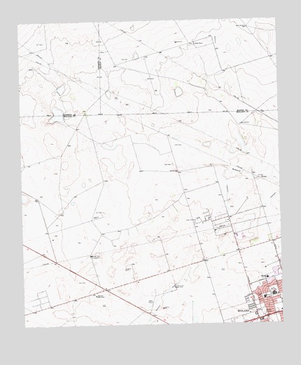
Northwest Midland, TX USGS Topographic Map
Click on map above to begin viewing in our Map Viewer.

This topographic map contains these locations and features:
Feature Name Type Latitude Longitude GNIS ID View Map
Barney Greathouse SchoolSchoolN32.0312°W102.1601°2007549View Map
Bethel United Methodist ChurchChurchN32.0004°W102.1296°2023221View Map
Bush Elementary SchoolSchoolN32.0079°W102.1535°2007554View Map
C J Kelly ParkParkN32.0151°W102.1621°2028702View Map
Cook Children's Multi - Specialty Center MidlandHospitalN32.0040°W102.1346°2015721View Map
Coombes Field - Trinity SchoolParkN32.0140°W102.1312°2027924View Map
Cowden RanchLocaleN32.1151°W102.1654°1333563View Map
Episcopal Day SchoolSchoolN32.0190°W102.1321°1335481View Map
Essax ParkParkN32.0160°W102.1513°2028371View Map
Fellowship Community ChurchChurchN32.0060°W102.1385°2023176View Map
George T Abell Junior High SchoolSchoolN32.0043°W102.1588°2007560View Map
Good Shepard Evangelical Lutheran ChurchChurchN32.0396°W102.1393°2023217View Map
Green Hill ParkParkN32.0421°W102.1657°1336930View Map
High Sky Girls RanchLocaleN32.0121°W102.2149°1337720View Map
Lee High SchoolSchoolN32.0123°W102.1293°1339785View Map
Midland DivisionCivilN32.0141°W102.1566°1938993View Map
Midland Fire Department Station 8BuildingN32.0264°W102.1274°2551212View Map
Midland Fire Department Station 9BuildingN32.0498°W102.1529°2551225View Map
Midland Park Shopping CenterLocaleN32.0307°W102.1329°2030326View Map
Midland Post Office Graves StationPost OfficeN32.0199°W102.1264°2766529View Map
North WindmillLocaleN32.1221°W102.1399°1342850View Map
Parker Elementary SchoolSchoolN32.0223°W102.1407°2007520View Map
Pioneer ParkParkN32.0037°W102.1501°2029590View Map
Rusk Elementary SchoolSchoolN32.0104°W102.1337°2007522View Map
Rusk ParkParkN32.0115°W102.1346°1345763View Map
Rusk SchoolSchoolN32.0107°W102.1337°1345766View Map
Sage ParkParkN32.0376°W102.1407°2029434View Map
Scharbauer Elementary SchoolSchoolN32.0029°W102.1604°2007524View Map
Trinity ParkParkN32.0229°W102.1332°2030052View Map
West WindmillLocaleN32.0818°W102.1438°1349842View Map

Note: Coordinates in the location and feature list above are referenced to NAD83 datum.


Copyright (C) 2008-2025 Ryan Niemi / Sunset Dynamics ... All Rights Reserved