TopoQuest Logo
Do you find TopoQuest useful?
Help keep TopoQuest running and adding new maps/features by donating!
Bitcoin:  19c7KJd3qBynnjoSw5npx9KScwjBe4ifkT
Litecoin:  LXs6TkuXGGXo1vDsWCkWVdjQX94eUKd6ui
Home View Maps Find Maps Find Places Resources & Links


Nowata West, Oklahoma Topographic Map

USGS Map Title: Nowata West, OK
USGS Map MRC: 36095F6
DRG (GeoTIFF) Download: o36095f6.tif


Neighboring USGS Topographic Map Quads:


  Blue Mound, OK  
36095G7
 

  Delaware, OK  
36095G6
 

  Childers, OK  
36095G5
 

  Oglesby, OK  
36095F7
 

  Nowata West, OK  
36095F6
 

  Nowata East, OK  
36095F5
 

  Bartlesville SE, OK  
36095E7
 

  Talala, OK  
36095E6
 

  Winganon, OK  
36095E5


Map MRC Location:

N37°
W96°
N37°
W95°
H8 H7 H6 H5 H4 H3 H2 H1
G8 G7 G6 G5 G4 G3 G2 G1
F8 F7 F6 F5 F4 F3 F2 F1
E8 E7 E6 E5 E4 E3 E2 E1
D8 D7 D6 D5 D4 D3 D2 D1
C8 C7 C6 C5 C4 C3 C2 C1
B8 B7 B6 B5 B4 B3 B2 B1
A8 A7 A6 A5 A4 A3 A2 A1
N36°
W96°
N36°
W95°

Nowata West, OK USGS 1:24K Topographic Map Preview:
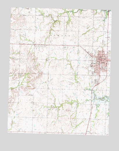
Nowata West, OK USGS Topographic Map
Click on map above to begin viewing in our Map Viewer.

This topographic map contains these locations and features:
Feature Name Type Latitude Longitude GNIS ID View Map
Armstrong - Journeycake CemeteryCemeteryN36.6769°W95.6425°2708903View Map
Bratcher CemeteryCemeteryN36.6769°W95.6442°2708905View Map
Central Church of ChristChurchN36.7004°W95.6414°1801297View Map
City of NowataCivilN36.6986°W95.6382°2411285View Map
Diamond Point Community HallLocaleN36.6631°W95.7200°1092074View Map
Elm Bend Community HallLocaleN36.7429°W95.7103°1092550View Map
Family Number 12 CemeteryCemeteryN36.6776°W95.6413°2708906View Map
Family Number 13 CemeteryCemeteryN36.6774°W95.6415°2708909View Map
First Baptist ChurchChurchN36.7051°W95.6486°1801298View Map
First Christian ChurchChurchN36.6990°W95.6397°1801299View Map
First Church of GodChurchN36.6956°W95.6397°1801300View Map
Glenn C. Moore Elementary SchoolSchoolN36.6976°W95.6459°1794271View Map
Hillside ChurchChurchN36.7073°W95.6533°1093784View Map
Jane Phillips Nowata Health CenterHospitalN36.6965°W95.6303°2695709View Map
Kingdom Hall of Jehovahs WitnessChurchN36.6965°W95.6386°1801301View Map
KNFB-FM (Nowata)TowerN36.6915°W95.6322°1102279View Map
Lincoln CemeteryCemeteryN36.6778°W95.6469°2708640View Map
Living Word Family ChurchChurchN36.6926°W95.6469°1801302View Map
New Life Assembly of GodChurchN36.7009°W95.6316°1801303View Map
North Fork Double CreekStreamN36.6612°W95.6375°1095948View Map
NowataPopulated PlaceN36.7006°W95.6380°1096069View Map
Nowata County JailBuildingN36.7026°W95.6383°2757857View Map
Nowata County Relocated CemeteriesCemeteryN36.6769°W95.6431°2708899View Map
Nowata County Sheriff's OfficeBuildingN36.7026°W95.6383°2757786View Map
Nowata DivisionCivilN36.7044°W95.6995°1937811View Map
Nowata Emergency Medical ServicesBuildingN36.6934°W95.6316°2695925View Map
Nowata Fire DepartmentBuildingN36.6934°W95.6316°2656840View Map
Nowata Fire Department Station 2BuildingN36.6988°W95.6287°2657023View Map
Nowata High SchoolSchoolN36.6964°W95.6453°1794269View Map
Nowata Memorial CemeteryCemeteryN36.6789°W95.6431°1095313View Map
Nowata Middle SchoolSchoolN36.6966°W95.6462°1794270View Map
Nowata Police DepartmentBuildingN36.6997°W95.6390°2757744View Map
Presbyterian ChurchChurchN36.7020°W95.6389°1801304View Map
Saint Catherines Catholic ChurchChurchN36.6979°W95.6383°1801305View Map
South Fork Double CreekStreamN36.6612°W95.6378°1098235View Map
Taylor CemeteryCemeteryN36.6493°W95.6761°1098767View Map
Township of NowataCivilN36.7279°W95.6836°1824538View Map
Township of WatovaCivilN36.6481°W95.6836°1824539View Map
Trinity Full Gospel ChurchChurchN36.6998°W95.6347°1801307View Map
United Methodist ChurchChurchN36.6701°W95.6375°1801308View Map

Note: Coordinates in the location and feature list above are referenced to NAD83 datum.


Copyright (C) 2008-2024 Ryan Niemi / Sunset Dynamics ... All Rights Reserved