TopoQuest Logo
Do you find TopoQuest useful?
Help keep TopoQuest running and adding new maps/features by donating!
Bitcoin:  19c7KJd3qBynnjoSw5npx9KScwjBe4ifkT
Litecoin:  LXs6TkuXGGXo1vDsWCkWVdjQX94eUKd6ui
Home View Maps Find Maps Find Places Resources & Links


Oasis, California Topographic Map

USGS Map Title: Oasis, CA
USGS Map MRC: 33116D1
DRG (GeoTIFF) Download: o33116d1.tif


Neighboring USGS Topographic Map Quads:


  Valerie, CA  
33116E2
 

  Mecca, CA  
33116E1
 

  Mortmar, CA  
33115E8
 

  Rabbit Peak, CA  
33116D2
 

  Oasis, CA  
33116D1
 

  Salton, CA  
33115D8
 

  Fonts Point, CA  
33116C2
 

  Seventeen Palms, CA  
33116C1
 

  Truckhaven, CA  
33115C8


Map MRC Location:

N34°
W117°
N34°
W116°
H8 H7 H6 H5 H4 H3 H2 H1
G8 G7 G6 G5 G4 G3 G2 G1
F8 F7 F6 F5 F4 F3 F2 F1
E8 E7 E6 E5 E4 E3 E2 E1
D8 D7 D6 D5 D4 D3 D2 D1
C8 C7 C6 C5 C4 C3 C2 C1
B8 B7 B6 B5 B4 B3 B2 B1
A8 A7 A6 A5 A4 A3 A2 A1
N33°
W117°
N33°
W116°

Oasis, CA USGS 1:24K Topographic Map Preview:
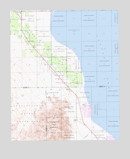
Oasis, CA USGS Topographic Map
Click on map above to begin viewing in our Map Viewer.

This topographic map contains these locations and features:
Feature Name Type Latitude Longitude GNIS ID View Map
Coachella ValleyValleyN33.4066°W116.0404°270512View Map
Coolidge SpringsPopulated PlaceN33.3942°W116.0503°1660508View Map
Desert ShoresPopulated PlaceN33.4042°W116.0397°1693254View Map
Desert Shores Census Designated PlaceCensusN33.4041°W116.0394°2408665View Map
Fish SpringSpringN33.4075°W116.0364°1693255View Map
Garner WashStreamN33.4298°W116.0406°242627View Map
OasisPopulated PlaceN33.4659°W116.0989°246776View Map
Oasis LateralCanalN33.4725°W116.1108°246780View Map
Oasis Maintenance StationLocaleN33.4703°W116.1036°1693258View Map
Oriols Service StationLocaleN33.4920°W116.1128°1693260View Map
Riverside County Fire Department Station 42 OasisBuildingN33.4925°W116.1130°2664646View Map
Salton Sea BeachPopulated PlaceN33.3750°W116.0119°1661370View Map
Salton Sea Beach Census Designated PlaceCensusN33.3758°W116.0114°2409243View Map
Salton Sea Beach MarinaLocaleN33.3756°W116.0064°1868183View Map
Travertine PalmsWoodsN33.4020°W116.0981°1693266View Map
Travertine Palms WashStreamN33.4403°W116.0606°250601View Map
Travertine RockSummitN33.4231°W116.0589°1661583View Map
West Shore Ambulance ServiceBuildingN33.4063°W116.0396°2665493View Map
Wonderstone WashStreamN33.3900°W116.0286°251762View Map

Note: Coordinates in the location and feature list above are referenced to NAD83 datum.


Copyright (C) 2008-2025 Ryan Niemi / Sunset Dynamics ... All Rights Reserved