TopoQuest Logo
Do you find TopoQuest useful?
Help keep TopoQuest running and adding new maps/features by donating!
Bitcoin:  19c7KJd3qBynnjoSw5npx9KScwjBe4ifkT
Litecoin:  LXs6TkuXGGXo1vDsWCkWVdjQX94eUKd6ui
Home View Maps Find Maps Find Places Resources & Links


Oatman, Arizona Topographic Map

USGS Map Title: Oatman, AZ
USGS Map MRC: 35114A4
DRG (GeoTIFF) Download: o35114a4.tif


Neighboring USGS Topographic Map Quads:


  Davis Dam, AZ  
35114B5
 

  Union Pass, AZ  
35114B4
 

  Secret Pass, AZ  
35114B3
 

  Davis Dam SE, AZ  
35114A5
 

  Oatman, AZ  
35114A4
 

  Mount Nutt, AZ  
35114A3
 

  Needles NE, AZ  
34114H5
 

  Boundary Cone, AZ  
34114H4
 

  Warm Springs, AZ  
34114H3


Map MRC Location:

N36°
W115°
N36°
W114°
H8 H7 H6 H5 H4 H3 H2 H1
G8 G7 G6 G5 G4 G3 G2 G1
F8 F7 F6 F5 F4 F3 F2 F1
E8 E7 E6 E5 E4 E3 E2 E1
D8 D7 D6 D5 D4 D3 D2 D1
C8 C7 C6 C5 C4 C3 C2 C1
B8 B7 B6 B5 B4 B3 B2 B1
A8 A7 A6 A5 A4 A3 A2 A1
N35°
W115°
N35°
W114°

Oatman, AZ USGS 1:24K Topographic Map Preview:
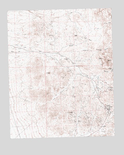
Oatman, AZ USGS Topographic Map
Click on map above to begin viewing in our Map Viewer.

This topographic map contains these locations and features:
Feature Name Type Latitude Longitude GNIS ID View Map
Battleship MountainSummitN35.0742°W114.3819°1083View Map
Cathedral RockPillarN35.0633°W114.4522°2566View Map
Cottonwood CanyonValleyN35.0594°W114.3930°3326View Map
Cottonwood SpringSpringN35.0656°W114.3772°3375View Map
Finger ButteSummitN35.0994°W114.4211°4601View Map
Gold Dust MineMineN35.0144°W114.3938°5101View Map
Gold Road CemeteryCemeteryN35.0444°W114.3919°2576294View Map
GoldroadLocaleN35.0467°W114.3797°5141View Map
Goldroad MineMineN35.0447°W114.3777°5143View Map
Grapevine CanyonValleyN35.0822°W114.4405°5271View Map
Grapevine Canyon SpringSpringN35.0839°W114.3889°5272View Map
Hardy MountainSummitN35.0592°W114.4361°5562View Map
Leland ButteSummitN35.0242°W114.4280°6974View Map
Midnight MineMineN35.0397°W114.4238°8028View Map
Moss MineMineN35.1000°W114.4477°8315View Map
Mossback MineMineN35.0967°W114.4097°8318View Map
Mossback WashStreamN35.0819°W114.4444°8319View Map
NegroheadSummitN35.0542°W114.4077°8565View Map
OatmanPopulated PlaceN35.0264°W114.3836°8901View Map
Oatman CemeteryCemeteryN35.0201°W114.3764°2576302View Map
Oatman Census Designated PlaceCensusN35.0274°W114.3839°2582835View Map
Oatman Fire DepartmentBuildingN35.0262°W114.3816°2672375View Map
Oatman Post OfficePost OfficeN35.0270°W114.3843°44955View Map
Old TrailsLocaleN35.0106°W114.3880°8971View Map
Pioneer MineMineN35.0186°W114.4077°9521View Map
Silver Creek SpringSpringN35.0766°W114.4289°11326View Map
Times GulchValleyN35.0308°W114.4694°12472View Map
Tom Reed MineMineN35.0236°W114.3805°12586View Map
United Eastern MineMineN35.0294°W114.3847°13048View Map
United Western MineMineN35.0342°W114.3913°23261View Map
Whiskey SpringSpringN35.0755°W114.3894°13592View Map
White Chief MineMineN35.0044°W114.3877°13602View Map

Note: Coordinates in the location and feature list above are referenced to NAD83 datum.


Copyright (C) 2008-2024 Ryan Niemi / Sunset Dynamics ... All Rights Reserved