TopoQuest Logo
Do you find TopoQuest useful?
Help keep TopoQuest running and adding new maps/features by donating!
Bitcoin:  19c7KJd3qBynnjoSw5npx9KScwjBe4ifkT
Litecoin:  LXs6TkuXGGXo1vDsWCkWVdjQX94eUKd6ui
Home View Maps Find Maps Find Places Resources & Links


Obsidian, Idaho Topographic Map

USGS Map Title: Obsidian, ID
USGS Map MRC: 44114A7
DRG (GeoTIFF) Download: o44114a7.tif


Neighboring USGS Topographic Map Quads:


  Stanley, ID  
44114B8
 

  Casino Lakes, ID  
44114B7
 

  Robinson Bar, ID  
44114B6
 

  Mount Cramer, ID  
44114A8
 

  Obsidian, ID  
44114A7
 

  Washington Peak, ID  
44114A6
 

  Snowyside Peak, ID  
43114H8
 

  Alturas Lake, ID  
43114H7
 

  Horton Peak, ID  
43114H6


Map MRC Location:

N45°
W115°
N45°
W114°
H8 H7 H6 H5 H4 H3 H2 H1
G8 G7 G6 G5 G4 G3 G2 G1
F8 F7 F6 F5 F4 F3 F2 F1
E8 E7 E6 E5 E4 E3 E2 E1
D8 D7 D6 D5 D4 D3 D2 D1
C8 C7 C6 C5 C4 C3 C2 C1
B8 B7 B6 B5 B4 B3 B2 B1
A8 A7 A6 A5 A4 A3 A2 A1
N44°
W115°
N44°
W114°

Obsidian, ID USGS 1:24K Topographic Map Preview:
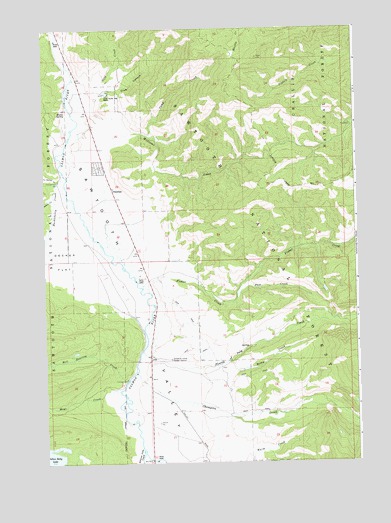
Obsidian, ID USGS Topographic Map
Click on map above to begin viewing in our Map Viewer.

This topographic map contains these locations and features:
Feature Name Type Latitude Longitude GNIS ID View Map
Alturas Lake CreekStreamN44.0041°W114.8370°376584View Map
Camp CreekStreamN44.0946°W114.8342°378758View Map
Champion CreekStreamN44.0260°W114.8390°379174View Map
Club CanyonValleyN44.1044°W114.8537°379450View Map
Decker CreekStreamN44.0769°W114.8712°380366View Map
Decker FlatFlatN44.0585°W114.8670°380368View Map
Fisher CreekStreamN44.0507°W114.8359°381776View Map
Fourth of July CreekStreamN44.0324°W114.8365°381981View Map
Gold CreekStreamN44.1085°W114.8648°399891View Map
Hell Roaring CreekStreamN44.0238°W114.8426°399911View Map
Huckleberry CreekStreamN44.0841°W114.8673°383502View Map
Idaho Rocky Mountain RanchLocaleN44.1063°W114.8484°383612View Map
Mays CreekStreamN44.0210°W114.8459°386563View Map
Milky CreekStreamN44.0263°W114.7992°386912View Map
ObsidianPopulated PlaceN44.0788°W114.8473°396978View Map
Pass CreekStreamN44.0482°W114.7984°388243View Map
Sawtooth Valley Ranger StationLocaleN44.0296°W114.8251°389998View Map
Williams CreekStreamN44.0985°W114.8604°400175View Map
Yellow Belly Lake Fish Barrier DamDamN44.0002°W114.8565°399597View Map

Note: Coordinates in the location and feature list above are referenced to NAD83 datum.


Copyright (C) 2008-2025 Ryan Niemi / Sunset Dynamics ... All Rights Reserved