TopoQuest Logo
Do you find TopoQuest useful?
Help keep TopoQuest running and adding new maps/features by donating!
Bitcoin:  19c7KJd3qBynnjoSw5npx9KScwjBe4ifkT
Litecoin:  LXs6TkuXGGXo1vDsWCkWVdjQX94eUKd6ui
Home View Maps Find Maps Find Places Resources & Links


Obsidian Cliff, Wyoming Topographic Map

USGS Map Title: Obsidian Cliff, WY
USGS Map MRC: 44110G6
DRG (GeoTIFF) Download: o44110g6.tif


Neighboring USGS Topographic Map Quads:


  Quadrant Mountain, WY  
44110H7
 

  Mammoth, WY  
44110H6
 

  Blacktail Deer Creek, WY  
44110H5
 

  Mount Holmes, WY  
44110G7
 

  Obsidian Cliff, WY  
44110G6
 

  Cook Peak, WY  
44110G5
 

  Madison Junction, WY  
44110F7
 

  Norris Junction, WY  
44110F6
 

  Crystal Falls, WY  
44110F5


Map MRC Location:

N45°
W111°
N45°
W110°
H8 H7 H6 H5 H4 H3 H2 H1
G8 G7 G6 G5 G4 G3 G2 G1
F8 F7 F6 F5 F4 F3 F2 F1
E8 E7 E6 E5 E4 E3 E2 E1
D8 D7 D6 D5 D4 D3 D2 D1
C8 C7 C6 C5 C4 C3 C2 C1
B8 B7 B6 B5 B4 B3 B2 B1
A8 A7 A6 A5 A4 A3 A2 A1
N44°
W111°
N44°
W110°

Obsidian Cliff, WY USGS 1:24K Topographic Map Preview:
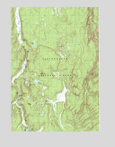
Obsidian Cliff, WY USGS Topographic Map
Click on map above to begin viewing in our Map Viewer.

This topographic map contains these locations and features:
Feature Name Type Latitude Longitude GNIS ID View Map
Amphitheater SpringsSpringN44.7969°W110.7258°1584821View Map
Apollinaris SpringSpringN44.8425°W110.7331°1584909View Map
Beaver LakeLakeN44.8160°W110.7311°1585323View Map
Bijah SpringSpringN44.7610°W110.7316°1609226View Map
Clearwater SpringsSpringN44.7885°W110.7391°1586768View Map
Crystal SpringSpringN44.8304°W110.7277°1587278View Map
Frying Pan SpringSpringN44.7524°W110.7227°1609251View Map
Horseshoe HillSummitN44.8351°W110.6771°1589735View Map
Horseshoe SpringSpringN44.7502°W110.7172°1848536View Map
Lake of the WoodsLakeN44.8005°W110.7144°1590457View Map
Lemonade CreekStreamN44.8108°W110.7344°1609268View Map
Lemonade LakeLakeN44.7809°W110.7404°1590640View Map
Lilypad PondLakeN44.8356°W110.7300°1590686View Map
Nymph LakeLakeN44.7517°W110.7273°1609280View Map
Obsidian CanyonValleyN44.8326°W110.7277°1592349View Map
Obsidian CliffCliffN44.8208°W110.7280°1609281View Map
Obsidian LakeLakeN44.8383°W110.7167°1592351View Map
Porcelain BasinBasinN44.7513°W110.7147°1848573View Map
Roadside SpringsSpringN44.7533°W110.7260°1593508View Map
Roaring MountainSummitN44.7776°W110.7264°1593514View Map
Semi-Centennial GeyserSpringN44.7861°W110.7399°1594093View Map
The LandmarkSummitN44.8084°W110.7045°1595438View Map
Twin LakesLakeN44.7735°W110.7363°1595800View Map
Whiterock SpringsSpringN44.7802°W110.6980°1609323View Map
Willow ParkFlatN44.8612°W110.7405°1596468View Map
Winter CreekStreamN44.8508°W110.7374°1596558View Map

Note: Coordinates in the location and feature list above are referenced to NAD83 datum.


Copyright (C) 2008-2024 Ryan Niemi / Sunset Dynamics ... All Rights Reserved