TopoQuest Logo
Do you find TopoQuest useful?
Help keep TopoQuest running and adding new maps/features by donating!
Bitcoin:  19c7KJd3qBynnjoSw5npx9KScwjBe4ifkT
Litecoin:  LXs6TkuXGGXo1vDsWCkWVdjQX94eUKd6ui
Home View Maps Find Maps Find Places Resources & Links


Ben Bolt SE, Texas Topographic Map

USGS Map Title: Ben Bolt SE, TX
USGS Map MRC: 27098E1
DRG (GeoTIFF) Download: o27098e1.tif


Neighboring USGS Topographic Map Quads:


  Ben Bolt NW, TX  
27098F2
 

  Alice South, TX  
27098F1
 

  Kingsville NW, TX  
27097F8
 

  Palito Blanco, TX  
27098E2
 

  Ben Bolt SE, TX  
27098E1
 

  Kingsville West, TX  
27097E8
 

  Seeligson Ranch, TX  
27098D2
 

  Ella, TX  
27098D1
 

  Escondido Lake, TX  
27097D8


Map MRC Location:

N28°
W99°
N28°
W98°
H8 H7 H6 H5 H4 H3 H2 H1
G8 G7 G6 G5 G4 G3 G2 G1
F8 F7 F6 F5 F4 F3 F2 F1
E8 E7 E6 E5 E4 E3 E2 E1
D8 D7 D6 D5 D4 D3 D2 D1
C8 C7 C6 C5 C4 C3 C2 C1
B8 B7 B6 B5 B4 B3 B2 B1
A8 A7 A6 A5 A4 A3 A2 A1
N27°
W99°
N27°
W98°

Ben Bolt SE, TX USGS 1:24K Topographic Map Preview:
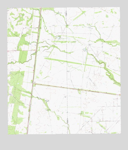
Ben Bolt SE, TX USGS Topographic Map
Click on map above to begin viewing in our Map Viewer.

This topographic map contains these locations and features:
Feature Name Type Latitude Longitude GNIS ID View Map
Ben Bolt Oil FieldOilfieldN27.6234°W98.1181°1330399View Map
Chivos LakeReservoirN27.6197°W98.0691°1332787View Map
Chivos WindmillLocaleN27.6081°W98.0589°1332788View Map
Ebanos WindmillLocaleN27.5373°W98.0622°1335056View Map
El Parr WindmillLocaleN27.6056°W98.0889°1335238View Map
Hormigas WindmillLocaleN27.5517°W98.0964°1338086View Map
King Ranch Borregos Oil FieldOilfieldN27.5367°W98.0172°1372169View Map
King Ranch Dam Number 4DamN27.5820°W98.0369°1859106View Map
Kleberg County AirportAirportN27.5447°W98.0283°1387023View Map
Las Conchas LakeReservoirN27.5954°W98.0687°1339654View Map
Los Machos RanchLocaleN27.5392°W98.1217°1340614View Map
Marrano WindmillLocaleN27.5203°W98.0442°1340974View Map
Motas Negras WindmillLocaleN27.5617°W98.0569°1341992View Map
North WindmillLocaleN27.5611°W98.1225°1342832View Map
Olmo Grande WindmillLocaleN27.5242°W98.0800°1343262View Map
Olmo LakeReservoirN27.5340°W98.0826°1343263View Map
Papalote Blanco WindmillLocaleN27.5881°W98.0353°1343564View Map
Patricio LakeLakeN27.5838°W98.0390°1343659View Map
Patricio WindmillLocaleN27.5770°W98.0806°1343662View Map
Presa de Rayo WindmillLocaleN27.6045°W98.0325°1344537View Map
Reservoir Number 4ReservoirN27.5820°W98.0369°1859107View Map
San Andreas CreekStreamN27.5836°W98.0383°1375952View Map
Tamales WindmillLocaleN27.5448°W98.0439°1348214View Map
Trinidad CreekStreamN27.5870°W98.0761°1348771View Map
Trinidad LakeLakeN27.5905°W98.0994°1348772View Map

Note: Coordinates in the location and feature list above are referenced to NAD83 datum.


Copyright (C) 2008-2025 Ryan Niemi / Sunset Dynamics ... All Rights Reserved