TopoQuest Logo
Do you find TopoQuest useful?
Help keep TopoQuest running and adding new maps/features by donating!
Bitcoin:  19c7KJd3qBynnjoSw5npx9KScwjBe4ifkT
Litecoin:  LXs6TkuXGGXo1vDsWCkWVdjQX94eUKd6ui
Home View Maps Find Maps Find Places Resources & Links


Odebolt West, Iowa Topographic Map

USGS Map Title: Odebolt West, IA
USGS Map MRC: 42095C3
DRG (GeoTIFF) Download: o42095c3.tif


Neighboring USGS Topographic Map Quads:


  Ida Grove NW, IA  
42095D4
 

  Schaller South, IA  
42095D3
 

  Early, IA  
42095D2
 

  Ida Grove, IA  
42095C4
 

  Odebolt West, IA  
42095C3
 

  Odebolt East, IA  
42095C2
 

  Schleswig, IA  
42095B4
 

  Kiron, IA  
42095B3
 

  Boyer, IA  
42095B2


Map MRC Location:

N43°
W96°
N43°
W95°
H8 H7 H6 H5 H4 H3 H2 H1
G8 G7 G6 G5 G4 G3 G2 G1
F8 F7 F6 F5 F4 F3 F2 F1
E8 E7 E6 E5 E4 E3 E2 E1
D8 D7 D6 D5 D4 D3 D2 D1
C8 C7 C6 C5 C4 C3 C2 C1
B8 B7 B6 B5 B4 B3 B2 B1
A8 A7 A6 A5 A4 A3 A2 A1
N42°
W96°
N42°
W95°

Odebolt West, IA USGS 1:24K Topographic Map Preview:
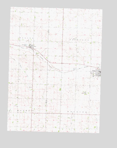
Odebolt West, IA USGS Topographic Map
Click on map above to begin viewing in our Map Viewer.

This topographic map contains these locations and features:
Feature Name Type Latitude Longitude GNIS ID View Map
ArthurLocaleN42.3339°W95.3458°1983118View Map
ArthurPopulated PlaceN42.3347°W95.3475°454245View Map
Arthur ChurchChurchN42.2708°W95.3419°1823208View Map
Arthur City HallBuildingN42.3350°W95.3472°1983112View Map
Arthur First RespondersBuildingN42.3351°W95.3472°1983111View Map
Arthur Post OfficePost OfficeN42.3355°W95.3472°1983110View Map
Arthur Public LibraryBuildingN42.3347°W95.3478°1983109View Map
City of ArthurCivilN42.3354°W95.3469°2393993View Map
City of OdeboltCivilN42.3118°W95.2542°2395297View Map
Evangelical Free ChurchChurchN42.3339°W95.3431°1983113View Map
Farmers Co-op ElevatorLocaleN42.3336°W95.3453°1983119View Map
Hayes CemeteryCemeteryN42.2944°W95.3430°457347View Map
Methodist ChurchChurchN42.3367°W95.3472°1983114View Map
Methodist ChurchChurchN42.3108°W95.2531°1982971View Map
Noah Webster Christian AcademySchoolN42.3339°W95.3431°1983117View Map
OdeboltPopulated PlaceN42.3122°W95.2506°459799View Map
OdeboltLocaleN42.3139°W95.2531°1982969View Map
Odebolt Ambulance ServiceBuildingN42.3113°W95.2501°2599966View Map
Odebolt Arthur - Battle Creek Ida Grove Middle SchoolSchoolN42.3080°W95.2524°2719730View Map
Odebolt Arthur Elementary SchoolSchoolN42.3081°W95.2527°1983024View Map
Odebolt City HallBuildingN42.3125°W95.2522°1982967View Map
Odebolt Fire DepartmentBuildingN42.3124°W95.2526°2577296View Map
Odebolt Historical MuseumBuildingN42.3119°W95.2569°1982966View Map
Odebolt Medical ClinicHospitalN42.3094°W95.2522°1982975View Map
Odebolt Post OfficePost OfficeN42.3100°W95.2506°1982965View Map
Odebolt Public LibraryBuildingN42.3119°W95.2536°1982964View Map
Odebolt-Arthur Middle SchoolSchoolN42.3372°W95.3469°1983116View Map
Presbyterian ChurchChurchN42.3114°W95.2522°1982972View Map
Sac County Golf Club (historical)LocaleN42.3122°W95.2506°1982962View Map
Saint Martins Catholic ChurchChurchN42.3094°W95.2553°1982973View Map
Township of RichlandCivilN42.3416°W95.2645°468612View Map
Township of WheelerCivilN42.2542°W95.2649°468992View Map
Trinity Lutheran ChurchChurchN42.3075°W95.2614°1982974View Map
Wall Lake StationPopulated PlaceN42.2564°W95.2572°464120View Map
Wheelers RanchLocaleN42.2655°W95.2639°466258View Map
Winebrenner Church of GodChurchN42.3361°W95.3444°1983115View Map

Note: Coordinates in the location and feature list above are referenced to NAD83 datum.


Copyright (C) 2008-2025 Ryan Niemi / Sunset Dynamics ... All Rights Reserved