TopoQuest Logo
Do you find TopoQuest useful?
Help keep TopoQuest running and adding new maps/features by donating!
Bitcoin:  19c7KJd3qBynnjoSw5npx9KScwjBe4ifkT
Litecoin:  LXs6TkuXGGXo1vDsWCkWVdjQX94eUKd6ui
Home View Maps Find Maps Find Places Resources & Links


Odessa NW, Texas Topographic Map

USGS Map Title: Odessa NW, TX
USGS Map MRC: 31102H4
DRG (GeoTIFF) Download: o31102h4.tif


Neighboring USGS Topographic Map Quads:


  North Cowden, TX  
32102A5
 

  Gardendale, TX  
32102A4
 

  Hackberry Lake, TX  
32102A3
 

  Goldsmith, TX  
31102H5
 

  Odessa NW, TX  
31102H4
 

  Odessa NE, TX  
31102H3
 

  Douro, TX  
31102G5
 

  Odessa SW, TX  
31102G4
 

  Odessa SE, TX  
31102G3


Map MRC Location:

N32°
W103°
N32°
W102°
H8 H7 H6 H5 H4 H3 H2 H1
G8 G7 G6 G5 G4 G3 G2 G1
F8 F7 F6 F5 F4 F3 F2 F1
E8 E7 E6 E5 E4 E3 E2 E1
D8 D7 D6 D5 D4 D3 D2 D1
C8 C7 C6 C5 C4 C3 C2 C1
B8 B7 B6 B5 B4 B3 B2 B1
A8 A7 A6 A5 A4 A3 A2 A1
N31°
W103°
N31°
W102°

Odessa NW, TX USGS 1:24K Topographic Map Preview:
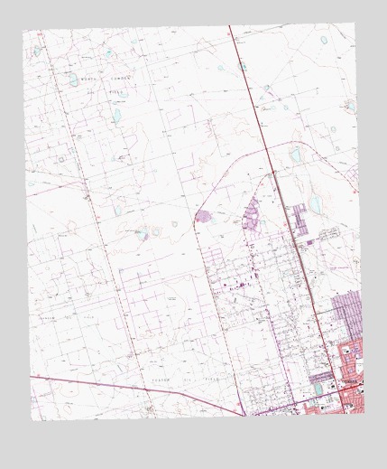
Odessa NW, TX USGS Topographic Map
Click on map above to begin viewing in our Map Viewer.

This topographic map contains these locations and features:
Feature Name Type Latitude Longitude GNIS ID View Map
Alternative Education CenterSchoolN31.9132°W102.3826°2005143View Map
Barbara Jordan Elementary SchoolSchoolN31.9471°W102.3982°2005145View Map
Bethel Assembly of God ChurchChurchN31.8829°W102.3821°2018203View Map
Bible Free Will Baptist ChurchChurchN31.8848°W102.4115°2018153View Map
Broughton ParkParkN31.9276°W102.3982°1331329View Map
Bull WellWellN31.8771°W102.4365°1331618View Map
Burleson Elementary SchoolSchoolN31.8771°W102.3926°2005148View Map
Burleson SchoolSchoolN31.8773°W102.3910°1331687View Map
Dipping Vat WellWellN31.9132°W102.4474°1334383View Map
Ector County ColiseumParkN31.8840°W102.3874°2027522View Map
Ector County Youth CenterSchoolN31.9137°W102.3807°2005154View Map
Goliad Elementary SchoolSchoolN31.8943°W102.3815°2005159View Map
Goliad SchoolSchoolN31.8951°W102.3810°1336665View Map
Greenfield Acres Baptist ChurchChurchN31.9062°W102.4149°2018159View Map
Greenfield Acres ChurchChurchN31.9062°W102.4143°1336966View Map
Hood Junior High SchoolSchoolN31.8810°W102.3776°2005162View Map
Hood Junior High SchoolSchoolN31.8821°W102.3760°1338032View Map
Kingston Auenue Baptist ChurchChurchN31.8951°W102.3801°2018162View Map
KOYL-AM (Odessa)TowerN31.8762°W102.4057°1385648View Map
Mexican WellWellN31.9148°W102.4788°1341451View Map
New WellWellN31.8932°W102.4549°1342520View Map
North Johnson WellWellN31.9348°W102.4579°1342761View Map
Northside ChurchChurchN31.8912°W102.3882°1342864View Map
Odessa Fire Department Station 8BuildingN31.9123°W102.3888°2551156View Map
Odessa Primitive Baptist ChurchChurchN31.9118°W102.3788°2018167View Map
Odessa-Schlemeyer FieldAirportN31.9190°W102.3924°1387259View Map
Sam Houston Elementary SchoolSchoolN31.8782°W102.3810°2005176View Map
San Houston SchoolSchoolN31.8779°W102.3801°1346355View Map
Seventh Day Adventist ChurchChurchN31.9410°W102.4029°2018134View Map
South WindmillLocaleN31.9579°W102.4651°1347561View Map
The Church of Jesus Christ of Latter Day SaintsChurchN31.8782°W102.3835°2018194View Map
University Park Baptist ChurchChurchN31.9307°W102.4090°2018173View Map
Wesley Evangelical Methodist ChurchChurchN31.9001°W102.3785°2018192View Map
West WindmillLocaleN31.9904°W102.4746°1349840View Map
Willow WellWellN31.9340°W102.4885°1350235View Map
Wolford WellWellN31.8851°W102.4596°1350490View Map

Note: Coordinates in the location and feature list above are referenced to NAD83 datum.


Copyright (C) 2008-2025 Ryan Niemi / Sunset Dynamics ... All Rights Reserved