TopoQuest Logo
Do you find TopoQuest useful?
Help keep TopoQuest running and adding new maps/features by donating!
Bitcoin:  19c7KJd3qBynnjoSw5npx9KScwjBe4ifkT
Litecoin:  LXs6TkuXGGXo1vDsWCkWVdjQX94eUKd6ui
Home View Maps Find Maps Find Places Resources & Links


Ogden Bay, Utah Topographic Map

USGS Map Title: Ogden Bay, UT
USGS Map MRC: 41112B2
DRG (GeoTIFF) Download: o41112b2.tif


Neighboring USGS Topographic Map Quads:


  Willard Spur, UT  
41112C3
 

  Plain City SW, UT  
41112C2
 

  Plain City, UT  
41112C1
 

  Fremont Island, UT  
41112B3
 

  Ogden Bay, UT  
41112B2
 

  Roy, UT  
41112B1
 

  Buffalo Point, UT  
41112A3
 

  Antelope Island North, UT  
41112A2
 

  Clearfield, UT  
41112A1


Map MRC Location:

N42°
W113°
N42°
W112°
H8 H7 H6 H5 H4 H3 H2 H1
G8 G7 G6 G5 G4 G3 G2 G1
F8 F7 F6 F5 F4 F3 F2 F1
E8 E7 E6 E5 E4 E3 E2 E1
D8 D7 D6 D5 D4 D3 D2 D1
C8 C7 C6 C5 C4 C3 C2 C1
B8 B7 B6 B5 B4 B3 B2 B1
A8 A7 A6 A5 A4 A3 A2 A1
N41°
W113°
N41°
W112°

Ogden Bay, UT USGS 1:24K Topographic Map Preview:
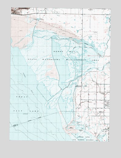
Ogden Bay, UT USGS Topographic Map
Click on map above to begin viewing in our Map Viewer.

This topographic map contains these locations and features:
Feature Name Type Latitude Longitude GNIS ID View Map
Hales BendBendN41.1352°W112.1613°1428474View Map
Hooper CemeteryCemeteryN41.1666°W112.1313°1435696View Map
Hooper Hot SpringsSpringN41.1366°W112.1761°1428809View Map
Hooper SloughStreamN41.1908°W112.1552°1428810View Map
Howard SloughStreamN41.1258°W112.1494°1428920View Map
Middle Fork Weber RiverStreamN41.2138°W112.1816°1430285View Map
Naisbitt AcresPopulated PlaceN41.1594°W112.1433°1453356View Map
Northwest Weber DivisionCivilN41.2280°W112.2258°1939431View Map
Ogden Bay Refuge HeadquartersLocaleN41.1766°W112.1638°1430954View Map
Ogden Bay Waterfowl Management AreaParkN41.2047°W112.1944°1430952View Map
South Fork Weber RiverStreamN41.1880°W112.1597°1432717View Map
The Church of Jesus Christ of Latter Day SaintsChurchN41.1613°W112.1255°1450770View Map
The Church of Jesus Christ of Latter Day SaintsChurchN41.1611°W112.1280°1450772View Map
Weber RiverStreamN41.2236°W112.1269°1455832View Map

Note: Coordinates in the location and feature list above are referenced to NAD83 datum.


Copyright (C) 2008-2025 Ryan Niemi / Sunset Dynamics ... All Rights Reserved