TopoQuest Logo
Do you find TopoQuest useful?
Help keep TopoQuest running and adding new maps/features by donating!
Bitcoin:  19c7KJd3qBynnjoSw5npx9KScwjBe4ifkT
Litecoin:  LXs6TkuXGGXo1vDsWCkWVdjQX94eUKd6ui
Home View Maps Find Maps Find Places Resources & Links


Ogden Dunes, Indiana Topographic Map

USGS Map Title: Ogden Dunes, IN
USGS Map MRC: 41087F2
DRG (GeoTIFF) Download: o41087f2.tif


Neighboring USGS Topographic Map Quads:


  Ogden Dunes, IN  
41087F2
 

  Dune Acres, IN  
41087F1
 

  Gary, IN  
41087E3
 

  Portage, IN  
41087E2
 

  Chesterton, IN  
41087E1


Map MRC Location:

N42°
W88°
N42°
W87°
H8 H7 H6 H5 H4 H3 H2 H1
G8 G7 G6 G5 G4 G3 G2 G1
F8 F7 F6 F5 F4 F3 F2 F1
E8 E7 E6 E5 E4 E3 E2 E1
D8 D7 D6 D5 D4 D3 D2 D1
C8 C7 C6 C5 C4 C3 C2 C1
B8 B7 B6 B5 B4 B3 B2 B1
A8 A7 A6 A5 A4 A3 A2 A1
N41°
W88°
N41°
W87°

Ogden Dunes, IN USGS 1:24K Topographic Map Preview:
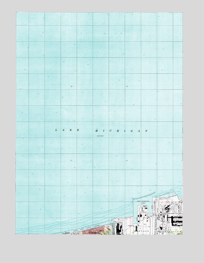
Ogden Dunes, IN USGS Topographic Map
Click on map above to begin viewing in our Map Viewer.

This topographic map contains these locations and features:
Feature Name Type Latitude Longitude GNIS ID View Map
Burns HarborPopulated PlaceN41.6259°W87.1334°449809View Map
Burns Harbor East LightLocaleN41.6495°W87.1309°452961View Map
Burns Harbor North Light 2LocaleN41.6486°W87.1459°452962View Map
Burns Harbor South Light 3LocaleN41.6464°W87.1464°452963View Map
Burns Haror West Light 4LocaleN41.6453°W87.1620°452964View Map
Burns International HarborHarborN41.6370°W87.1498°431857View Map
Burns Waterway East Jetty North LightLocaleN41.6331°W87.1770°452969View Map
Burns Waterway East Jetty South LightLocaleN41.6328°W87.1770°452968View Map
Burns Waterway East Pier LightLocaleN41.6331°W87.1764°452967View Map
Burns Waterway HarborHarborN41.6425°W87.1539°449970View Map
Burns Waterway West Pier Inner LightLocaleN41.6331°W87.1756°452965View Map
Burns Waterway West Pier Outer LightLocaleN41.6345°W87.1756°452966View Map
East Harbor ArmHarborN41.6395°W87.1500°446904View Map
Port of IndianaLocaleN41.6392°W87.1539°450009View Map
Town of Ogden DunesCivilN41.6285°W87.1929°2396829View Map
United States Steel Midwest Division Fire DepartmentBuildingN41.6267°W87.1730°2626598View Map
West Harbor ArmHarborN41.6375°W87.1598°446905View Map

Note: Coordinates in the location and feature list above are referenced to NAD83 datum.


Copyright (C) 2008-2024 Ryan Niemi / Sunset Dynamics ... All Rights Reserved