TopoQuest Logo
Do you find TopoQuest useful?
Help keep TopoQuest running and adding new maps/features by donating!
Bitcoin:  19c7KJd3qBynnjoSw5npx9KScwjBe4ifkT
Litecoin:  LXs6TkuXGGXo1vDsWCkWVdjQX94eUKd6ui
Home View Maps Find Maps Find Places Resources & Links


Ojai, California Topographic Map

USGS Map Title: Ojai, CA
USGS Map MRC: 34119D2
DRG (GeoTIFF) Download: o34119d2.tif


Neighboring USGS Topographic Map Quads:


  Wheeler Springs, CA  
34119E3
 

  Lion Canyon, CA  
34119E2
 

  Topatopa Mountains, CA  
34119E1
 

  Matilija, CA  
34119D3
 

  Ojai, CA  
34119D2
 

  Santa Paula Peak, CA  
34119D1
 

  Ventura, CA  
34119C3
 

  Saticoy, CA  
34119C2
 

  Santa Paula, CA  
34119C1


Map MRC Location:

N35°
W120°
N35°
W119°
H8 H7 H6 H5 H4 H3 H2 H1
G8 G7 G6 G5 G4 G3 G2 G1
F8 F7 F6 F5 F4 F3 F2 F1
E8 E7 E6 E5 E4 E3 E2 E1
D8 D7 D6 D5 D4 D3 D2 D1
C8 C7 C6 C5 C4 C3 C2 C1
B8 B7 B6 B5 B4 B3 B2 B1
A8 A7 A6 A5 A4 A3 A2 A1
N34°
W120°
N34°
W119°

Ojai, CA USGS 1:24K Topographic Map Preview:
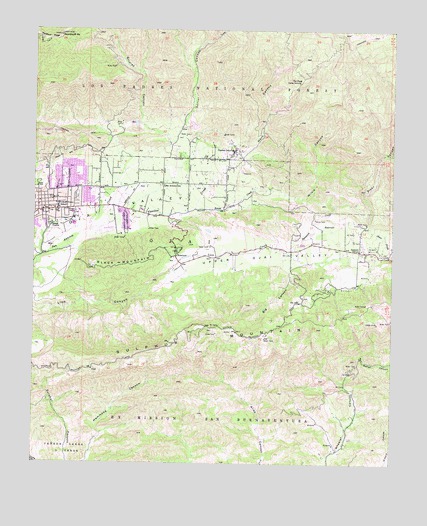
Ojai, CA USGS Topographic Map
Click on map above to begin viewing in our Map Viewer.

This topographic map contains these locations and features:
Feature Name Type Latitude Longitude GNIS ID View Map
Big CanyonValleyN34.4358°W119.1612°269814View Map
Black MountainSummitN34.4319°W119.2221°269887View Map
Chaparral High SchoolSchoolN34.4489°W119.2423°272662View Map
City of OjaiCivilN34.4486°W119.2470°2411308View Map
Daly Ranch ParkParkN34.4611°W119.2404°1870614View Map
Dennison ParkParkN34.4364°W119.2018°270839View Map
First Church of Christ ScientistChurchN34.4503°W119.2487°1870632View Map
Foothill TrailTrailN34.4703°W119.2473°271169View Map
Four Winds Pre-SchoolSchoolN34.4475°W119.2432°1870634View Map
Gridley CanyonValleyN34.4675°W119.2034°271440View Map
Gridley Springs CampLocaleN34.4897°W119.2232°275239View Map
Gymkhana AreaLocaleN34.4419°W119.2237°1870585View Map
Happy Valley SchoolSchoolN34.4398°W119.1864°1870586View Map
Horn CanyonValleyN34.4644°W119.1784°271627View Map
Horn Canyon TrailTrailN34.4789°W119.1632°275248View Map
KCPB-FM (Thousand Oaks)TowerN34.4131°W119.1871°1663112View Map
KMRO-FM (Camarillo)TowerN34.4131°W119.1871°1662823View Map
Libbey ParkParkN34.4464°W119.2448°1870637View Map
Lion Canyon ReservoirReservoirN34.4345°W119.1978°1870591View Map
Lion CreekStreamN34.4347°W119.1965°272057View Map
Monica Ros SchoolSchoolN34.4565°W119.1981°1870592View Map
Nordhoff PeakSummitN34.4980°W119.2418°272659View Map
OjaiPopulated PlaceN34.4480°W119.2429°1652763View Map
OjaiCivilN34.4372°W119.2157°272772View Map
Ojai Branch Ventura County LibraryBuildingN34.4475°W119.2468°1870640View Map
Ojai Church of ChristChurchN34.4514°W119.2429°1870641View Map
Ojai City HallBuildingN34.4444°W119.2476°1870642View Map
Ojai Community CenterBuildingN34.4528°W119.2362°1870643View Map
Ojai District Ranger StationLocaleN34.4489°W119.2301°275245View Map
Ojai Post OfficePost OfficeN34.4476°W119.2457°1870644View Map
Ojai Unified School District OfficeBuildingN34.4483°W119.2421°1870645View Map
Ojai Valley Center for the ArtsBuildingN34.4455°W119.2437°1870646View Map
Ojai Valley Chamber of CommerceBuildingN34.4480°W119.2437°1870647View Map
Ojai Valley Christian SchoolSchoolN34.4489°W119.2482°1870648View Map
Ojai Valley Historical MuseumBuildingN34.4453°W119.2437°1870649View Map
Ojai Valley Restoration CenterChurchN34.4497°W119.2434°1870650View Map
Ojai-Mira Monte DivisionCivilN34.4457°W119.2151°1935198View Map
Our Lady and All Angels Catholic ChurchChurchN34.4503°W119.2262°1870651View Map
Reeves CreekStreamN34.4483°W119.1946°273261View Map
Saint Thomas Aquinas SchoolSchoolN34.4503°W119.2493°1870653View Map
San Antonio Elementary SchoolSchoolN34.4550°W119.2059°273438View Map
Sarzotti ParkParkN34.4517°W119.2362°273582View Map
Senior CanyonValleyN34.4678°W119.2034°273629View Map
Senior Canyon 1761 DamDamN34.4730°W119.1946°1664347View Map
Senior Canyon ReservoirReservoirN34.4724°W119.1957°275250View Map
Sisar CanyonValleyN34.4436°W119.1343°273721View Map
Sisar PastureFlatN34.4519°W119.1412°275244View Map
Sisar Repeater SiteLocaleN34.4992°W119.1418°275238View Map
Soule County ParkParkN34.4428°W119.2268°1870604View Map
Soule Golf CourseLocaleN34.4453°W119.2273°1870605View Map
Soule Recreation AreaParkN34.4392°W119.2409°1870606View Map
Stewart Canyon Debris BurnAreaN34.4578°W119.2476°275246View Map
Sulphur MountainSummitN34.4097°W119.2032°273944View Map
Sulphur SpringSpringN34.4694°W119.2209°1670843View Map
Summit Elementary SchoolSchoolN34.4367°W119.1373°273964View Map
Sycamore CreekStreamN34.4358°W119.1629°274002View Map
Thacher CreekStreamN34.4416°W119.2336°274078View Map
Thacher High SchoolSchoolN34.4647°W119.1807°274079View Map
The Arcade Shopping CenterLocaleN34.4486°W119.2448°1870660View Map
The Pines CampgroundLocaleN34.4853°W119.1582°274096View Map
Topa Topa Elementary SchoolSchoolN34.4580°W119.2359°1870662View Map
Topatopa TrailTrailN34.4980°W119.1354°274162View Map
Upper Ojai ValleyValleyN34.4301°W119.2037°274292View Map
Ventura County Fire Protection District Station 20 SummitBuildingN34.4363°W119.1352°2665246View Map
Ventura County Fire Protection District Station 21 OjaiBuildingN34.4484°W119.2311°2664532View Map
Ventura County Sheriff's Office Ojai Police StationBuildingN34.4446°W119.2464°2756225View Map
Wesleyan Church of Ojai ValleyChurchN34.4480°W119.2479°1870664View Map
White Rock RanchLocaleN34.4675°W119.1929°275249View Map
Wilsie CanyonValleyN34.4539°W119.1721°274538View Map
Wilsie SpringSpringN34.4858°W119.1420°275237View Map
World UniversitySchoolN34.4494°W119.2493°1870665View Map

Note: Coordinates in the location and feature list above are referenced to NAD83 datum.


Copyright (C) 2008-2025 Ryan Niemi / Sunset Dynamics ... All Rights Reserved